Yosemite’s Tioga Road
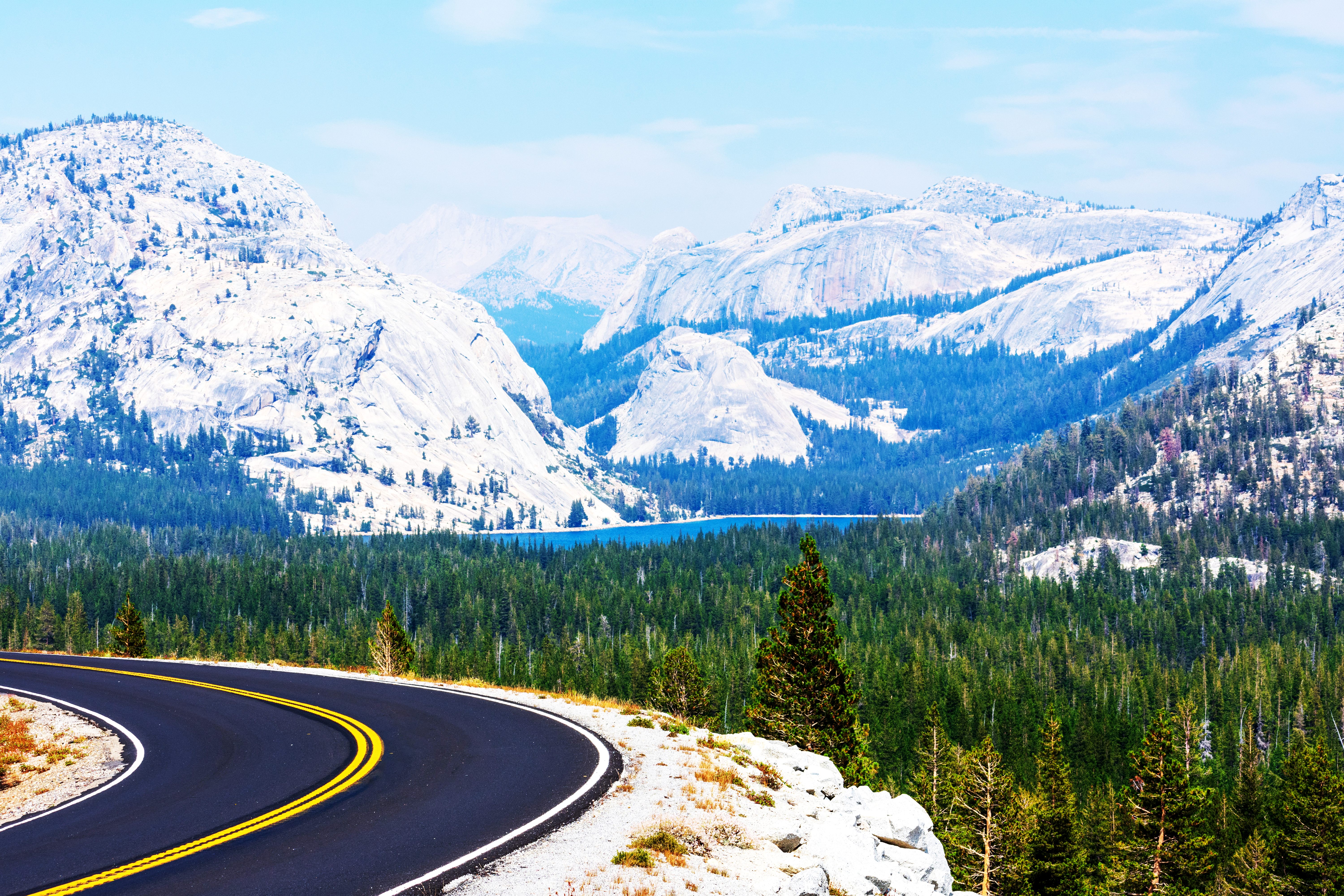
Across Yosemite's High Country
Tioga Road is the highest paved through-road in California and the only road that crosses Yosemite National Park east to west, climbing from 6,200 feet at Crane Flat to 9,945 feet at Tioga Pass on the Sierra Nevada crest, then descending 3,000 feet in 14 miles to Lee Vining on the shore of Mono Lake in the Great Basin. The route follows an ancient Mono Paiute and Sierra Miwok trade route across the High Sierra, used for centuries to move obsidian, acorns, salt, and other goods between the desert tribes east of the mountains and the foothill peoples to the west. In the 1880s, the route became a wagon road serving silver mines near Tioga Pass; the mines played out within five years, but the wagon road remained. The current alignment, widened, regraded, and paved in 1961, follows the heart of Yosemite's high country between the timbered slopes of the western Sierra and the alpine tundra of the eastern crest. Unlike the better-known Yosemite Valley (where 4 million annual visitors pack a 7-mile-long canyon), Tioga Road traverses the largely empty 95 percent of the park: granite domes polished mirror-smooth by Ice Age glaciers, subalpine forests of lodgepole pine and red fir, Tuolumne Meadows (the largest subalpine meadow in the Sierra Nevada at 8,600 feet, a UNESCO-recognized component of the park's World Heritage Site designation), Tenaya Lake (a pristine alpine lake at 8,150 feet flanked by domes that draw rock climbers from around the world), and the trailheads for both the John Muir Trail and the Pacific Crest Trail. The road's defining feature is Olmsted Point, a roadside overlook 8,000 feet above sea level looking down a glacier-carved canyon to the back side of Half Dome, a view John Muir's contemporary Frederick Law Olmsted Jr. helped preserve. The pass itself is the eastern gateway to Yosemite, with a sudden, dramatic transition: in 12 miles between Tioga Pass and Lee Vining, the road drops from alpine whitebark pine into the Great Basin's arid sagebrush, one of the most abrupt ecological transitions on any road in North America.
Key Stops
Crane Flat (Western Gateway) At Mile 0 of Tioga Road, where CA-120 meets the road from Yosemite Valley at 6,200 feet. Crane Flat Service Station offers fuel, a small store, and a campground, the last reliable fuel for the next 45 miles before the eastern entrance. The 17-mile-long Big Oak Flat Road descends from here to the El Portal park entrance and US-140; the road to Yosemite Valley drops south.
Tuolumne Grove of Giant Sequoias A 1-mile descent (each way) from a trailhead just east of Crane Flat reaches one of Yosemite's three giant sequoia groves. The grove contains around two dozen mature sequoias, including the Tunnel Tree (a fallen sequoia whose hollowed-out base you can walk through). The trail is paved but steep on the return climb (allow 1 to 2 hours). The grove is far less visited than the more famous Mariposa Grove at the south end of the park.
Tamarack Flat and the El Capitan Side Trip A rough 3-mile spur road south from Tioga Road leads to Tamarack Flat Campground, with several rustic sites and trailhead access to a strenuous 8-mile round-trip hike to the top of El Capitan, the 3,000-foot granite monolith and the world's most famous big-wall climb. The hike requires care; the granite slabs at the top have sheer drops with no guardrails.
White Wolf Lodge and Campground A short detour north of Tioga Road leads to White Wolf, a 1926 historic lodge with whitewashed cabins (currently closed for renovation; check the National Park Service for 2026 reopening status), a campground, and trailheads for hikes to Lukens Lake and Harden Lake. Quiet, less-visited area of the park.
May Lake Trailhead A 2-mile spur road leads to the trailhead for May Lake, a 1.2-mile (each way) hike to one of Yosemite's five High Sierra Camps (rustic backcountry tent cabins, reservation-only, lottery system for summer occupancy). The lake sits beneath 10,850-foot Mount Hoffmann, geographically the center of Yosemite National Park.
Olmsted Point The drive's signature view. A short paved path from the parking lot leads to a granite outcrop with sweeping panoramic views: south down the glacially polished expanse of Tenaya Canyon to the back side of Half Dome (a perspective few visitors ever see); east toward Tenaya Lake and the granite domes around it; and immediately around you, a tortured field of glacier-deposited erratic boulders left when the Ice Age ice sheets retreated 15,000 years ago. The point is named for Frederick Law Olmsted (the landscape architect who helped design Yosemite Valley's protection) and his son Frederick Law Olmsted Jr. (who served on the National Park Service Advisory Board). Restrooms; small parking lot fills mid-day in summer.
Tenaya Lake A mile-long alpine lake at 8,150 feet, named for Chief Tenaya of the Ahwahnechee people, whose village in Yosemite Valley was destroyed by the Mariposa Battalion in 1851. The Ahwahnechee called the lake Pywiak ("lake of the shining rocks") for the surrounding domes of glacier-polished granite. Pywiak Dome, Stately Pleasure Dome, and Polly Dome rise around the lake and offer some of the finest rock climbing in California. Sandy beaches along the north shore are ideal for picnicking and (very cold) swimming. Non-motorized boating allowed. Several pullouts with restrooms.
Cathedral Lakes (Hike) A popular day hike from Tuolumne Meadows: 7 to 8 miles round trip to two glacier-carved lakes beneath the spire of Cathedral Peak (10,911 feet), one of the most photographed mountains in the Sierra. The trail follows the John Muir Trail.
Tuolumne Meadows The largest subalpine meadow in the Sierra Nevada (8,600 feet), a 2.5-mile-long expanse of grasses, wildflowers, and meandering streams flanked by granite domes. The meadow is grazed by mule deer, black bears, coyotes, and (in October) the occasional bighorn sheep. Wildflowers peak mid-July through early August: lupines, paintbrush, monkeyflower, shooting stars, columbine, and false hellebore. Key sites:
- Tuolumne Meadows Visitor Center (open summer only) with exhibits on the high country
- Tuolumne Meadows Lodge (canvas-tent cabins, reservations through Yosemite Hospitality, summer only)
- Tuolumne Meadows Campground (304 sites; reservations through Recreation.gov)
- Tuolumne Meadows Grill and Tuolumne Meadows Store (small but indispensable for hikers)
- Lembert Dome, a 9,450-foot granite roche moutonnée (sheep-back) rising directly from the meadow; a moderate hike to the top offers spectacular 360-degree views
- Soda Springs, a naturally carbonated mineral spring in a historic log cabin near the meadow
Tuolumne Meadows is the trailhead for two of America's premier long-distance hikes: the John Muir Trail (211 miles from Yosemite Valley to the summit of Mount Whitney) and the Pacific Crest Trail (2,650 miles from Mexico to Canada).
Dana Meadows Just before Tioga Pass, the meadows below 13,061-foot Mount Dana (Yosemite's second-highest peak) carpet with wildflowers in August. A strenuous 6-mile round-trip hike (3,000 feet of elevation gain) climbs Dana for one of the finest summit views in the Sierra: east across Mono Lake to the White Mountains, south across the Sierra crest to Mount Lyell, and west across Yosemite's high country.
Tioga Pass At 9,945 feet, Tioga Pass is the highest highway pass in California and the highest pass crossed by any public road in the Sierra Nevada. The park's eastern entrance station sits at the pass. The 1-mile Gaylor Lakes Trail climbs from the pass to a series of alpine lakes; a longer 2-mile hike continues to the historic Great Sierra Mine ruins, a brief 1880s silver-mining venture that gave Tioga Pass its name (after the Tioga Mining District in New York; Tioga is a Cayuga word meaning "swift water" or "at the forks").
Lee Vining Canyon Descent The most dramatic stretch of road on the drive. CA-120 descends 3,000 feet in 14 miles down a series of steep grades and curves with sweeping views to the east. Watch for Tioga Lake, Ellery Lake, and roadside waterfalls. Pull-offs let you stop for photos and to let your brakes cool. The transition from subalpine forest to Great Basin sagebrush happens within a few miles.
Tioga Lake and Ellery Lake (Inyo National Forest) Just east of the park boundary, two glacial lakes flank the road on the descent. Both have campgrounds and excellent trout fishing. The setting between granite peaks is breathtaking.
Mono Lake and Lee Vining (Eastern Terminus) At the foot of the descent, CA-120 meets US-395 at the small town of Lee Vining. Just east of town spreads Mono Lake, a hypersaline, alkaline lake (twice as salty as the ocean) that has no outlet and has been concentrating salts for 760,000 years (one of the oldest lakes in North America). The lake is famous for its tufa towers, calcium-carbonate columns formed when freshwater springs bubbled up through the alkaline lake water; the tufas were exposed when Los Angeles diverted Mono's tributary streams for water supply between 1941 and 1994, dropping the lake level by 45 feet. The Mono Basin National Forest Scenic Area Visitor Center in Lee Vining is a must-stop, with exhibits, films, and panoramic views over the lake to the Mono Craters (a chain of dormant volcanoes) and the White Mountains beyond. The lake also hosts massive populations of brine shrimp, alkali flies, and (in summer) over 100,000 nesting California gulls (the largest inland nesting colony in the world) plus migrating eared grebes (over a million pass through annually) and phalaropes. South Tufa, accessed from a separate parking area off US-395 south of Lee Vining, is the most photographed of the tufa groves.
Driving Tips
- Tioga Road is typically closed November through May or June due to snow. The road usually opens late May or early June, but in heavy snow years it can remain closed into July. Closing depends on snowfall and weather, typically early to mid-November. Check status at the National Park Service road conditions page before traveling.
- Park entry fee: $35 per vehicle (7 days). America the Beautiful Pass accepted. The Tioga Pass entrance (east) is staffed during the open season.
- Yosemite reservation system: Yosemite has used summer entry reservation systems intermittently from 2020 through recent years. The 2026 system status may apply during peak summer; check the National Park Service Yosemite website for current reservation requirements before traveling.
- Lodging at Tuolumne Meadows (Tuolumne Meadows Lodge) and the campgrounds along Tioga Road must be booked well in advance through Recreation.gov (typically 5 months ahead, opens in waves; sells out quickly). White Wolf Lodge has been closed for renovation in recent seasons; verify 2026 status.
- Fuel options: Crane Flat at the western end and Lee Vining at the eastern end. There is no fuel along Tioga Road itself. Plan accordingly.
- Altitude affects most visitors. The road tops 9,945 feet at Tioga Pass and stays above 8,000 feet for much of its length. Drink water, limit alcohol, and watch for altitude effects. Strenuous hikes (Mount Dana, Cathedral Peak) should be attempted only after acclimation.
- Afternoon thunderstorms are common in July and August. Lightning is a serious hazard on exposed granite domes and summits. Plan high-elevation hikes to be off ridges by noon.
- Bears are active throughout Tioga Road. Use bear-resistant food storage in campgrounds (provided) and never leave food in your vehicle. Backcountry hikers must use bear canisters (required by park regulation, available for rent at park stores).
- Cell coverage is essentially nonexistent along Tioga Road. Download offline maps and tell someone your itinerary. Tuolumne Meadows has very limited service.
- Traffic on Tioga Road is far less than Yosemite Valley, but Olmsted Point and Tenaya Lake parking lots fill by mid-morning in July and August. Arrive early or after 4 p.m.
- Crossing the Sierra via Tioga Pass is a popular alternative to the long detour around the southern Sierra. The pass connects the San Francisco Bay Area to the Eastern Sierra (Mammoth Lakes, Bodie, June Lake) directly.
- Mono Lake's tufa towers are most striking at sunrise and sunset. The South Tufa Trail (1-mile loop) is the best access. Modest fee at the trailhead.
- Watch for mule deer, black bears, and coyotes crossing the road, especially at dawn and dusk. Yellow-bellied marmots whistle from the rocks near Tioga Pass.
- For more information visit: Yosemite National Park (NPS): Tioga Road