Trollstigen to Geiranger Route
Norway's Signature Drive: Hairpins, Waterfalls, and a UNESCO Fjord
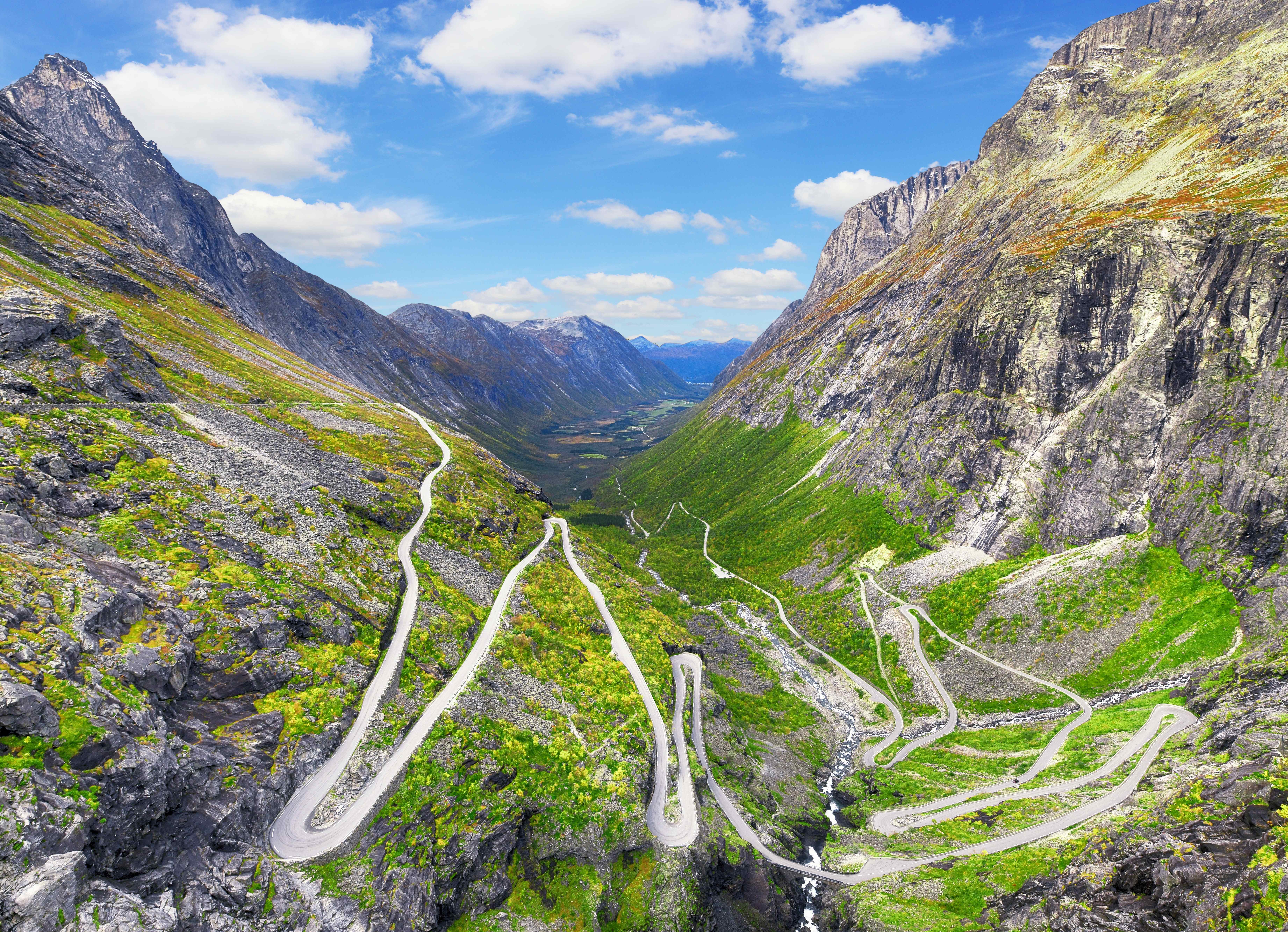
If Norway's fjord country has a single essential drive, this is it: an officially designated National Scenic Route that crosses from the climbing town of Åndalsnes over a troll-named mountain ladder, through a strawberry-growing fjord valley, and down a second staircase of hairpins to the head of the Geirangerfjord, a UNESCO World Heritage site. Its two engineering set pieces bookend the trip. Trollstigen ("the Troll's Ladder"), opened by King Haakon VII in 1936 after eight years of largely hand-built construction, stacks eleven hairpins up a wall of mountains at gradients near ten percent, crossing the 320-meter Stigfossen waterfall on a stone bridge mid-climb. At the far end, the Eagle Road (Ørnevegen, 1955) uncoils eleven more bends down to Geiranger with the fjord and the Seven Sisters waterfall filling the windshield. Between them lie a churning slot gorge, a fjord ferry, and some of the boldest viewpoint architecture in Europe, the steel walkways and cantilevered platforms that have made this route as famous for its design as its scenery. After rockfalls closed Trollstigen for most of 2024, a major protection program reopened it in July 2025, and it now runs full seasons again.
Key Stops
Åndalsnes and Trollveggen. The route's northern gateway, a mountaineering town deep in the Romsdalen valley. Before starting the climb, look up Romsdalen to Trollveggen, the Troll Wall, Europe's tallest vertical rock face at over 1,000 meters, and consider the Romsdalen gondola or the famous Rauma Railway for a car-free warm-up. The official route begins at Sogge Bridge just south of town.
The Trollstigen ascent. The main event: eleven numbered hairpins climbing the mountain wall, each with its own name, many hand-built by workers in the 1930s. The road crosses the thundering Stigfossen waterfall on a curved stone bridge partway up. Take it slowly; the drama is the point.
The Trollstigen plateau and skywalk. At the top, an award-winning visitor center anchors a network of steel walkways leading to viewing platforms, the largest cantilevered out to hang some 200 meters above the road you just drove. The view straight down the hairpins to Romsdalen is among the most photographed in Norway. Cafe and facilities in season.
The mountain crossing. South of the pass the road runs across an open plateau of tarns, bare rock, and lingering snow patches, a stark intermission between the route's two green valleys. Watch for sheep on the road.
Gudbrandsjuvet. A gorge where the Valldøla river has drilled itself a channel only a few meters wide and over 20 meters deep. Architect-designed bridges and walkways loop above the churn, and the whole stop takes a rewarding half hour.
Valldal. Norway's self-declared strawberry capital, spread along the Norddalsfjord. Roadside stalls sell berries all summer, cafes serve strawberry everything, and the village makes a quieter, cheaper overnight alternative to Geiranger. A side road leads to Tafjord, remembered for the catastrophic 1934 rockslide tsunami.
The Linge to Eidsdal ferry. A ten-minute hop across the Norddalsfjord, running continuously through the day with no booking needed. Queue, roll on, and enjoy the crossing; it is the route's built-in pause.
Ørnesvingen, the Eagle Bend. From Eidsdal the road climbs to 620 meters before tipping over the edge of the Geirangerfjord at the Eagle Road's topmost bend, where a glass-and-steel platform juts over the void. The full length of the fjord, the Seven Sisters waterfall, and cruise ships like toys below make this the route's single greatest view. Descend the eleven bends to the water.
Geiranger. The tiny village at the fjord head, home to a few hundred residents and, on big cruise days, many thousands of visitors. The Norwegian Fjord Centre explains the UNESCO landscape; sightseeing boats and kayaks get you onto the water beneath the Seven Sisters, the Suitor, and the abandoned cliff farms, which is the fjord seen properly.
Flydalsjuvet. Just above the village on the road south, the classic postcard viewpoint: the fjord curving away beneath overhanging rock ledges. Two platforms serve different nerves.
Dalsnibba and the Geiranger Skywalk. The finale: a private toll road spirals up to roughly 1,500 meters, where the Skywalk platform delivers Europe's highest road-accessed fjord view, straight down to Geiranger far below. The official scenic route ends at Langvatnet lake on the main road just beyond the toll road junction, where the highway continues south toward Stryn and Lom.
Driving Tips
Check road status before you commit. The route closes each winter (typically from October or November until May), and after the 2024 rockfall closure Trollstigen may still shut temporarily during intense rain. Norway's road authority and the scenic-route website publish live status; check the morning you drive.
Start early or drive late. Between mid-morning and late afternoon in July you'll share the hairpins with tour buses and the viewpoints with cruise crowds. Before 9 am or after 6 pm the road can feel almost private, and the light is better.
Check the cruise calendar for Geiranger. The village's character on a given day depends on how many ships are in. Geiranger's port schedule is public; pick a light day for your fjord activities if you can.
Tolls are electronic, mostly. Norwegian public roads bill automatically via AutoPASS (rental cars pass charges through), but the Dalsnibba road is a private toll paid at a booth; a bank card covers it.
Fuel and charge at the ends. Åndalsnes, Valldal, and Geiranger have fuel and EV chargers; Geiranger's chargers get busy in season, so top up when you see an open one.
Get on the water. The drive shows you the fjord from above; a sightseeing boat or kayak from Geiranger shows you the thousand-meter walls and waterfalls from below. Budget a half day for it; the fjord, not the road, is the World Heritage site.
For more information visit: Norwegian Scenic Routes: Geiranger-Trollstigen