Seward Highway
Alaska's Greatest 127 Miles
The Seward Highway is a 127-mile triple-designated National Scenic Byway, All-American Road, and USDA Forest Service Scenic Byway, running south from Anchorage to Seward through some of the most concentrated natural drama of any road on the continent: glaciers calving into tidewater within sight of the highway, beluga whales chasing salmon up tidal narrows, Dall sheep grazing 50 feet from the pavement, bore tides racing up Turnagain Arm at 15 mph, and the Chugach Mountains rising directly from the water with peaks over 4,000 feet. The road was scratched out of the mountainsides between the 1920s and the 1950s and finally paved in 1971. For the first 50 miles south of Anchorage, it threads a ledge between sheer cliffs and the salt water of Turnagain Arm, the long fjord-like extension of Cook Inlet named in 1778 by Captain James Cook, who sailed up the inlet hunting for the Northwest Passage, was forced to "turn again" at this dead end, and gave up his search. The arm has the second-highest tidal range in North America after the Bay of Fundy (35 feet between low and high tide), producing bore tides: walls of water up to 10 feet high that race up the narrowing channel about 45 minutes after low tide. From Portage, the highway turns inland, climbs over Turnagain Pass at 988 feet, descends past glacier-fed lakes through the Chugach National Forest (America's second-largest national forest at 6.9 million acres), and ends at the port city of Seward on Resurrection Bay, the gateway to Kenai Fjords National Park and its 1,047-square-mile Harding Icefield, a single glacier sheet that spills 38 named glaciers down to the sea. The drive crosses the lands of the Dena'ina Athabaskan people on the northern half and the Alutiiq/Sugpiaq people on the southern Kenai Peninsula, both nations whose presence here predates Russian colonization by thousands of years.
Key Stops
Anchorage The starting point and Alaska's largest city (population approximately 290,000, about 41 percent of the state's total). The downtown sits between the Knik and Turnagain Arms with the Chugach Mountains rising to the east. Notable pre-drive stops include the Anchorage Museum (one of the finest museums on the West Coast, with the Smithsonian Arctic Studies Center), the Alaska Native Heritage Center (life-sized recreations of traditional dwellings from the state's 11 Native cultures), and Lake Hood Seaplane Base (the busiest seaplane port in the world). Full services and the most lodging options on the loop. Stock up here.
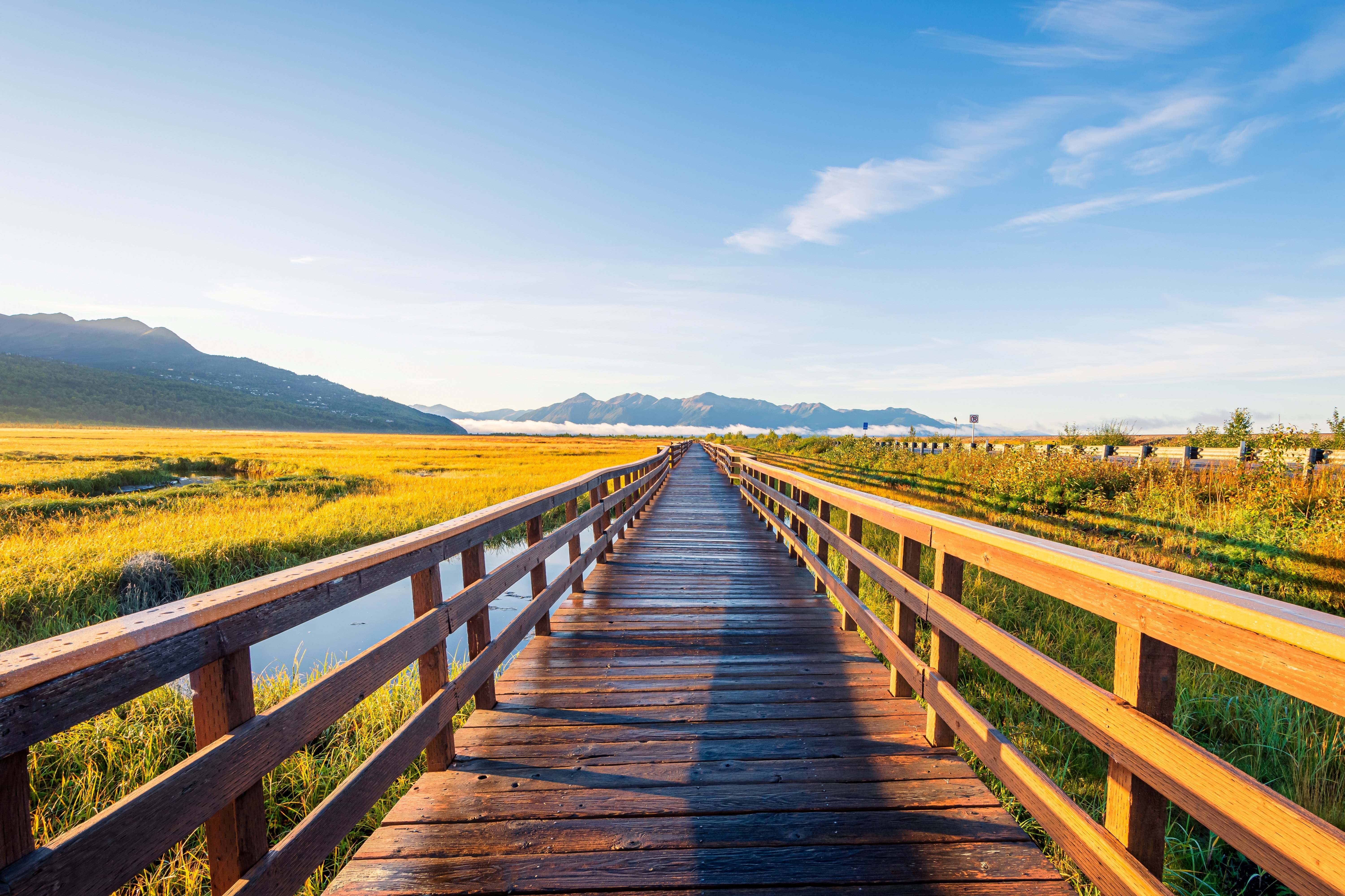
Potter Marsh (Anchorage Coastal Wildlife Refuge) A 564-acre wetland on the southern edge of Anchorage with a boardwalk and observation platforms. Common sightings include Canada geese, arctic terns, green-winged teal, pintails, bald eagles, and (in spring and fall) sandhill cranes and trumpeter swans. Free.
Chugach State Park and Potter Section House At Mile 115 (mileposts on the Seward Highway count down from Anchorage to Seward), the Potter Section House, a restored 1929 railroad-workers' bunkhouse, serves as the visitor center for half-million-acre Chugach State Park, the third-largest state park in the United States. A vintage rotary snowplow stands outside.
Beluga Point (Mile 110) A scenic pulloff named for the white beluga whales that follow salmon into Turnagain Arm, particularly between late July and August. The site has telescopes, interpretive panels, and excellent views across the arm. Also one of the best places to watch the bore tide arrive: about 45 minutes after a Cook Inlet low tide, a wall of water 6 to 10 feet high races up the narrowing arm at 10 to 15 mph, occasionally surfed by experienced kayakers and paddleboarders. Tide-time predictions are available at the Anchorage Visitor Center or in local newspapers.
Bird Point (Mile 96) A more developed pulloff than Beluga Point with restrooms, paved overlooks, and views toward the Kenai Mountains across the arm. Connected to the 13-mile Bird to Gird paved bike trail running between Bird Creek and Girdwood, one of Alaska's premier cycling paths.
Girdwood and Alyeska Resort (Mile 90) A 3-mile spur road north from the highway leads to Girdwood, a quirky former gold-mining village turned ski town, and to the Alyeska Resort, the largest ski resort in Alaska. The Alyeska Aerial Tram climbs from the base lodge to the Seven Glaciers Restaurant at 2,300 feet, with panoramic views of Turnagain Arm and seven hanging glaciers visible from the deck. Operates year-round (winter for skiing, summer for sightseeing and hiking). Approximately $40 per adult round trip for the summer tram. The resort hosts the famous Bake Shop in town (massive sourdough and cinnamon rolls; a Girdwood institution since 1973).
Crow Creek Mine (Side Trip from Girdwood) A working historic gold mine open to visitors for recreational gold panning. Founded 1898 and still operating; equipment is provided.
Twentymile River and Glacier (Mile 81) A turnout offers views up the verdant Twentymile River valley to Twentymile Glacier at its head. Eulachon (smelt) fishing draws long-handled-net users here in May.
Portage Glacier and the Begich-Boggs Visitor Center (Side Trip) A 5-mile spur road from Mile 79 leads to the Begich-Boggs Visitor Center at Portage Lake. The visitor center is named for Congressman Nick Begich and House Majority Leader Hale Boggs, who disappeared in a small plane near here in October 1972. The center offers films, exhibits including ice worms (tiny black creatures that genuinely live inside glacial ice), and views across the lake to Burns Glacier. Portage Glacier itself has retreated out of sight from the visitor center and now requires a 1-hour narrated tour boat trip aboard the MV Ptarmigan to see ($46 per adult; operates late May through mid-September). Several other small glaciers are visible from short trails, including Byron Glacier (1.4 miles round trip).
Whittier (Side Trip) A 2.5-mile drive through the Anton Anderson Memorial Tunnel (the longest highway tunnel in North America at 2.5 miles, shared between cars and trains; one-way traffic alternates every 30 minutes; toll approximately $13 per car each way) leads to Whittier, a strange and atmospheric port town where almost all 270 residents live in a single 14-story building. Day cruises into Prince William Sound depart from Whittier for views of more than 20 tidewater glaciers, including Surprise Glacier and Blackstone Bay.
Turnagain Pass (Mile 68) The highway climbs out of the saltwater zone and crosses the Chugach Mountains at 988 feet. Heavy snowpack creates an avalanche zone in winter; the pass is famous for backcountry skiing, snowboarding, and snowmobiling. In summer, fields of fireweed glow magenta in July and August.
Summit Lake and Tern Lake Junction The road descends through the Chugach National Forest past Lower Summit Lake and Summit Lake, popular fishing and photography stops with abundant wildflowers in mid-summer. At Tern Lake Junction (Mile 37), the Seward Highway meets the Sterling Highway (AK-1 continues west toward Soldotna, Kenai, and Homer). The Seward Highway becomes AK-9 from here and continues south.
Moose Pass (Mile 29) A tiny lakeside village named for an early postal-route incident when a stubborn bull moose blocked the trail. Sitting on the shores of Trail Lake, Moose Pass has a small store, a few cabins, and a hydropower plant. The local "Moose Pass Wye" diner is a worthwhile lunch stop. Don't miss the rotating grindstone water-driven sharpening wheel at the Estes Brothers Grocery, with its famous sign: "If you have an axe to grind, do it here."
Kenai Lake (Mile 23) The highway hugs the eastern shore of this 24-mile-long glacial lake for 5 miles. The unmistakable turquoise color comes from glacial flour: rock particles ground to powder by the upstream glaciers and suspended in meltwater. Several trailheads along this stretch access lake-front hikes.
Exit Glacier (Side Trip near Seward) At Mile 3 (just before Seward), turn west onto Herman Leirer Road for the 9-mile drive to Exit Glacier in Kenai Fjords National Park. Exit Glacier is the only part of the park accessible by road. A series of markers along the access road and short trails show the glacier's dramatic retreat over the past 200 years (you walk past markers labeled 1815, 1899, 1951, 2010, etc., each marking where the glacier's terminus stood that year; recent retreat has accelerated significantly). The Glacier View Loop is a 1-mile easy walk. The Edge of the Glacier Trail (1.5 miles round trip) approaches the toe. The strenuous Harding Icefield Trail (8.2 miles round trip, 3,500 feet of elevation gain) climbs to a viewpoint of the 700-square-mile Harding Icefield, one of the largest icefields in the United States. Free park entry; visitor center open seasonally.
Seward The drive's southern terminus, a charming port town of about 2,800 residents on Resurrection Bay at the foot of 4,603-foot Mount Marathon. Named for William H. Seward, US Secretary of State who negotiated the 1867 Alaska Purchase from Russia. Key sites:
- Kenai Fjords National Park Visitor Center at the harbor, with exhibits on glaciers, marine life, and Alutiiq culture
- Seward Boat Harbor, with daily glacier and wildlife cruises into Kenai Fjords National Park (4 to 9 hours, $130–$240 per adult); the longer cruises reach the calving face of tidewater glaciers and offer the best wildlife viewing (orcas, humpbacks, sea otters, puffins, Steller sea lions, bald eagles)
- Alaska SeaLife Center, a major marine research facility and public aquarium with sea otters, harbor seals, Steller sea lions, puffins, and other Alaskan marine species
- Iditarod Trail Mile 0 monument (the historic mail route began in Seward)
- Mount Marathon Trail, the world's oldest mountain race (held every July 4 since 1915; 3,022 feet straight up and back down to the finish line in town)
- Resurrection Bay kayak tours
Driving Tips
- The Seward Highway is the only road link between Anchorage and the southern Kenai Peninsula (Seward, Homer, Soldotna, Kenai), making it one of Alaska's busiest highways. Summer traffic can be heavy, especially Friday evenings southbound and Sunday afternoons northbound. Allow extra time and use the numerous pulloffs to let faster traffic pass.
- The mudflats of Turnagain Arm are extraordinarily dangerous: a glacial silt and clay mixture that behaves like quicksand and can trap pedestrians within minutes. Rising tides (one of the largest tidal ranges in North America) drown the trapped. Stay off the mudflats entirely. Multiple deaths have occurred.
- Watch for the bore tide on Turnagain Arm. Tide tables for Anchorage will tell you when low tide occurs; the bore reaches Beluga Point approximately 2.5 hours later. Pull off at the official Bore Tide Pullouts (signed) for the best viewing.
- Watch for Dall sheep on the cliff faces above the highway between Beluga Point and Bird Point. Look up.
- Wildlife on the road: moose throughout the corridor (more deadly to motorists than bears; can total a vehicle), black and brown bears, wolves, and (in fall) caribou. Most active at dawn and dusk. Slow down significantly in low-light conditions.
- Construction is ongoing in stretches of the highway every summer; check 511.alaska.gov before driving for current delays and chip-seal operations.
- The Anton Anderson Memorial Tunnel to Whittier alternates direction every 30 minutes. Check the schedule (whittieralaskachamber.org or signage at the tunnel) to avoid long waits. Pay the toll in cash or by card.
- Fuel up in Anchorage, Girdwood, Moose Pass, or Seward. Long stretches between Portage and Moose Pass have no services.
- Cell coverage is reliable in Anchorage, Girdwood, and Seward, intermittent over Turnagain Pass, and spotty in the Chugach. Download offline maps.
- Weather changes rapidly. Pack layers, rain gear, and sun protection regardless of season. Even in midsummer, mornings can be in the 40s°F and afternoons in the 70s°F.
- Book Seward lodging and Kenai Fjords cruises well in advance (often 4 to 6 months for summer). Major Kenai Fjords cruise operators: Major Marine Tours, Kenai Fjords Tours, and Alaska Saltwater Lodging.
- Daylight in midsummer is 18 to 19 hours; the long Alaska day allows leisurely driving with extended evening photography light. Conversely, winter daylight is only 5 to 6 hours; plan accordingly.
- The Seward Highway is open year-round. Winter driving requires winter tires, traction devices, and emergency supplies. The road is plowed but avalanche-prone over Turnagain Pass; check conditions before traveling November through April.
- For more information visit: An Intro to Alaska's Highways | Travel Alaska