RoadDrive
AboutApp StoreSign In / Up

Serra do Rio do Rastro

Serra do Rio do Rastro
Tubarão
São Joaquim
Brazil
377 km
6h 47m

Two Hundred and Eighty-Four Turns to the Sky

The Serra do Rio do Rastro is one of the most breathtaking mountain roads on Earth and ranks among Brazil's most iconic drives. Built in the 1950s and formerly known as "Serra do 12," the SC-390 highway carves 284 relentless curves into the eastern flank of the Serra do Rio do Rastro range, climbing from the steamy subtropical coastal lowlands to a high-altitude plateau where — remarkably for Brazil — snow sometimes falls in winter. Listed among the world's great "skyscraping drives," it is a road that tests both car and driver to the limit while rewarding them with views that stretch all the way to the Atlantic Ocean on clear days. The broader journey from the coastal city of Tubarão through the climb and onward to São Joaquim traverses a complete transformation of landscape, climate, and vegetation — from tropical palm forests to alpine grasslands and araucaria pine forests in just a few hours.


Key Stops

Tubarão - The coastal starting point in southern Santa Catarina. A mid-sized city at sea level, it marks the beginning of the transition from Brazil's warm littoral to the highland interior. Stock up on fuel and supplies here.

Lauro Müller - The gateway town at the base of the mountain climb. This is your last chance for services before the ascent begins. From here, the SC-390 tilts skyward and the 284 curves begin in earnest. The landscape shifts rapidly from lowland greenery to exposed mountain rock.

The 284 Curves (SC-390 Climb) - The heart of the drive. Over just 15 miles (24.5 km), the road gains enormous altitude through relentless hairpin switchbacks cut into sheer cliff faces. At each bend the air grows cooler and fresher, the landscape greener, and the views more dramatic. Several pulloffs allow you to stop, breathe, and photograph the serpentine road unfurling below you.

Mirante (Summit Viewpoint) - At 1,460 meters, the observation point at the top of the climb is the signature moment of the route. On clear days, you can see beyond the mountains all the way to the Atlantic coastline. The view back down the zigzagging road is one of Brazil's most photographed scenes. Nearby, the café and restaurant Mensageiro da Montanha is an excellent stop for coffee and a warm meal.

Bom Jardim da Serra - A charming mountain town just beyond the summit. Renowned for its viewpoints and cool climate, it serves as the base for visiting the Cascata do Avencal, a spectacular waterfall plunging over 100 meters (330 ft) down a basalt cliff face. The town has eco-lodges and pousadas nestled in the highland scenery.

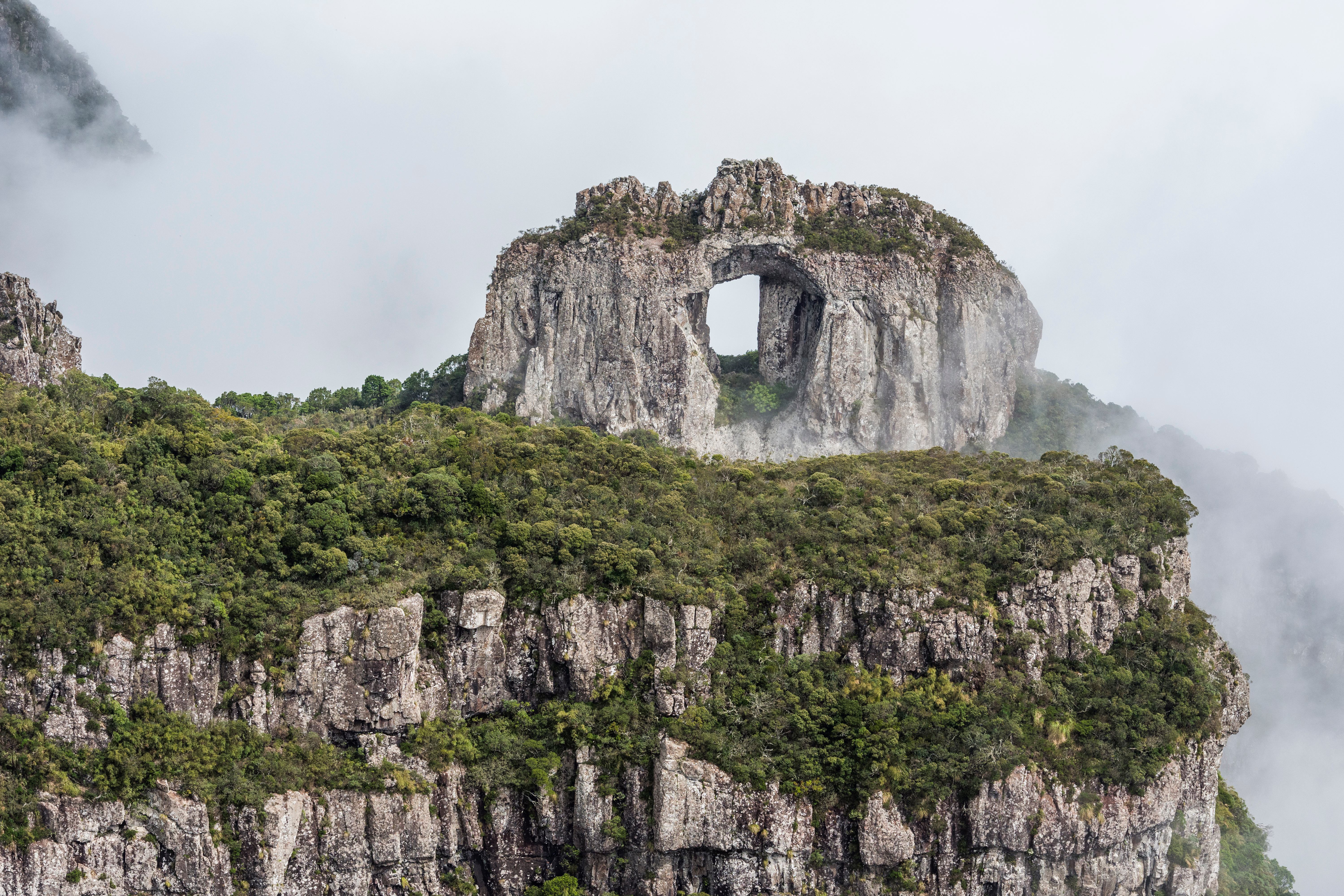
Urubici - A detour well worth making. This mountain town is the hub of the Serra Catarinense region and gateway to some of its finest natural attractions, including Morro da Igreja (1,822 m / 5,978 ft — one of the highest points in southern Brazil) and the iconic Pedra Furada, a natural rock arch with a 30-meter circumference opening perched above a dramatic canyon. Advance booking through ICMBio is required, and a guide is mandatory for the 6.2 km trail to Pedra Furada.

São Joaquim - The endpoint of the route, sitting at 1,360 meters elevation. Famous for being one of the coldest cities in Brazil, it is also known for its apple orchards and a growing wine region. In winter, São Joaquim regularly records sub-zero temperatures and occasional snowfall — a novelty that draws visitors from across Brazil.

São Joaquim National Park - Surrounding the town, this park protects one of the last significant stands of Brazilian araucaria pine forest, along with highland grasslands, canyons, and rare fauna. A striking contrast to the tropical coast you left behind just hours ago.


Driving Tips

  • Weather awareness: Conditions change rapidly in the mountains. Fog can roll in within minutes at higher elevations, reducing visibility to near zero. Check forecasts before departing. Even on warm days, bring a jacket — temperatures at the summit can be 15°C cooler than at the base.
  • Winter driving: From June to August, temperatures can drop below 0°C (32°F) at the top. Ice on the road is possible, and snow occasionally closes the route. Drive with extreme caution in winter conditions.
  • Summer advantage: December to February offers the clearest skies and safest driving conditions, with less fog and no ice risk. This is the best season for the famous Atlantic views from the mirante.
  • Take it slow: This is not a road to rush. Use low gear on both the ascent and descent to preserve your brakes. Yield to uphill traffic on narrow sections. The descent is more demanding on brakes than the climb.
  • Timing: Start early in the morning for the best visibility and least fog. Cloud cover typically builds through the afternoon.
  • Fuel up: Fill your tank in Tubarão or Lauro Müller. Services are limited between the base and Bom Jardim da Serra.
  • Eco-lodges: Combine the drive with an overnight stay at one of the eco-lodges scattered through the mountains above Bom Jardim da Serra — the stargazing from this altitude is exceptional.
  • No guardrails: Some sections of the climb have minimal barriers between you and steep drops. Stay focused and avoid distractions.
  • For more information visit: Winter tourism in Serra Catarinense breaks historical record

Waypoints (7)

☰
1
Tubarão
⛰️ 71 m
43 km
48m
☰
2
Lauro Muller
⛰️ 258 m
13 km
15m
☰
3
Mirante da Serra do Rio do Rastro
⛰️ 995 m
24 km
39m
☰
4
Bom Jardim da Serra
⛰️ 1349 m
82 km
1h 13m
☰
5
Urubici
⛰️ 1286 m
49 km
58m
☰
6
Morro da Igreja
⛰️ 1044 m
74 km
1h 14m
☰
7
São Joaquim
⛰️ 1293 m