Sea to Sky Highway
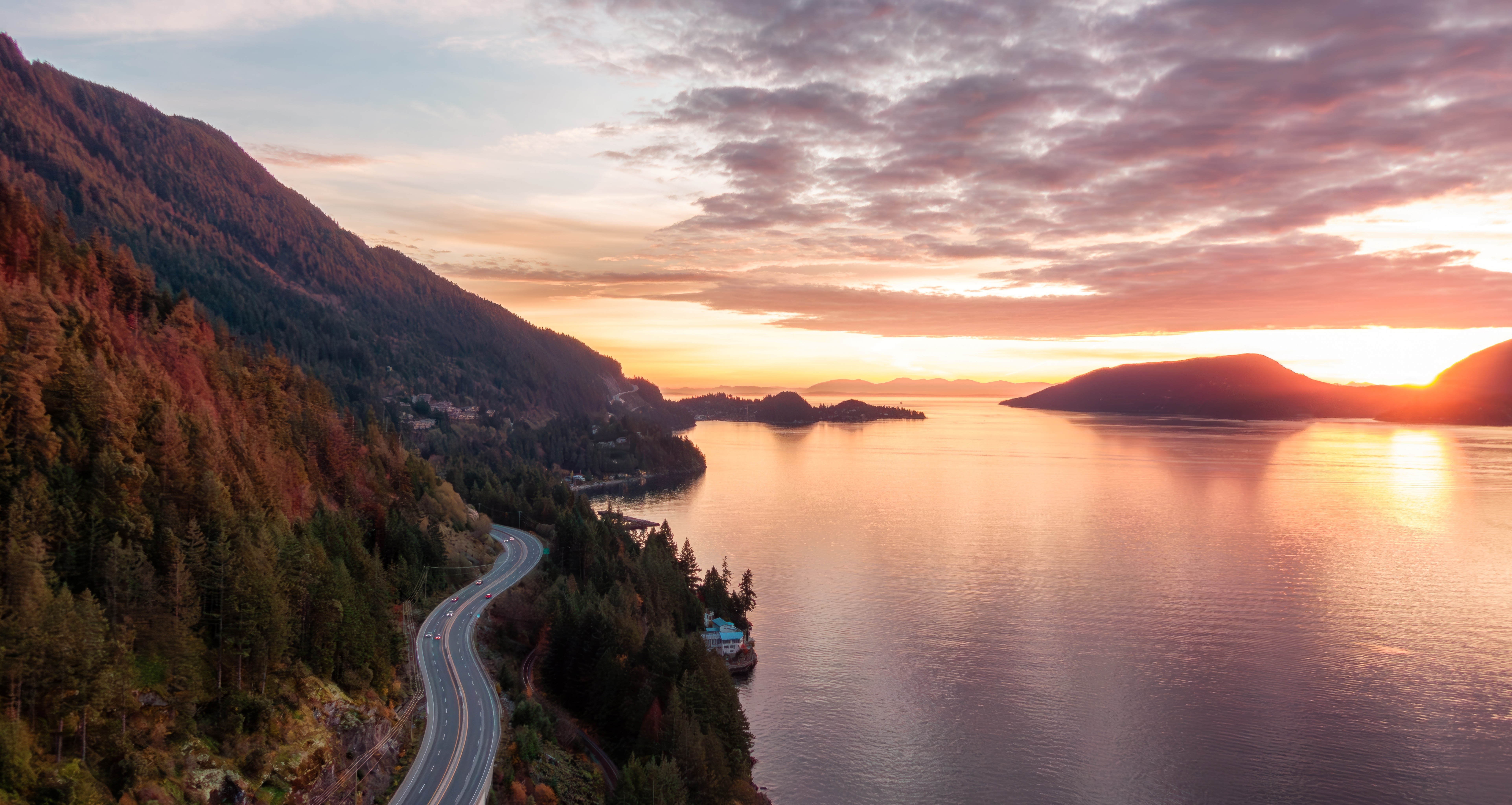
From Fjord to Summit on Canada's Most Dramatic Mountain Road
Highway 99, the Sea to Sky Highway, climbs from the tidewater at Horseshoe Bay into the Coast Mountains of British Columbia on a road that received a $600-million transformation before the 2010 Winter Olympics. What was once a notoriously dangerous two-lane cliff road is now a well-engineered mountain highway, though it still hugs the edge of Howe Sound, a glacier-carved fjord flanked by snow-capped peaks that rise straight from the waterline. The route follows an ancient trading path of the Squamish and Lil'wat nations, passing through territory their peoples have inhabited for thousands of years. At Squamish, roughly halfway, a 700-meter granite monolith called the Stawamus Chief towers over the highway, drawing rock climbers from around the world to its more than 1,000 routes. In winter, the Brackendale stretch of the Squamish River hosts the largest gathering of bald eagles in the world, with nearly 4,000 counted in a single migration. The road then climbs past Brandywine Falls and into Whistler, host of the 2010 Winter Olympics, where two mountains offer year-round recreation and the Peak 2 Peak Gondola spans nearly two miles between summits at 436 meters above the valley floor. Beyond Whistler, the highway drops into the broad, fertile Pemberton Valley, where potato farms and hay meadows spread beneath the Lillooet Range.
Key Stops
Horseshoe Bay The starting point: a small waterfront village in West Vancouver where BC Ferries depart for Nanaimo and the Sunshine Coast. Fish and chips at the marina make a fitting send-off. Whytecliff Park, just west, is Canada's first protected saltwater diving area. Full services.
Porteau Cove Provincial Park A waterfront park on Howe Sound with some of British Columbia's most accessible shore diving: sunken ships and man-made reefs attract giant lingcod, anemones, and seals. Tide pools brim with life at low tide. Waterfront campsites (44 vehicle-accessible, 16 walk-in) look across the fjord to the coastal mountains. The park's name derives from the French porte d'eau, "water's gate." Reservable through BC Parks' Discover Camping system.
Britannia Mine Museum (National Historic Site) A century-old copper mine that was once the largest in the British Empire, discovered by chance in 1888 when a wounded buck's hooves scraped away the earth to expose mineralized rock. The museum offers underground mine train tours (approximately 45 minutes), gold panning, and exhibits in the landmark gravity-powered Mill House. The mine operated for 70 years and roughly 60,000 people lived and worked here before it closed in 1974. Approximately $30–$35 per adult.
Shannon Falls Provincial Park British Columbia's third tallest waterfall, plunging 335 meters (1,099 feet) in a thundering cascade visible from an easy 10-minute walk from the parking area. Best flow in spring and early summer during snowmelt. Free admission. Connected by trail to the Stawamus Chief and the Sea to Sky Gondola.
Stawamus Chief Provincial Park One of the largest granite monoliths in the world, rising 700 meters above Highway 99. Over 1,000 climbing routes and 2,000 bouldering problems draw rock climbers from around the globe. Three summit hiking trails of increasing difficulty reach the three peaks, all strenuous with roughly 600 meters of elevation gain, ladders, and chains. The Second Peak trail offers the best views of Howe Sound and the Squamish Valley. BC Parks requires a free day-use pass during peak season to manage crowding; check availability online.
Sea to Sky Gondola The gondola rises 885 meters to a summit lodge with the 100-meter Sky Pilot Suspension Bridge, the Spirit Trail loop, and panoramic views across Howe Sound and the Coast Mountains. The gondola was rebuilt and reopened in June 2022 after two cable-cutting vandalism incidents (2019 and 2020) and now operates with enhanced 24/7 security. Approximately $72–$78 per adult. Via Ferrata climbing routes are available at the summit for an additional fee. Hours vary seasonally; typically closed for maintenance in late fall.
Squamish A town of roughly 25,000 that bills itself "The Outdoor Recreation Capital of Canada," with over 200 mountain biking trails, world-class kiteboarding at the Squamish Spit, and rafting on the Elaho and Squamish Rivers. Downtown Cleveland Avenue has a growing restaurant, brewery, and gallery scene, anchored by local favorites Backcountry Brewing and Howe Sound Brewing. The West Coast Railway Heritage Park features over 60 vintage railcars.
Brackendale Eagle Reserve One of the world's most important bald eagle wintering sites, along the Squamish River in northern Squamish. Eagles gather from November through February to feed on spawning chum and coho salmon, with a record 3,769 counted in a single 1994 migration. Viewing platforms along the dike trail at Eagle Run on Government Road offer the closest access. Guided river float tours bring visitors even closer. Peak viewing: December and January.
Tantalus Viewpoint A signed pullout a few miles north of Brohm Lake with views of the snowcapped Tantalus Range. The region receives an average annual precipitation of 95 inches, feeding the dense forests, wildflowers, and glaciers that blanket these mountains.
Garibaldi Provincial Park Sprawling across more than 400,000 acres east of the highway, British Columbia's most popular wilderness park encompasses ancient lava flows, alpine meadows, and glacial peaks rising to 2,890 meters at Wedge Mountain. Garibaldi Lake, formed when lava flows blocked a glacial valley, is a turquoise jewel reached by a 9-km hike from the trailhead. Black Tusk, the park's volcanic spire, is visible from the highway and is a favorite destination for experienced hikers.
Brandywine Falls Provincial Park A 70-meter (230-foot) waterfall roaring into a volcanic rock gorge, reached by an easy 500-meter trail through temperate rainforest past basalt columns and lava flows. A second platform overlooks Daisy Lake and Black Tusk. Free admission. Impressive year-round, including partially frozen in winter.
Whistler Host of the 2010 Winter Olympics, Whistler is a pedestrian village of over 200 shops and 90 restaurants at the base of Whistler Mountain and Blackcomb Mountain. The Peak 2 Peak Gondola connects the two summits, spanning 4.4 km with a free span of 3.03 km at 436 meters above the valley floor; try to board a glass-bottom cabin. Summer sightseeing tickets are approximately $75–$85 per adult. Summer activities include the Whistler Mountain Bike Park (one of the world's best gravity-fed parks), alpine hiking via gondola, zip-lining, and golf on four championship courses. The Audain Art Museum houses a superb collection spanning Northwest Coast First Nations masks through Emily Carr paintings to contemporary art (approximately $20–$22 per adult). The Squamish Lil'wat Cultural Centre explores the heritage of the two Coast Salish nations whose trading routes intersected here. The paved Valley Trail network (over 40 km) connects the village to parks and lakes. The town's name comes from the native hoary marmots, whose calls sound like whistling.
Nairn Falls Provincial Park A powerful series of cascades on the Green River dropping roughly 60 meters through a narrow volcanic rock canyon, 28 km north of Whistler. A well-maintained 1.5-km trail leads to the viewing area (30 minutes each way). The 94-site campground is reservable through Discover Camping.
Pemberton The drive's quiet finale: a small farming community in a broad fertile valley surrounded by mountains. Accessible only by rail until the highway was completed in 1972, Pemberton remains true to its agricultural roots, known locally as "Spud Valley" for its prodigious potato crop. Horseback riding, mountain biking, and pick-your-own farms offer a slower pace after Whistler's bustle. Beyond Pemberton, Duffey Lake Road continues east as a stunning but more challenging drive through the Coast Mountains toward Lillooet, popular with motorcyclists.
Driving Tips
- Winter tires are mandatory on Highway 99 from October 1 through April 30. Tires must bear the mountain snowflake (3PMSF) symbol or M+S rating with at least 3.5 mm tread depth.
- Weekend traffic can be extremely heavy, especially Friday evenings northbound and Sunday evenings southbound. Travel midweek or at off-peak hours when possible.
- Check DriveBC (drivebc.ca) for real-time road conditions before departing. Avalanche control closures occur between Squamish and Whistler in winter, and rockfall warnings can affect the Howe Sound section.
- Pre-book timed entry for the Sea to Sky Gondola, Stawamus Chief day-use passes, and BC Parks campsite reservations, especially between June and September.
- Wildfire smoke can reduce air quality and visibility in July through September. Check BC wildfire status before planning a summer trip.
- EV charging stations are available in Squamish (DC fast chargers), Whistler, and Pemberton. Use PlugShare or ChargePoint apps for current availability.
- Cell coverage is generally good from Horseshoe Bay through Whistler on major carriers. Coverage weakens north of Pemberton.
- Fuel up in Squamish or Whistler. Prices are significantly higher than in Vancouver.
- Bears have been spotted grazing on clover in the highway median during summer. Watch for wildlife, particularly at dawn and dusk.
- For more information visit: Sea to Sky Highway - Highway 99 | Tourism Squamish