Salmon River Scenic Byway
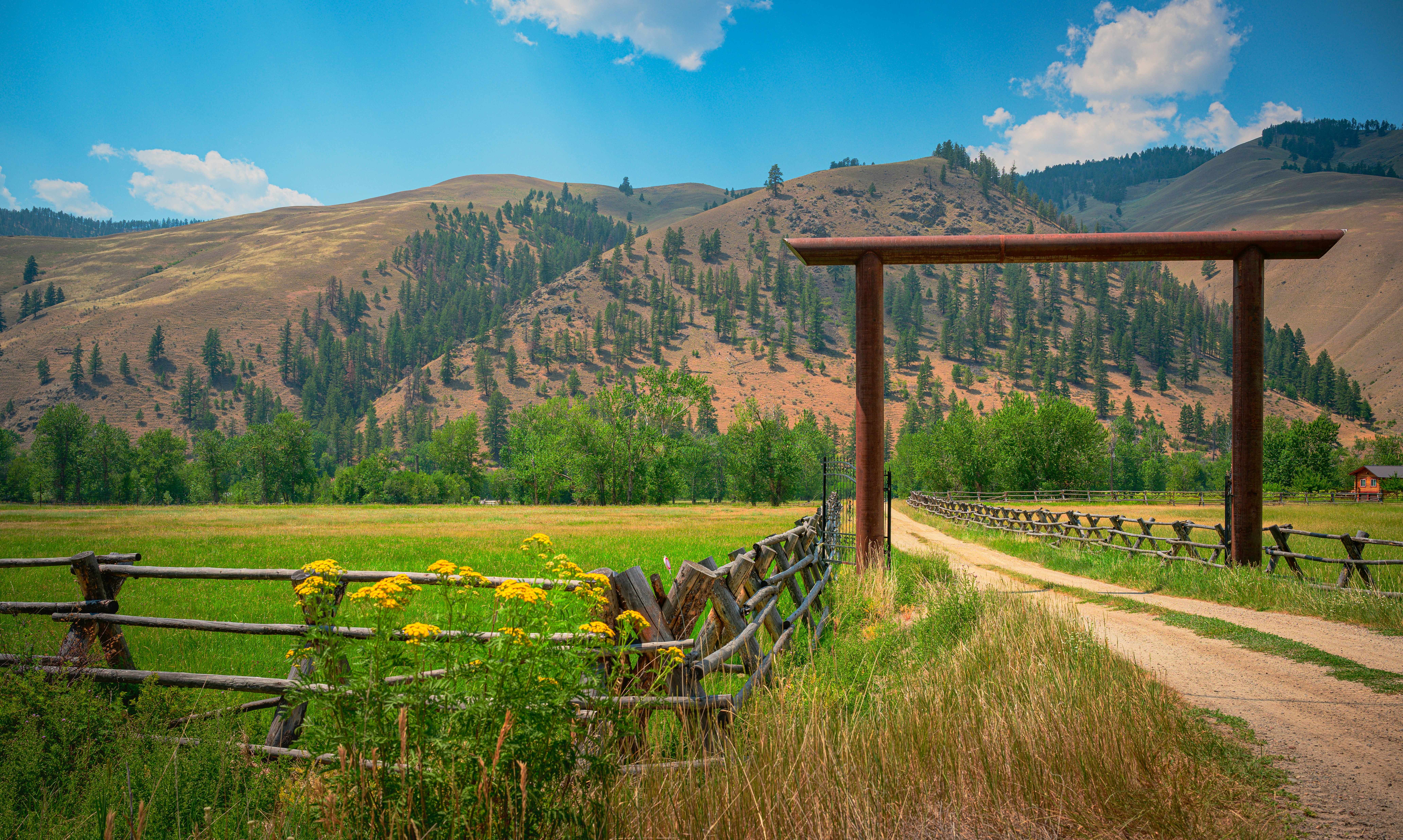
Along Idaho's River of No Return
The Salmon River Scenic Byway traces 161 miles of the longest free-flowing river contained within a single state in the lower 48, descending from the headwaters in the Sawtooth Mountains at Stanley through one of the deepest gorges in North America (deeper, in places, than the Grand Canyon) to the Montana border at Lost Trail Pass. The Salmon River was nicknamed the "River of No Return" by early boatmen, who could float downstream through the canyon but could not paddle back up against the current; the Shoshone, who had inhabited this country for thousands of years, told Lewis and Clark in August 1805 that the river was impassable, forcing the expedition to detour north over Lost Trail Pass into the Bitterroot Valley of Montana. Stanley, the byway's southern starting point, sits at 6,253 feet in a bowl of meadows beneath the jagged spires of the Sawtooth Range, the most photographed mountain skyline in Idaho. The road then drops downstream past Sunbeam Hot Springs (where natural hot water mixes with the cold river right at the streambed), passes the ghost towns of Custer and Bonanza in the Yankee Fork mining district, threads the deep canyon to Salmon (the Lemhi Valley town that calls itself the "Whitewater Capital of the World"), and finally climbs the Continental Divide at Lost Trail Pass (7,014 ft) into Montana. The Salmon River drainage holds 425 miles of free-flowing water and 2.3 million acres of the Frank Church–River of No Return Wilderness, the largest forested wilderness in the contiguous United States. The byway is bracketed by world-class whitewater (the Main Salmon and Middle Fork are among the finest multi-day river trips in North America) and by Lewis and Clark history: the Sacajawea Interpretive and Education Center in Salmon stands on the homeland of the Lemhi Shoshone woman whose translation skills helped guide the Corps of Discovery to the Pacific.
Key Stops
Stanley The byway's southern starting point and one of the most photogenic small towns in the American West. At 6,253 feet, Stanley sits in a broad meadow with the Sawtooth Mountains rising abruptly to the south, their jagged ridge of 10,000-plus-foot granite peaks providing what is widely considered the finest mountain backdrop in Idaho. Year-round population is roughly 70, with a coldest-place-in-the-contiguous-48 reputation: winter temperatures routinely drop to minus 40°F. The town has a handful of restaurants, lodges, and outfitters serving rafters, anglers, hikers, and hot-springs seekers. The Sawtooth Scenic Byway (ID-75 south to Ketchum/Sun Valley) and the Ponderosa Pine Scenic Byway (ID-21 west to Boise) both end at Stanley. Stanley Lake, five miles west on ID-21, offers one of the most-photographed reflection views of the Sawtooths from McGown Peak.
Salmon River Headwaters ID-75 leaves Stanley and follows the Salmon River downstream as the river snakes out of Stanley Basin between high cliffs. Douglas fir and lodgepole pine dominate, with aspens lighting the mountain slopes gold in late September. Several primitive Forest Service hot springs line the river, including Mormon Bend, Boat Box, and Basin Creek Hot Springs.
Sunbeam Hot Springs and Sunbeam Dam About 13 miles east of Stanley, Sunbeam Hot Springs flows from the cliff face directly into the Salmon River, creating a hot-cold mixing zone where bathers can find their preferred temperature. A few hundred yards downstream, the concrete ruins of Sunbeam Dam (built in 1910 to power a stamp mill at the Sunbeam Mine) stand as the only dam ever built on the Main Salmon River. Because it blocked salmon migration, locals dynamited the dam in 1934, restoring the free-flowing river. Free.
Yankee Fork Ghost Towns: Bonanza and Custer (Side Trip) A partly unpaved forest road heads north from Sunbeam up the Yankee Fork to the gold-rush ghost towns of Bonanza (founded 1877) and Custer (founded 1879). Both boomed when rich veins were discovered in the mid-1870s, both were all but abandoned by 1911. The Custer Ghost Town Museum (in the original 1900 schoolhouse) and the Yankee Fork Gold Dredge (a four-story, 988-ton bucket-line dredge that gouged a five-mile trail of tailings up the Yankee Fork between 1940 and 1952) are preserved as a National Historic District. The dredge offers guided tours in summer (small fee). Allow half a day.
Indian Riffles A pullout on ID-75 where Chinook salmon and steelhead can be observed spawning in the gravel beds in late summer and fall, after one of the longest fish migrations on Earth: roughly 900 miles from the Pacific Ocean up the Columbia, Snake, and Salmon Rivers, climbing nearly 7,000 feet in elevation. The salmon return is a fraction of historic numbers due to dam impacts downstream.
Challis The Custer County seat, a small town with full services, lodging, and the Land of the Yankee Fork State Park Interpretive Center, which tells the story of the Yankee Fork mining district. The Salmon-Challis National Forest headquarters is also here. The drive joins US-93 north of Challis.
Salmon Falls and the Lower Canyon Between Challis and the town of Salmon, US-93 follows the river through a tightening canyon. Bighorn sheep winter on the south-facing slopes; mountain goats roam the cliffs above. Golden eagles and ospreys ride the thermals. Watch for the prominent Indian rock formation and old homesteads along the river benches.
Salmon The Lemhi Valley town, named for the river that runs through it, is the byway's northern hub with full services. The Sacajawea Interpretive, Cultural, and Educational Center sits on the riverbank and tells the story of the Lemhi Shoshone woman who guided Lewis and Clark across the Bitterroots in 1805 (the Lemhi Valley was her birthplace and the homeland of her people). A short walking trail with interpretive panels brings the culture to life. Free, donations welcomed. Salmon is the staging point for multi-day rafting trips on the Main Salmon River through the Frank Church Wilderness; major outfitters operate from town. Half-day to full-day jet boat tours run upstream into the canyon from Salmon and from the river's North Fork put-in.
North Fork A tiny river town 20 miles north of Salmon at the confluence of the Main Salmon and the North Fork of the Salmon. The last reliable services before the climb to Lost Trail Pass. The North Fork Store and the North Fork Cafe are local institutions. From here, gravel Forest Road 030 follows the Main Salmon downstream into the Frank Church Wilderness, ending at Corn Creek (the put-in for multi-day Main Salmon float trips). Drivers should not attempt this road without a high-clearance vehicle and prior research.
Frank Church–River of No Return Wilderness Although the byway only skirts the eastern edge, the 2.366-million-acre wilderness (designated 1980, renamed in 1984 for Senator Frank Church) is the largest forested wilderness in the contiguous United States, larger than Yellowstone, and contains over 2,600 miles of trails. Most access is by raft, foot, or backcountry airstrip.
Lost Trail Pass US-93 climbs from North Fork through dense forest to Lost Trail Pass at 7,014 feet on the Idaho-Montana border, where Lewis and Clark crossed on September 3, 1805. After being told by the Shoshone that the Salmon River could not be navigated, the Corps of Discovery scaled the pass over what one member called "the worst route that was ever travelled." The Lost Trail Pass Powder Mountain Ski Area (small, family-friendly) sits at the summit. The Continental Divide National Scenic Trail crosses here. From the pass, US-93 descends into Montana's Bitterroot Valley, eventually reaching Missoula 90 miles north.
Lemhi Pass (Side Trip) Twenty-eight miles southeast of Salmon via gravel forest road, Lemhi Pass at 7,373 feet marks the Continental Divide and the spot where Meriwether Lewis crossed on August 12, 1805, becoming the first US citizen to cross the divide on this side. A monument and interpretive panels tell the story. Sacajawea Memorial Camp is nearby. The road is rough; high-clearance vehicle recommended. The detour adds 56 miles round trip but offers an authentic Lewis and Clark experience away from the main byway.
Driving Tips
- The byway is fully paved, two-lane, and well-maintained throughout. Stay aware of slow-moving farm equipment, livestock trucks, and recreational vehicles.
- The Yankee Fork ghost towns (Bonanza, Custer) are reached via a partly unpaved forest road from Sunbeam. Standard cars in dry weather can usually make it, but high-clearance is more comfortable. Avoid after heavy rain.
- Cell coverage is intermittent throughout the corridor. Stanley and Salmon have reliable service; canyon sections between Challis and Salmon are nonexistent. Download offline maps.
- Services are spaced widely. Fuel up in Stanley, Challis, Salmon, or North Fork. The 90-mile stretch from Stanley to Challis has minimal services (Sunbeam has a small store but limited fuel).
- Watch for wildlife: bighorn sheep, mountain goats, mule deer, elk, and occasionally black bears and moose. Most active at dawn and dusk.
- Wildfire smoke can affect the corridor from mid-July through September. Idaho air quality forecasts and active fire status are available at airnow.gov and inciweb.nwcg.gov.
- The Salmon River and its Middle Fork are world-class multi-day whitewater trips, but permits are required and allocated by lottery (annual application opens December 1 each year through Recreation.gov). Commercial outfitters in Stanley, Salmon, and North Fork hold a portion of permits and offer guided trips.
- Stanley and Salmon both have a handful of natural hot springs accessible by short hike or short drive. Some are popular and crowded; others remain quiet. Check current conditions and respect Leave No Trace.
- Winter access on ID-75 and US-93 is generally maintained, but the Galena Summit (south of Stanley) and Lost Trail Pass receive heavy snow and can close briefly during storms. Carry chains and winter gear November through March.
- Stanley sits in a frost pocket. Even in midsummer, overnight lows can drop near freezing. Pack layers regardless of season.
- For more information visit: Idaho Tourism: Salmon River Scenic Byway