Ruby Mountains Alpine Drive
Nevada's Hidden Alps
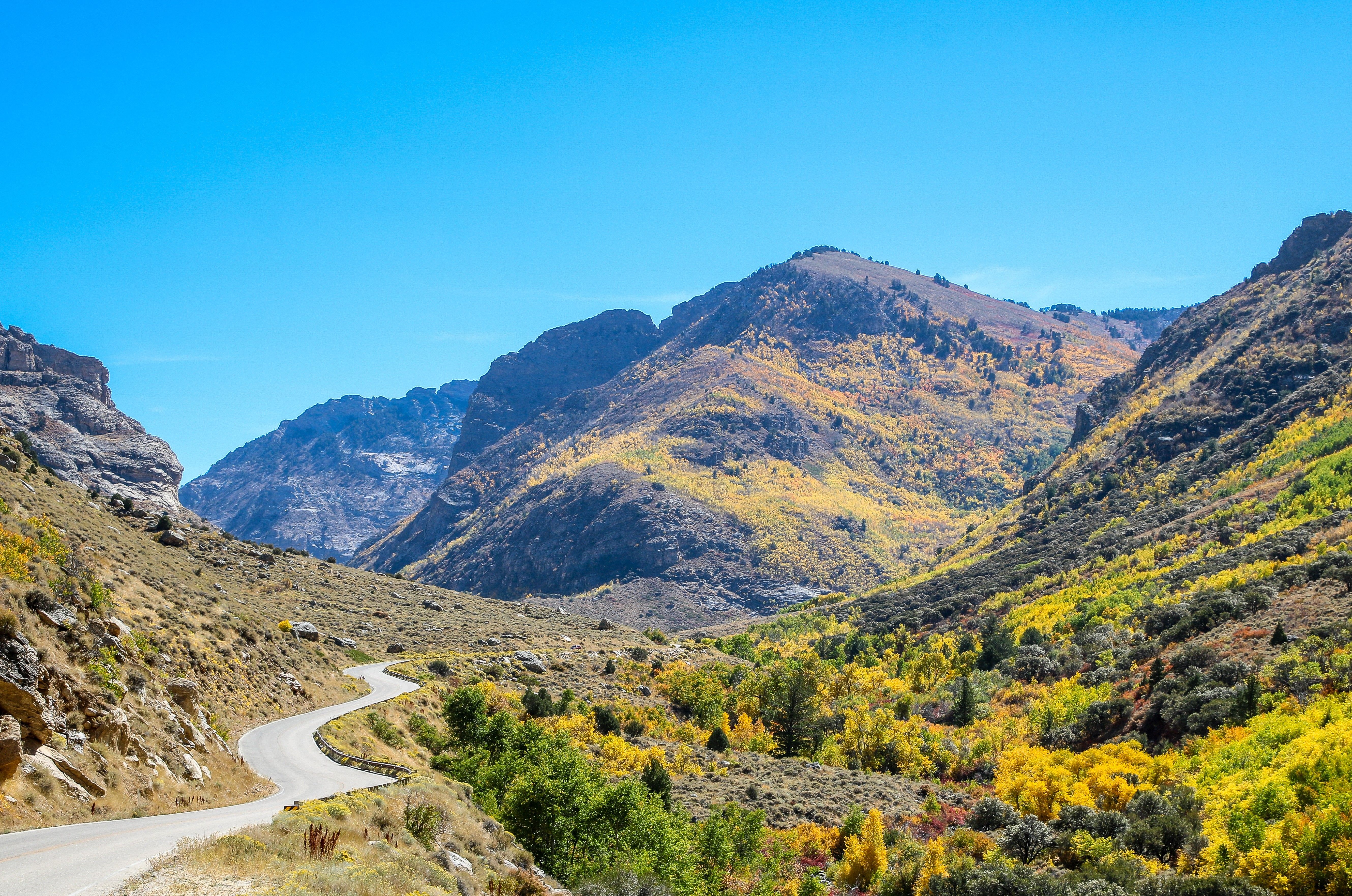
The Ruby Mountains seem to burst from the flat desert floor of northeastern Nevada like a mirage — a wall of glacially carved granite peaks topping 11,000 feet, draped with snowfields, alpine lakes, and wildflower meadows that have earned them the nickname "the Swiss Alps of Nevada." Lamoille Canyon Road climbs 2,800 feet in 12 miles through a textbook U-shaped glacial valley, its walls rising in sheer metamorphic cliffs swirled with light-colored granite while dozens of small waterfalls cascade from hanging valleys above. The road follows Lamoille Creek through corridors of cottonwood and aspen, past interpretive panels explaining how ice sheets a mile thick carved this landscape, before ending abruptly at a ring of peaks at 8,800 feet where the pavement simply runs out of mountain. From Road's End, the 33-mile Ruby Crest National Recreation Trail disappears into 90,000 acres of wilderness that harbors bighorn sheep, mountain goats, and the only population of Himalayan snowcock in the Western Hemisphere. It is one of the most dramatic dead-end roads in the American West, and almost nobody knows it's here.
Key Stops
Powerhouse Picnic Area At the mouth of the canyon, this fully ADA-accessible site marks where a hydroelectric plant operated from 1911 to 1971. Rebuilt in 2003, it now offers a pavilion, group fire ring, BBQ grills, and vault toilets — a good place to orient yourself before the climb. Interpretive signs introduce the canyon's geology and the self-guided auto tour that follows. Day use is $5 per vehicle; open mid-May through late September.
Glacier Overlook Approximately six miles up the byway, this pullout features interpretive panels explaining how glaciers carved Lamoille Canyon's signature U-shape. The exhibit traces the path the ice took as it sculpted the valley, pointing out cirques, moraines, and hanging valleys visible from where you stand. Several peaks topping 10,000 feet fill the view ahead. This is one of four geology-interpretive panels along the road that together tell the canyon's deep history.
Thomas Canyon Campground Two miles beyond Glacier Overlook, at 7,600 feet, this Forest Service campground sits at the mouth of a glacial side canyon. Its 39 sites are tucked among conifers along Lamoille Creek ($19–$38/night, mix of reservable and first-come first-served, Memorial Day through Labor Day). From here, a trail climbs the floor of Thomas Canyon through wildflower meadows and forests of limber and whitebark pine — a moderate hike that offers a taste of the high country without committing to a full-day outing.
Changing Canyon Nature Trail Just past the Hanging Valley pullout, this easy 0.5-mile interpretive loop winds through quaking aspen, chokecherry, and mountain mahogany with numbered signs explaining the canyon's ecology. Beaver habitat along Lamoille Creek supports rich birdlife — woodpeckers, warblers, and hawks are common. A descriptive brochure from the Nevada Department of Wildlife corresponds to the trail markers. It's a quick, rewarding stop that most drivers overlook.
Terraces Picnic Area An off-road site set in mature aspens at 8,000 feet, where you can stop for views of a 1,500-foot cliff of metamorphic rock swirled with pale granite — the exposed backbone of the Ruby Mountains. Lamoille Creek runs alongside, holding brook and rainbow trout. The site accommodates up to 75 people for group camping (reservable up to one year ahead on Recreation.gov) and is open mid-June through late September. Vault toilets and drinking water are available.
Road's End The byway terminates dramatically in a natural amphitheater at 8,800 feet, where a ring of peaks rises from the forest and stops the road in its tracks. This is the northern trailhead for the 33-mile Ruby Crest National Recreation Trail, which traverses the spine of the Ruby Mountains through alpine lakes, wildflower basins, and glacial passes. The most popular day hikes begin here: the trail to Island Lake (3.6 miles round trip, 940 feet gain) reaches a glacial cirque lake at 9,700 feet in about an hour, while the trail to Lamoille Lake (4.4 miles round trip, 1,000 feet gain) follows the Ruby Crest south past the Dollar Lakes. Both offer brook trout fishing. Parking fills quickly in peak season — arrive early.
Island Lake A moderate 1.8-mile climb from Road's End through dense aspen and pine forest, ascending switchbacks through wildflower meadows to a glacial cirque lake at 9,700 feet. The lake sits beneath towering cliffs with snowfields that persist well into summer. Brook trout dimple the surface in the evening. This is the single best short hike on the byway and justifies the entire drive.
Driving Tips
- Seasonal closure: The road is not plowed in winter and is typically open May through October, weather dependent. A snow-line gate closes the upper section. Call the Ruby Mountains Ranger District at (775) 738-5171 for current conditions.
- Vehicle suitability: The road is paved and suitable for all vehicles, though it is narrow and winding with steep grades. Large RVs and trailers can navigate the road but will find tight turns and limited parking at Road's End.
- No services in the canyon: There is no fuel, food, or drinking water along the byway (water is available at Thomas Canyon Campground and Terraces Picnic Area only). Fill up in Elko or Lamoille before entering.
- Cell service: Essentially nonexistent throughout Lamoille Canyon and the Ruby Mountains. Do not rely on your phone for navigation or emergencies — carry a paper map.
- Wildflowers: Peak bloom at alpine elevations runs mid-July to early August. Lower meadows bloom earlier (June). Indian paintbrush, columbine, lupine, and alpine sunflower are the showstoppers.
- Wildlife: Mountain goats are often visible on the canyon walls — the Rubies are the only mountains in Nevada with a mountain goat population (introduced from Washington State in the 1960s). The Ruby Mountains also harbor the only Himalayan snowcock in the Western Hemisphere, introduced in 1963, though seeing one requires a pre-dawn hike above 10,000 feet.
- Fishing: A Nevada fishing license is required. Lamoille Creek holds brook, rainbow, and tiger trout; alpine lakes offer brook trout and Lahontan cutthroat. Best fishing is July through October after spring runoff subsides.
- No fees for the road itself: The byway has no entrance fee. Campground and picnic area fees apply separately. No permits are needed for day hiking or the Ruby Crest Trail.
- Dining: Pine Lodge Dinner House in the small town of Lamoille (population ~276) serves steaks and prime rib in a rustic lodge setting — a fitting end to the drive.
- For more information visit: Travel Nevada — Lamoille Canyon & the Ruby Mountains