Ring of Kerry
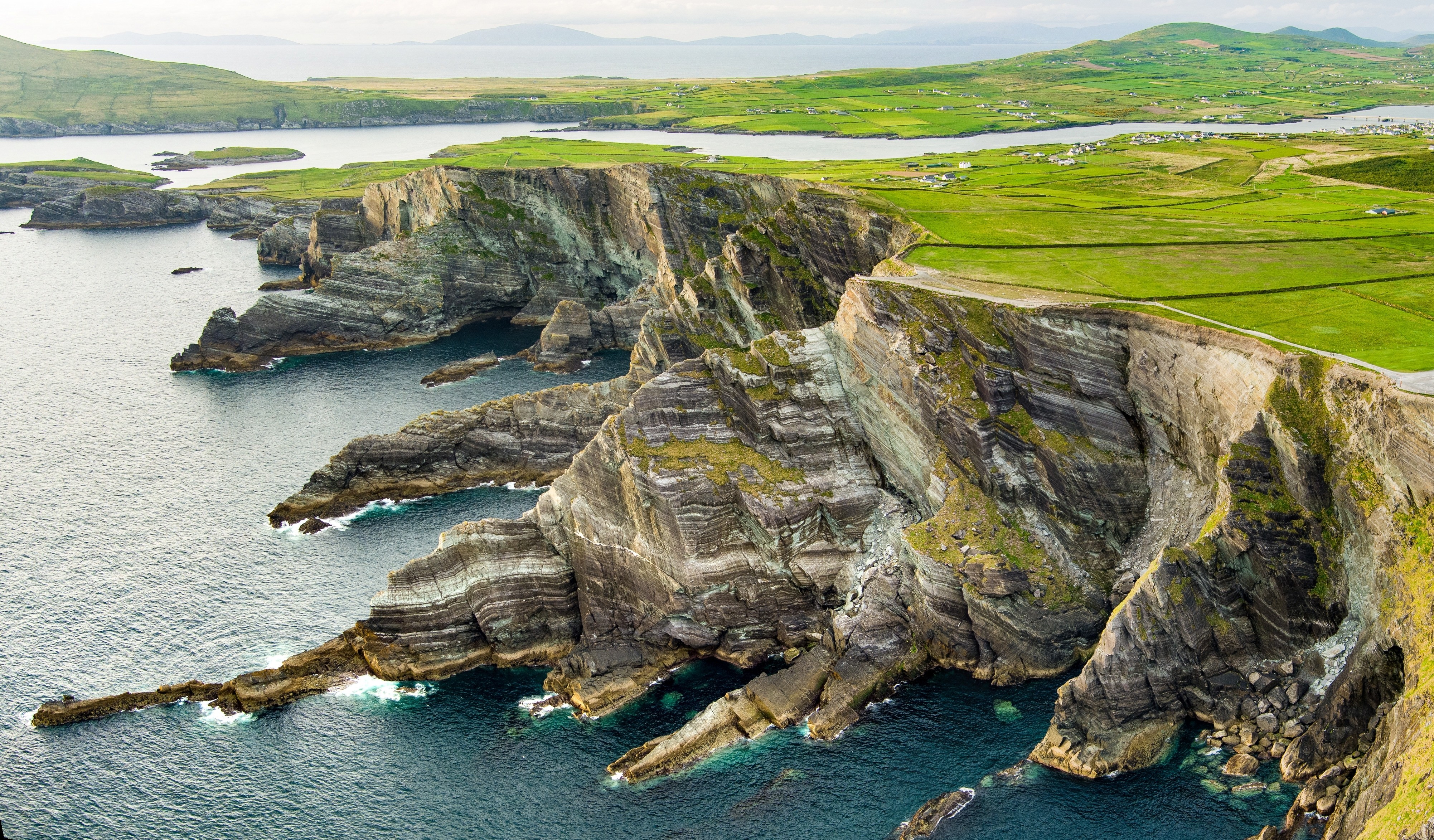
Ireland's Grand Tour of Mountain, Sea, and Stone
The Ring of Kerry loops around the Iveragh Peninsula in County Kerry, tracing Ireland's most famous scenic driving route through a landscape of mountains plunging to the Atlantic, island-scattered bays, and stone forts older than recorded history. From Killarney, the route climbs through the national park past Torc Waterfall and Ladies View, descends to the colorful town of Kenmare, then follows the coast west through Sneem, Caherdaniel, and Waterville before rounding the peninsula's Atlantic edge. On clear days, the silhouette of Skellig Michael rises from the ocean to the southwest: a 6th-century monastery perched on a rock pinnacle 12 km offshore, inscribed as a UNESCO World Heritage Site. The Kerry Cliffs near Portmagee rival the Cliffs of Moher at 1,000 feet but draw a fraction of the visitors. The Skellig Ring detour, a narrow side loop too tight for tour buses, offers the most dramatic coastal scenery on the entire route. The drive finishes through Killorglin and the Gap of Dunloe, returning to Killarney through 10,000 hectares of national park designated as a UNESCO Biosphere Reserve.
Key Stops
Killarney National Park Ireland's first national park covers 10,000 hectares of mountains, lakes, and ancient oak woodland, designated a UNESCO Biosphere Reserve. Ross Castle, a 15th-century tower house on the shore of Lough Leane, and Muckross House, a grand Victorian mansion with landscaped gardens, anchor the park's eastern edge. Muckross Abbey, a well-preserved Franciscan friary from 1445, has an ancient yew tree growing in the center of its cloister. All are accessible before you leave Killarney.
Torc Waterfall A 20-meter cascade thundering through oak woodland just off the N71, reached by a short walk from the car park. It is one of the most visited spots in the national park and a natural first stop heading south.
Ladies View A panoramic viewpoint over the three lakes of Killarney, named after Queen Victoria's ladies-in-waiting, who stopped here during the royal visit of 1861 and were captivated by the scene. Free roadside parking.
Kenmare A charming heritage town at the head of Kenmare Bay, with colorful streets, excellent restaurants, and craft shops. It also serves as the starting point for the Ring of Beara. A good place for coffee or an early lunch before the coast road.
Sneem A picture-postcard village of painted cottages and intimate squares. Nearby Staigue Stone Fort, one of Ireland's best-preserved ancient ring forts dating to around 300–400 AD, sits in the hills with massive 4-meter-high dry-stone walls.
Derrynane and Caherdaniel Derrynane Beach is one of the finest strands on the route, with crystal-clear water backed by dunes. Derrynane House, the ancestral home of Daniel O'Connell ("The Liberator"), is now a museum and national park. The quiet village of Caherdaniel is a good stop for a pub break.
Waterville A seaside town at the halfway mark, popular for its long beach and as a natural lunch stop. Charlie Chaplin and his family holidayed here every summer for over a decade after 1959, on the recommendation of Walt Disney. A life-sized statue of Chaplin as the Tramp stands on the waterfront, unveiled in 1998.
Kerry Cliffs and the Skellig Ring The Skellig Ring is a narrow detour off the N70 that loops through Portmagee and Ballinskelligs, too tight for tour buses and far quieter than the main route. The Kerry Cliffs near Portmagee rise 1,000 feet above the Atlantic with views across to the Skellig Islands. On a clear day, the beehive huts and monastery of Skellig Michael (UNESCO World Heritage Site) are visible on the rock pinnacle 12 km offshore. Boat trips to the island depart from Portmagee and Caherdaniel in season (advance booking essential, weather dependent).
Valentia Island Connected to the mainland by bridge at Portmagee, Valentia has patchwork fields, dramatic coastal cliffs, and traces of 350-million-year-old tetrapod trackways, among the oldest evidence of vertebrate life on land. The island was the eastern terminus of the first transatlantic telegraph cable in 1866.
Cahersiveen The birthplace of Daniel O'Connell, with a heritage center and the atmospheric ruins of the Old Royal Irish Constabulary Barracks on the waterfront. A gateway town for provisioning.
Killorglin Known for the ancient Puck Fair held every August, when a wild mountain goat is crowned "King" of the town for three days. Ireland's oldest fair and one of its most eccentric.
Gap of Dunloe A spectacular narrow mountain pass winding between Purple Mountain and the MacGillycuddy's Reeks (Ireland's highest peaks). Best experienced by jaunting car or on foot. The pass connects to the Black Valley and the lakes of Killarney.
Driving Tips
- Drive clockwise from Killarney (south to Kenmare first, then west along the coast). Tour buses are required to drive anticlockwise, so clockwise travel keeps you ahead of them and places your car on the seaward side for unobstructed coastal views.
- Start before 9 a.m. to stay ahead of the bus convoys, which depart Killarney between 9:30 and 11:00 a.m.
- Take the Skellig Ring detour. Tour buses cannot navigate its narrow roads, making it the quietest and most scenic section of the entire route.
- The N70 is a good two-lane road for most of its length, but sections narrow significantly, especially on detours like the Skellig Ring and the road to Staigue Fort.
- Fuel up in Killarney, Kenmare, or Cahersiveen. Options are limited on the remote western stretches.
- Allow at least 7 hours for a day trip with stops, or spread the drive over two days with an overnight in Kenmare, Waterville, or Caherdaniel.
- The Gap of Dunloe is extremely narrow and not suitable for large vehicles. In peak season, consider walking or taking a jaunting car through the gap rather than driving.
- Weather changes quickly on the peninsula. Rain can sweep in from the Atlantic without warning, but the light between showers is part of Kerry's appeal.
- For more information visit: Ring of Kerry Tourism