Richardson Highway
Alaska's First Road, From Tidewater to the Interior
The Richardson Highway is the oldest road in Alaska, running 368 miles from the tidewater port of Valdez through the Chugach Mountains, across the broad Copper River basin, over the Alaska Range, and down to the interior plains at Fairbanks. The route began as a wagon trail in 1898, blazed by US Army Captain Wilds P. Richardson during the Klondike Gold Rush to bring prospectors from the ice-free port of Valdez to the gold fields of the Klondike and Tanana. It was upgraded to a sled-and-stagecoach road by 1907, became Alaska's first road open to automobiles in 1923, and was finally paved in the 1950s. From its southern end at Valdez, the highway climbs almost immediately through Keystone Canyon past Bridal Veil and Horse Tail Falls, then crests Thompson Pass at 2,805 feet, which holds Alaska's all-time annual snowfall record (974.5 inches in the winter of 1952–53, more than 81 feet of snow). The road descends past the Worthington Glacier, which spills directly toward the highway and is one of the most accessible road-side glaciers in Alaska, then crosses the Copper River Basin past the entrance to Wrangell-St. Elias National Park and Preserve (the largest national park in the United States at 13.2 million acres, more than six times the size of Yellowstone, with nine of the 16 highest peaks in North America and the longest tidewater glacier outside Antarctica). The highway continues north past lakes, boreal forest, and the Trans-Alaska Pipeline (a constant companion paralleling and crossing the road, carrying crude oil 800 miles from Prudhoe Bay's Arctic oil fields to the tanker terminal at Valdez since 1977). The route crosses the Alaska Range at Isabel Pass (3,420 feet), descends through the Delta River valley into bison and caribou country, and finishes at Fairbanks on the Tanana River. The drive crosses the traditional lands of the Ahtna and Athabaskan peoples and gives access to two of Alaska's most extreme landscapes: the temperate maritime fjords of Prince William Sound at Valdez and the boreal interior at Fairbanks, where summer days run 22 hours of light and winter nights run 22 hours of dark.
Key Stops
Valdez The drive's southern terminus and one of the most dramatically situated towns in North America: a tight ledge of land wedged between the Chugach Mountains and Prince William Sound, with peaks rising 5,000 feet straight from the harbor. Modern Valdez was rebuilt 4 miles west of its original site after the 1964 Good Friday Earthquake (magnitude 9.2, the second-largest earthquake ever recorded) destroyed the old town and killed 32 residents when the harbor and waterfront slumped into the sea. Today Valdez is the terminus of the Trans-Alaska Pipeline (the Valdez Marine Terminal is across the bay, loading roughly half a million barrels of crude oil onto tankers daily). The Valdez Museum tells the story of the 1964 earthquake, the 1989 Exxon Valdez oil spill (which contaminated Prince William Sound when the tanker ran aground on Bligh Reef, 25 miles outside Valdez Harbor), and the town's gold-rush origins. Day cruises to Columbia Glacier (one of the fastest-retreating tidewater glaciers in the world, calving spectacularly into Prince William Sound) and the Meares Glacier depart from the harbor. The Alaska Marine Highway ferry connects Valdez to Whittier, Cordova, and beyond. Full services. Heavy snow makes Valdez North America's snowiest city by some measures (average 297 inches a year).
Keystone Canyon Just 12 miles north of Valdez, AK-4 enters this 4-mile-long gorge of the Lowe River, where slate-gray glacial water cuts through 800-foot cliffs. Bridal Veil Falls (Mile 13.5) cascades 600 feet down the canyon wall in two main drops; Horse Tail Falls (Mile 13.9) plunges nearby. The canyon was the site of the 1907 "Keystone Canyon Shootout" between rival railroad construction crews, an incident that ended railroad ambitions in the area and helped pave the way for the wagon road that became the Richardson Highway.
Thompson Pass The road climbs 2,805 feet over the Chugach Mountains at Thompson Pass, holder of multiple Alaska snowfall records: 81 feet in a single winter (1952–53), 62 inches in a single day (1955), and 974.5 inches in a single season. The pass remains open year-round but is the most avalanche-prone section of any Alaska highway. The Worthington Glacier State Recreation Site (Mile 28.7) provides one of the most accessible glacier viewings in Alaska: a paved access road leads to within walking distance of the glacier's terminus. A self-guided trail crosses moraines to within 200 feet of the ice. Free.
Tonsina and Copper Center The highway descends into the broad Copper River Basin. Copper Center (Mile 100), founded 1898, is one of Alaska's oldest non-Native communities. The historic Copper Center Lodge (1932) operates as a roadhouse with restaurant and rooms.
Wrangell-St. Elias National Park Visitor Center At Mile 106.8, the visitor center for the largest national park in the United States (and a UNESCO World Heritage Site jointly with Canada's Kluane National Park and the Tatshenshini-Alsek Provincial Park, forming the largest internationally protected area in the world). The park's 13.2 million acres include four major mountain ranges (Wrangell, St. Elias, Chugach, and Alaska), nine of the 16 highest peaks in North America (including Mount St. Elias at 18,008 feet, the second-highest in the United States after Denali), the Bagley Icefield (the largest non-polar icefield in North America), and the Hubbard Glacier (the longest tidewater glacier in North America outside Antarctica, calving directly into Yakutat Bay). Two dirt roads access the park's interior: the McCarthy Road (60 miles east from Chitina to McCarthy and Kennecott, the historic copper-mining ghost town and National Historic Landmark) and the Nabesna Road (42 miles south from Slana). The visitor center is free; exhibits, a film, and ranger talks. The McCarthy Road takes 3–4 hours each way and is one of the great Alaska back-road experiences, ending at a footbridge that visitors must cross on foot to reach McCarthy.
Tazlina and Gulkana Rivers The highway crosses the Tazlina and Gulkana rivers, two of Alaska's prime fly-fishing rivers for king and red (sockeye) salmon. The Gulkana is a National Wild and Scenic River. Salmon fishing peaks in late June and July.
Glennallen Junction At Mile 115, the Glenn Highway (AK-1) heads west to Anchorage (about 190 miles). Glennallen, just west on the Glenn Highway, has full services. From this junction, the Richardson Highway continues north toward Fairbanks.
Paxson Junction At Mile 185, the Denali Highway (AK-8) branches west, a 135-mile mostly gravel road across the eastern Alaska Range to Cantwell on the Parks Highway near Denali National Park. The Denali Highway is one of the great unpaved scenic drives in North America (early summer through fall only) but is a significant detour.
Isabel Pass The highway crests at 3,420 feet at Isabel Pass, the high point of the Richardson, with views of glaciers spilling from the eastern Alaska Range. Gulkana Glacier is visible from a pullout north of the pass; a turnoff leads to Black Rapids Glacier, which once advanced rapidly enough to threaten the highway (it "galloped" toward the road in 1936-37 at over 100 feet per day; locals nicknamed it the "Galloping Glacier"). Black Rapids has since retreated significantly.
Delta Junction At Mile 266, the town of Delta Junction marks the official northern terminus of the Alaska Highway (the 1,387-mile road from Dawson Creek, British Columbia, completed in 1942 as a wartime supply route). A monument and visitor center mark the spot. The Trans-Alaska Pipeline crosses the Tanana River nearby on a striking suspension structure. Delta Junction has a herd of approximately 400 introduced bison (transplanted from Montana in 1928); sightings are possible from the highway in the surrounding fields, particularly in spring and fall. The Delta Junction Visitor Center has interpretive displays and a free Alaska Highway "End of Highway" certificate.
Big Delta State Historical Park A short detour at Mile 274 visits Rika's Roadhouse, a 1910 wayside inn restored to its early 20th-century appearance, with costumed interpreters and a museum on the gold-rush era. The Tanana River crossing here was a critical link on the original wagon road.
North Pole At Mile 349 (just south of Fairbanks), the town of North Pole is a year-round Christmas-themed community with the famous Santa Claus House (a candy-striped emporium operating since 1952) and a 50-foot fiberglass Santa Claus. The local post office handles thousands of children's letters addressed to Santa every December.
Fairbanks The drive's northern terminus, Alaska's second-largest city (population approximately 32,000) and the major hub of interior Alaska. Founded in 1901 as a gold-rush boomtown, Fairbanks is now best known as the gateway to the Arctic, to Denali National Park (125 miles southwest), and to one of the world's premier aurora borealis viewing locations (the city's latitude places it directly under the auroral oval; visible most clear nights between late August and mid-April). Key Fairbanks stops:
- University of Alaska Museum of the North, with extensive natural history, anthropology, and contemporary Alaskan art exhibits
- Pioneer Park, a 44-acre historical theme park with restored gold-rush-era buildings
- Creamer's Field Migratory Waterfowl Refuge, where sandhill cranes, Canada geese, and snow geese stage in spring and fall
- Chena Hot Springs, 60 miles northeast, with year-round hot springs, an ice museum, and excellent aurora viewing
- Trans-Alaska Pipeline Viewing Area (just north of town) with interpretive panels and a section of the pipeline pig (cleaning device) on display
- Riverboat Discovery, a sternwheeler offering 3-hour cruises on the Chena and Tanana rivers
- Gold Dredge 8, a working historic gold dredge with tours and gold-panning
Driving Tips
- Drive north-to-south (Fairbanks to Valdez) for the most dramatic finale: the Chugach Mountains, Worthington Glacier, and Keystone Canyon descent into Valdez build to a stunning conclusion. South-to-north works equally well if you're starting from a Prince William Sound ferry arrival in Valdez.
- The highway is paved its entire length but suffers extensively from frost heaves (rolling, wavelike pavement undulations caused by freeze-thaw cycles in the permafrost beneath the road). Slow down; some heaves can launch cars airborne at highway speeds. Watch for orange warning signs and the words "Frost Heaves Ahead."
- The Richardson Highway is open year-round, but winter driving in interior Alaska requires winter tires, traction devices, emergency supplies (sleeping bag, food, water, candles, matches), and a full tank. Cell coverage between towns is nonexistent for long stretches.
- Pull off for the Trans-Alaska Pipeline viewing areas. The 800-mile pipeline crosses the highway and parallels it for much of the route. The most popular viewing site is just north of Fairbanks at Mile 8.4 of the Steese Highway.
- Wrangell-St. Elias is the largest national park in the country but receives only about 80,000 visitors a year. The McCarthy Road (60 miles, mostly gravel) is rough but passable for standard vehicles in dry weather; allow 3–4 hours each way. Check current conditions at the visitor center. Vehicles must park at the Kennicott River footbridge; visitors cross on foot or by shuttle van to reach McCarthy and Kennecott.
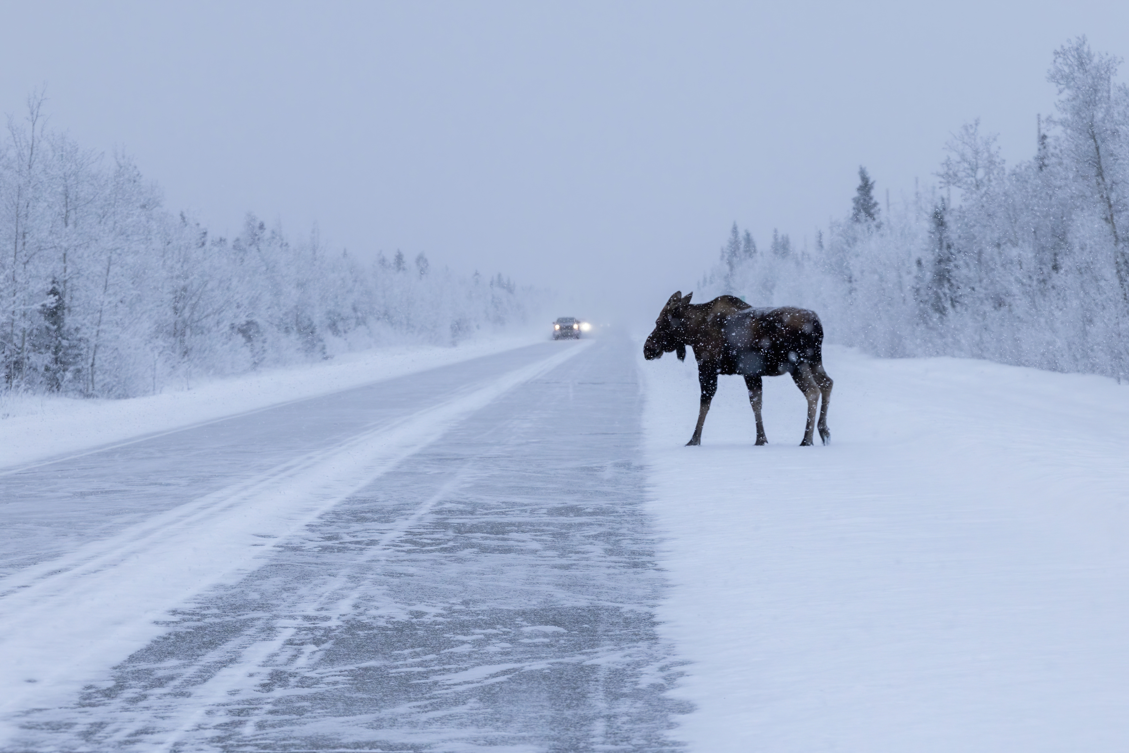
- Watch for wildlife on the road: moose throughout the corridor (especially dawn and dusk; moose collisions are deadly), caribou and bison near Delta Junction, Dall sheep on the cliffs near Thompson Pass, and the occasional grizzly or black bear. Slow down significantly in low-light conditions.
- Fuel up in Valdez, Glennallen, Paxson, Delta Junction, and Fairbanks. Long stretches between these towns have no services. Carry extra fuel if driving the McCarthy Road or Nabesna Road into Wrangell-St. Elias.
- Cell coverage is reliable in Valdez, Glennallen, Delta Junction, and Fairbanks, spotty along the corridor, and nonexistent in Wrangell-St. Elias backcountry. Download offline maps. A satellite messenger is recommended for off-highway adventures.
- Reservations are essential for lodging in Valdez and Fairbanks during the summer season (May through August). Roadhouses along the corridor (Copper Center Lodge, Paxson Lodge, Tonsina River Lodge) provide more limited options and book up early.
- Aurora viewing season runs late August through mid-April. Fairbanks and Delta Junction sit directly under the auroral oval; clear winter nights provide the best displays. Check aurora forecasts at the University of Alaska Geophysical Institute.
- Summer days are extraordinarily long: at the summer solstice, Fairbanks has 22 hours of daylight and Valdez has 19. Photograph in the soft light of late evening (10 p.m. to midnight) for the most magical lighting.
- The Alaska Marine Highway ferry to Valdez from Whittier or Cordova is a worthwhile alternative or addition to the Richardson Highway drive, offering Prince William Sound views and access to towns inaccessible by road.
- For more information visit: An Intro to Alaska's Highways | Travel Alaska