RoadDrive
AboutApp StoreSign In / Up

Ponderosa Pine Scenic Byway

Ponderosa Pine Scenic Byway
Boise
Stanley
United States
240 km
3h 51m

From Desert Foothills to Granite Summits

Idaho Highway 21 climbs from the high-desert floor around Boise at 910 m into the heart of one of America's largest wilderness regions, ascending through twisting river canyons cloaked in ponderosa pine to crest Banner Summit at 2,150 m before the jagged Sawtooth Range — 57 peaks exceeding 3,000 m — erupts into view above Stanley, one of the coldest towns in the lower 48 states. The route follows the Boise River through the historic gold-rush country of the Boise Basin, where Idaho City was briefly the largest city in the Pacific Northwest in the 1860s, then traces the South Fork of the Payette River past a chain of natural hot springs steaming at the river's edge, through the regenerating forest of the 1989 Lowman Burn, and over two mountain summits into the Sawtooth Valley — gateway to 306,000 hectares of protected wilderness, more than 300 alpine lakes, and the headwaters of the Salmon River, the longest undammed river in the contiguous United States.

Key Stops

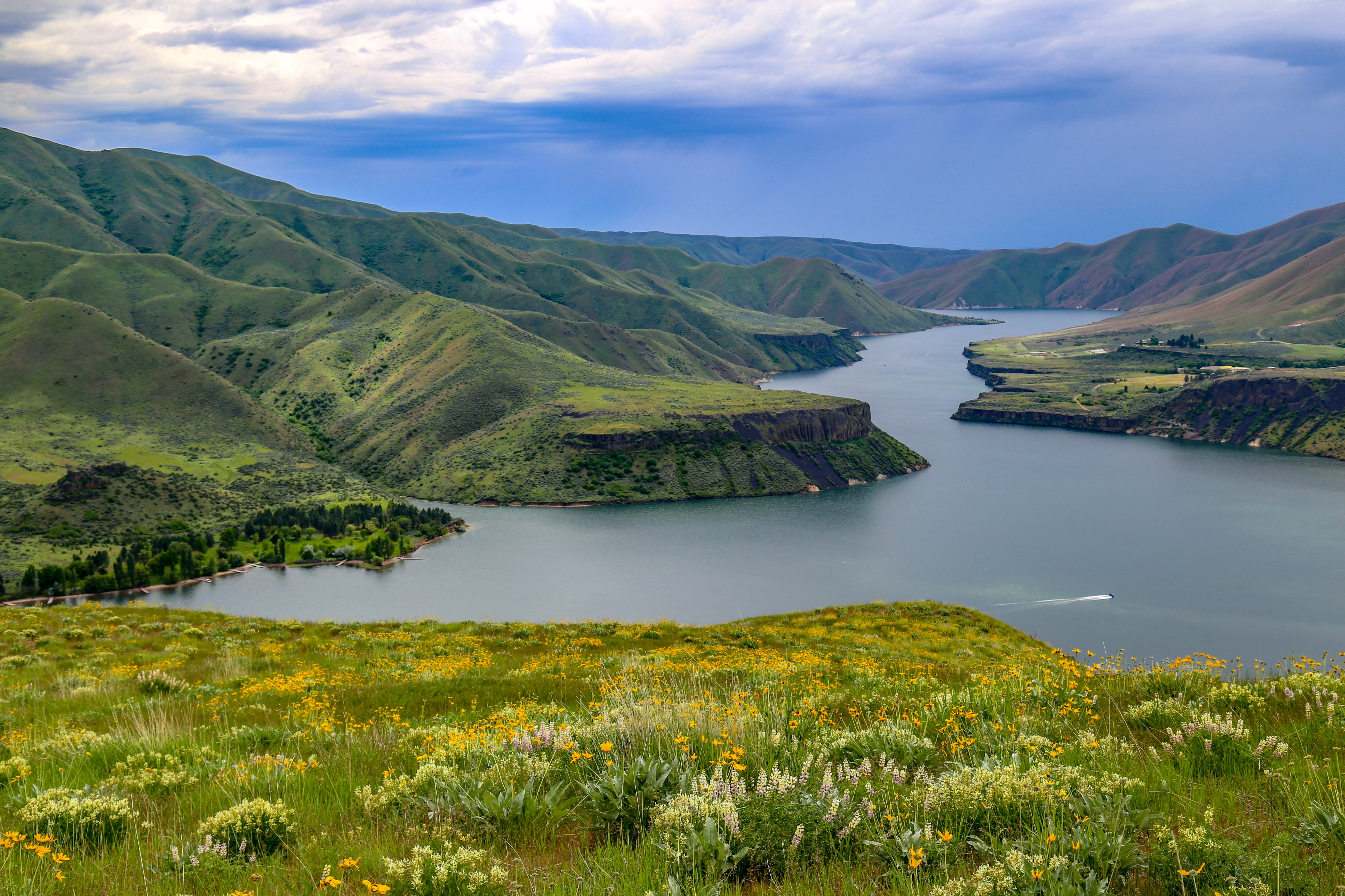
Lucky Peak Reservoir Just 16 km east of Boise, this reservoir behind a 104 m earth-fill dam on the Boise River marks the transition from city to wilderness. Sandy Point offers a swimming beach and volleyball courts, while Spring Shores has boat ramps and a marina. The lake supports kokanee salmon, rainbow trout, and smallmouth bass, and draws nearly one million visitors annually — the last place for easy water recreation before the road climbs into the mountains.

Idaho City Founded in December 1862 as "Bannock" during the Boise Basin gold rush, Idaho City exploded to over 6,000 residents by 1863 — surpassing Portland as the largest city in the Pacific Northwest — after prospectors struck gold on Boston Bar. The rush produced over 2.8 million ounces of gold between 1863 and 1959. Today a quiet town of 500, its Boise Basin Museum traces the mining history, while the Pon Yam House preserves the story of Idaho City's Chinese community, and the Strauss House hosts a Smokejumper Exhibit. Heaps of cobblestones from hydraulic dredging operations still line the roadside. Just before town, The Springs Resort ($15–$25) offers mineral pools at 36–41 °C in a setting that has served travellers since the 19th century.

Lowman & the 1989 Burn Beyond Mores Creek Summit (1,864 m), the highway descends into the Lowman Burn — where lightning-sparked fires in July 1989 merged into a firestorm that sent flames 60 m into the sky and consumed 18,600 hectares before 2,300 firefighters brought it under control after three weeks. Interpretive signs along the road chart the fire's path and the forest's regeneration. The tiny village of Lowman (population 44) sits on the South Fork Payette River, which offers Class IV whitewater through its canyon — a premier Idaho rafting run.

Kirkham Hot Springs Five miles east of Lowman, where the South Fork Payette River flows through a granite chasm, natural thermal pools steam at the water's edge. Multiple rock-lined soaking pools range from warm to hot, with the cold river just steps away for contrast plunges. Day use only (7 AM–9 PM); vault restrooms on site. This is the most accessible of a remarkable chain of hot springs along the highway — a geothermal corridor that also includes Pine Flats (a natural hot waterfall cascading into rock pools), Haven Hot Springs (a private resort with lodging and restaurant), Bonneville Hot Springs (featuring a rustic wooden "soak shack" with a cast-iron tub), and Sacajawea Hot Springs near Grandjean (free, riverside pools at 36–39 °C).

Grandjean A 10 km dirt-road detour off the highway reaches this trailhead — the primary gateway into the Sawtooth Wilderness. The Sawtooth Lodge offers 11 rustic cabins with a geothermal pool (40 °C, 24-hour access) and three meals daily, operating early June to early October. Free self-registration wilderness permits are required for all who enter (effective through 2030); groups of eight or more need a Forest Service group permit. From here, multi-day backpacking routes lead to alpine lakes, granite cirques, and some of Idaho's most remote country.

Banner Summit & Sawtooth Overlook At 2,150 m, Banner Summit is the drive's highest point and the dividing line between the Boise River and Salmon River drainages. The road loops through a narrow, steep-walled canyon past Cape Horn before reaching the Sawtooth Overlook — a final, breathtaking vantage point where the entire Sawtooth Range crests to the east, its serrated granite skyline stretching across the horizon. This section contains 60 regular avalanche paths — the reason it closes frequently from October through May.

Stanley Lake & Elk Mountain Overlook Five miles west of Stanley on ID-21, a paved spur road leads to Stanley Lake, where McGown Peak appears to rise directly from the water — one of the most photographed scenes in Idaho. The Elk Mountain Overlook at the road's end provides one of the finest panoramas in the Sawtooth region, with the shimmering alpine lake set in a forest of lodgepole pines against a wall of granite peaks. The 18 km Elk Mountain Loop Trail offers a moderately challenging day hike through wildflower meadows best experienced June through October.

Stanley At 1,905 m in the Sawtooth Valley, Stanley (population 122) is a town of outsized significance — gateway to the 306,000-hectare Sawtooth National Recreation Area, jumping-off point for Middle Fork of the Salmon River expeditions, and part of the Central Idaho Dark Sky Reserve (designated 2017, the first Gold Tier reserve in the United States, covering 3,600 km²). It is one of the coldest inhabited places in the lower 48 — recording the nation's lowest temperature on 398 days over one decade, with a record of −48 °C. Despite its tiny population, Stanley offers lodging at the historic Sawtooth Hotel (since 1931), Mountain Village Resort (61 rooms), and several campgrounds. The Salmon River's headwaters flow through town, beginning a 680 km journey — the "River of No Return" — to the Pacific.


Driving Tips

  • Check road conditions on 511.idaho.gov before departure — the 18 km section between Grandjean and Banner Summit (known as "Avalanche Alley") closes frequently October through May; rockslides and landslides from the 2025 Wapiti Fire burn scar have caused additional closures
  • Fill up on fuel in Boise or Idaho City — there are virtually no fuel stations between Idaho City and Stanley (131 km); Haven Hot Springs near Lowman has a small gas station but availability is not guaranteed
  • Carry warm layers even in summer — Stanley regularly drops below freezing on summer nights; Banner Summit at 2,150 m can be cold and windy any time of year
  • No mobile phone coverage for most of the route between Idaho City and Stanley — download offline maps and inform someone of your itinerary
  • Drive slowly through the canyon sections — the road is winding with limited sightlines, and deer, elk, and occasionally mountain goats cross at dawn and dusk
  • Hot springs etiquette — pack out everything you bring in; leave rocks arranged as you find them; many springs are clothing-optional but check posted signs; never use soap or shampoo in natural pools
  • Free wilderness permits are required for entering the Sawtooth Wilderness — self-register at trailheads; groups of 8+ need a Forest Service-issued group permit
  • Winter driving is not recommended for through-travel — Banner Summit accumulates heavy snow, and Stanley averages 2–2.5 m of snowfall annually with temperatures dropping to −40 °C
  • For more information visit: Visit Idaho — Ponderosa Pine Scenic Byway

Waypoints (13)

☰
1
Lucky Peak Reservoir
⛰️ 976 m
3 km
6m
☰
2
Sandy Point
⛰️ 976 m
48 km
38m
☰
3
Pon Yam House, Idaho City
⛰️ 1272 m
0.29 km
0m
☰
4
Boise Basin Museum, Idaho City
⛰️ 1272 m
54 km
54m
☰
5
Lowman
⛰️ 1320 m
8 km
7m
☰
6
Kirkham Hot Springs
⛰️ 1406 m
0.30 km
1m
☰
7
Sawtooth Lodge, Grandjean
⛰️ 1738 m
36 km
33m
☰
8
Banner Summit
⛰️ 2178 m
10 km
15m
☰
9
Park Creek Overlook
⛰️ 2017 m
52 km
32m
☰
10
Stanley Lake
⛰️ 2081 m
6 km
9m
☰
11
Elk Mountain Trailhead
⛰️ 2081 m
3 km
5m
☰
12
Elk Mountain Overlook
⛰️ 2081 m
21 km
27m
☰
13
Stanley
⛰️ 1926 m