Pine Ridge Trail
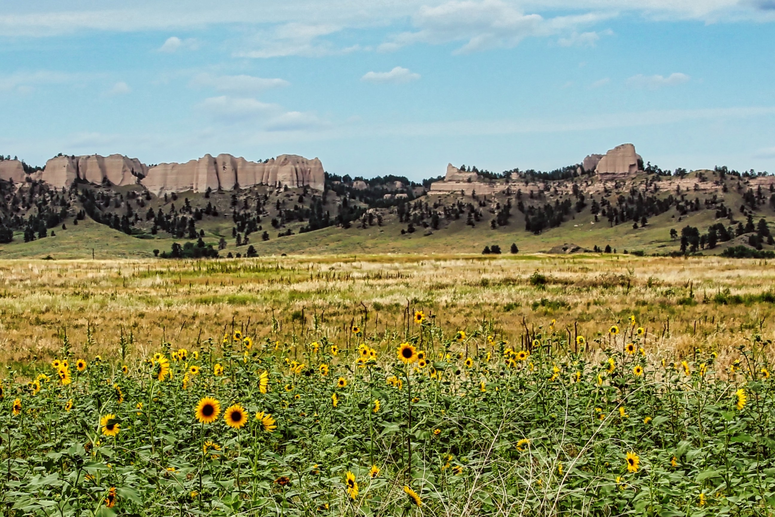
Where the Plains Break into Ponderosa and Deep Time
The Pine Ridge is a 100-mile forested escarpment cutting across northwest Nebraska, where the flat High Plains break apart into ponderosa-covered ridges, eroded badlands, and deep canyons that look nothing like the rest of the state. This drive follows US-20 and connecting roads through a landscape layered with geological and human history stretching back millions of years. At Toadstool Geologic Park, mushroom-shaped rock formations rise from Oligocene sediments containing the fossils of saber-toothed cats and three-toed horses. At Agate Fossil Beds, 19-million-year-old Miocene mammals are preserved in such completeness that the site became the world's leading source of full-skeleton specimens from that era. Between the fossil beds, Fort Robinson State Park occupies 22,000 acres of the same landscape where Crazy Horse was killed in 1877, where Northern Cheyenne prisoners made their desperate winter breakout in 1879, where Buffalo Soldiers served, and where German POWs were held during World War II. The Pine Ridge is also one of Nebraska's last strongholds for bighorn sheep, elk, and mule deer, and the ponderosa pine forests, shaped by millennia of grassland fire, have a spacious, cathedral-like quality found nowhere else on the Great Plains.
Key Stops
Chadron The eastern gateway to the Pine Ridge, with a downtown historical district of over 40 heritage sites listed on the National Register of Historic Places. Three miles east of town, the Museum of the Fur Trade is the largest of its kind in the United States, displaying over 6,000 artifacts from the North American fur trade era, including trade goods, weapons, and Native American items. Open daily May through October, 8 a.m. to 5 p.m. ($5 per adult). The Mari Sandoz High Plains Heritage Center on the Chadron State College campus honors the renowned Nebraska author who chronicled this landscape.
Chadron State Park Nebraska's first and oldest state park, established in 1921, nestled in the ponderosa pine forest 8.5 miles south of Chadron on US-385. Combined with the adjacent Nebraska National Forest, over 100 miles of trails are accessible for hiking, mountain biking, and horseback riding. Guided trail rides are available spring through early fall. The park also offers a pool (seasonal) and cross-country skiing in winter. Nebraska State Park vehicle entry permit required ($7 daily for Nebraska plates, $14 out-of-state).
Toadstool Geologic Park Seventeen miles north of Crawford via NE-2 and Toadstool Road, this surreal landscape of mushroom-shaped rock formations rises from the Oglala National Grassland like a miniature mountain range. The "toadstools" form when harder sandstone caps protect softer clay beneath from erosion, leaving pillars topped with balanced rocks. The formations are carved from Oligocene-era sediments (28 to 35 million years old) containing fossils of saber-toothed cats, early dogs, three-toed horses, and early camels. A 1-mile interpretive loop trail explores the best formations. The 3-mile Bison Trail continues to the Hudson-Meng Bison Bonebed. A 12-site primitive campground is available year-round ($15 per night, no water available, bring everything you need). The final miles are unpaved and can become impassable when wet.
Hudson-Meng Bison Bonebed Twenty miles northwest of Crawford within the Oglala National Grassland, this is the largest bison bone bed in North America: an approximately 10,000-year-old site where over 600 bison perished. Whether it represents a Paleoindian mass kill or a natural die-off event remains a subject of ongoing scientific debate. A climate-controlled visitor center protects the excavation with interpretive exhibits and guided tours led by Forest Service staff. Open Fridays only, Memorial Day weekend through Labor Day, 9 a.m. to 4:30 p.m. The 3-mile Bison Trail connects the site to Toadstool Geologic Park on foot.
Oglala National Grassland A 94,520-acre expanse of mixed-grass prairie stretching north of Crawford to the South Dakota border. This is the best place in Nebraska to spot pronghorn antelope, and notable prairie dog colonies line the northern reaches. The grassland contains both Toadstool and Hudson-Meng within its boundaries. Free access, managed by the USDA Forest Service.
Fort Robinson State Park Nebraska's largest and most historically layered state park, covering 22,000 acres of Pine Ridge scenery on the grounds of a 19th-century military post. The fort was established near the Red Cloud Agency in 1874. Crazy Horse, the Oglala Lakota leader who helped defeat Custer at the Little Bighorn, was killed here on September 5, 1877, under circumstances still debated by historians. In January 1879, Northern Cheyenne prisoners led by Dull Knife attempted a desperate escape during a bitter winter night; many were killed. The fort later served as the world's largest cavalry remount depot, a Buffalo Soldiers post, a World War II German prisoner-of-war camp, and a K-9 war dog training center. Today the park offers 60 miles of hiking trails, 20 miles of mountain biking trails, guided horseback rides, open-air Jeep tours among the buttes, bison and longhorn herds, and museums in the original military buildings. Lodging includes the historic lodge (22 rooms), officers' quarters cabins dating from 1874 to 1909, and three campgrounds. Park entry permit required. Lodging reservations accepted up to one year in advance.
Soldier Creek Wilderness A 7,794-acre federally designated wilderness area (established 1986) within the Pine Ridge section of the Nebraska National Forest, bordering Fort Robinson. The 10.4-mile Soldier Creek Loop and connecting trails pass through ponderosa pine forest and open grassland. No motorized or mechanical equipment is permitted, making this one of the quietest places in Nebraska.
Sowbelly Canyon An 11-mile scenic canyon 3.5 miles northeast of Harrison, with rugged sandstone buttes, ponderosa pine forest, and Sowbelly Creek, one of Nebraska's rare trout streams supporting naturally reproducing brown trout. Named after the incident when hungry soldiers fleeing conflict were offered "sowbelly" (salt pork) by a rescue party. Excellent birding, with Cordilleran Flycatcher, Plumbeous Vireo, and White-throated Swift among the species present.
Harrison The highest town in Nebraska at 4,876 feet and the western anchor of the drive. Minimal services but a gateway to Sowbelly Canyon and the spur south to Agate Fossil Beds. Harrison marks the transition from the Pine Ridge to the open rangeland of Sioux County.
Agate Fossil Beds National Monument Twenty-three miles south of Harrison via NE-29, along the Niobrara River. This National Park Service site preserves the world's leading source of full-skeleton Miocene mammal specimens, approximately 19.2 million years old. Species found here include Moropus (a large clawed herbivore, part horse, part giraffe, part tapir), Menoceras (a pony-sized two-horned rhinoceros), Dinohyus (the giant "terrible pig"), and Palaeocastor (a dry-land beaver whose spiral burrows, called "Devil's Corkscrews," are visible on the Daemonelix Trail). The visitor center houses fossil exhibits, a park film, and the Cook Collection: over 500 Oglala Lakota artifacts given to rancher James Cook by Chief Red Cloud and his people during decades of friendship visits from the 1880s through the early 1900s, one of the finest such collections in existence. The Fossil Hills Trail (2.7 miles round trip) leads to the University Hill and Carnegie Hill excavation sites. Free admission. Open daily year-round.
Driving Tips
- US-20 is a well-maintained two-lane highway, but roads to Toadstool Geologic Park, Hudson-Meng, and Sowbelly Canyon are unpaved gravel or dirt. Avoid these after heavy rain, as they can become impassable. Standard vehicles are fine in dry conditions, but higher clearance is helpful.
- Fill up in Chadron or Crawford before exploring. Harrison has minimal services, and there are no fuel stops on the side roads or within the grassland.
- Cell coverage is spotty to nonexistent across most of the Pine Ridge backcountry and grasslands. Download offline maps and tell someone your planned route before heading out. Consider carrying a satellite communicator for remote areas.
- Most attractions (Fort Robinson lodging and activities, Hudson-Meng, Museum of the Fur Trade) are only fully operational from late May through September. Agate Fossil Beds is open year-round.
- Hudson-Meng is open Fridays only (Memorial Day through Labor Day). Plan your itinerary around this if the bison bonebed is a priority.
- Nights can be cool even in summer at these elevations (3,500 to 4,800 feet). Bring layers. Afternoon thunderstorms are common and can produce hail, lightning, and flash flooding on dirt roads.
- Toadstool Geologic Park campground has no water. Bring all water, food, and supplies if camping.
- Nebraska State Park vehicle entry permits are required at Chadron State Park and Fort Robinson ($7 daily for Nebraska plates, $14 out-of-state). Agate Fossil Beds and the Oglala National Grassland are free.
- For more information visit: Discover Northwest Nebraska