Pig Trail Scenic Byway
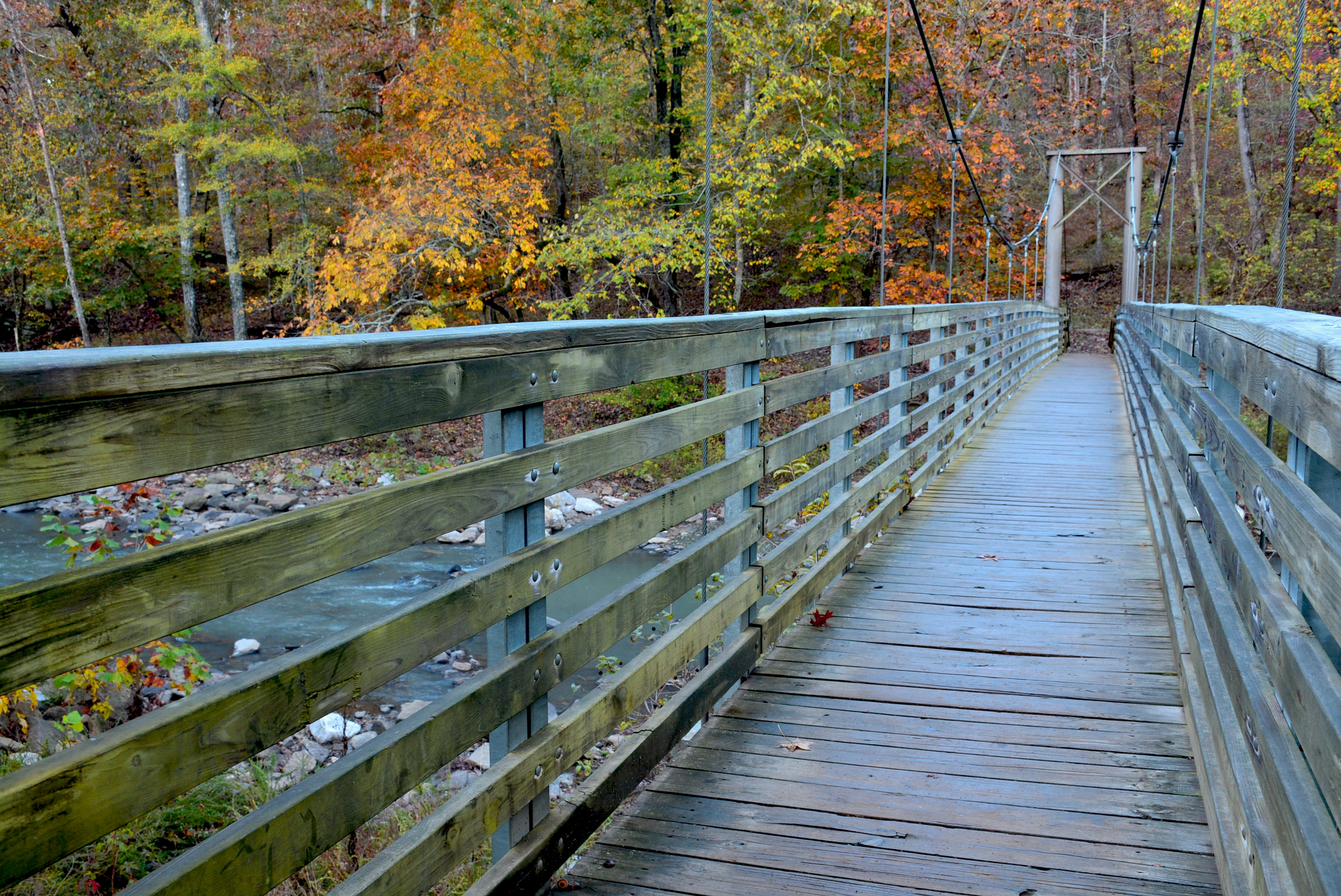
The Razorbacks' Roller Coaster Through the Boston Mountains
The Pig Trail Scenic Byway follows Arkansas Highway 23 through the Boston Mountains, the highest and most rugged section of the Ozark Plateau, on a road so twisted it was named the number one motorcycle ride in the United States by USA Today. The designated 19-mile stretch between I-40 and the junction with AR-16 at Brashears is the heart of the experience: continuous hairpin turns, steep switchbacks, and speed limits that drop to 10 mph on the tightest curves, all beneath a dense hardwood canopy that closes overhead like a tunnel. The name's origin is debated, but the most popular explanation links it to University of Arkansas Razorbacks fans who used this road as a shortcut to football games in Fayetteville before Interstate 40 was completed in 1975. Beyond the designated byway, Highway 23 continues north through the 1.2-million-acre Ozark National Forest to Eureka Springs, a Victorian hillside town with nearly 1,000 buildings on the National Register of Historic Places. Along the way, the road crosses the Mulberry River (a federally designated National Wild and Scenic River), passes within reach of White Rock Mountain's 360-degree panorama, and skirts Devil's Den State Park, one of the most intact Civilian Conservation Corps developments in the country. In October, when the Boston Mountains hardwoods ignite, this is one of the finest fall foliage drives in the American South.
Key Stops
Ozark The small town at the junction of US-64 and AR-23 near I-40, serving as the southern gateway to the Pig Trail. Full services: fuel, food, and lodging. Fill up here before entering the national forest, as there are no gas stations on the byway itself.
Pig Trail Falls Roughly two miles south of Turner Bend on AR-23, a 30-foot waterfall with two cascades merging before a final 15-foot plunge, visible directly from a sharp bend in the road. Visitors can walk behind the falls. No hike required: park at the pullout and the falls are steps away. Best flow after spring rains.
Turner Bend Store Operating since 1911 at the crossing of the Mulberry River near Cass, this is the only real services stop on the byway. Deli sandwiches, restrooms, Pig Trail merchandise, canoe and kayak rentals, camping, and cabin accommodations. A natural midpoint break.
Mulberry River AR-23 crosses this National Wild and Scenic River at Cass. The Mulberry flows 56 miles through the Boston Mountains with Class I to Class II rapids, making it one of Arkansas's finest floating rivers. Season runs primarily late fall through June, depending on water levels. Turner Bend and Byrd's Adventure Center provide canoe, kayak, and raft rentals. The surrounding forest hosts one of Arkansas's largest concentrations of black bears, and eagles can be spotted during migration.
Ozark Scenic Overlook Approximately six miles south of Brashears on AR-23, a mountain vista viewpoint with sweeping views across the forested ridges and valleys of the Ozark National Forest. One of the few points where the canopy opens up for a long view.
White Rock Mountain Recreation Area Accessible via a Forest Service road off AR-23, this 2,309-foot summit offers 360-degree panoramic views across the Ozarks, one of the finest viewpoints in the region. Three CCC-built stone cabins and a stone lodge from the 1930s are available for overnight rental, each with stone fireplaces, full kitchens, electricity, and running water. Nine primitive campsites are also available. The summit connects to the 240-mile Ozark Highlands Trail, Arkansas's longest hiking trail. Named for the white-appearing lichen on its sheer bluffs.
Shores Lake Recreation Area A short side road off AR-23 leads to this 82-acre lake built by the CCC in the 1930s (completed 1958), with 18 campsites, picnic areas, and the Shores Lake Loop Trail passing waterfalls and upland hardwood forest. A quiet, uncrowded stop.
Devil's Den State Park South of Fayetteville in the Boston Mountains, this 2,200-acre park is one of the most intact CCC developments in the United States, with hand-built stone and log cabins, trails, a stone dam on Lee Creek, and bridges all constructed between 1933 and 1942. The park contains approximately 60 sandstone crevice caves formed by hillside collapse 10,000 to 70,000 years ago (currently closed to the public due to White Nose Syndrome protecting endangered Ozark big-eared bats). Eleven archaeological sites document Native American presence dating back 8,000 years. The 15-mile Butterfield Hiking Trail connects to the Ozark National Forest. Facilities include 17 cabins with kitchens and fireplaces, 9 camper cabins, 135 campsites, a seasonal cafe, swimming pool, and store.
Eureka Springs The drive's northern destination, a Victorian hillside town containing the largest collection of Victorian architecture in the central United States: nearly 1,000 buildings in two square miles, virtually all on the National Register of Historic Places. The steep, winding streets follow the natural contours of the Ozark hillsides, creating a three-dimensional streetscape where buildings stack vertically. The Crescent Hotel (1886), known as "America's Most Haunted Hotel," crowns a hilltop with panoramic views and nightly ghost tours. Thorncrown Chapel, designed by E. Fay Jones (a Frank Lloyd Wright apprentice), rises 48 feet with 425 windows in a woodland clearing and won the AIA Design of the Year Award in 1981 (free admission, open daily 9 a.m. to 5 p.m.). Christ of the Ozarks, the largest statue of Christ in North America at seven stories tall, overlooks the town from Magnetic Mountain. Over 100 shops, galleries, and restaurants line Spring Street and Main Street.
Driving Tips
- The 19-mile designated byway is extremely winding with hairpin turns, steep inclines, and posted speed limits as low as 10 mph on the tightest curves. This is not a road to rush. Respect every posted speed sign.
- Fill up in Ozark (south) or Elkins (north) before entering the byway. There are no gas stations on the scenic stretch. Turner Bend offers food and basic supplies but not fuel.
- Cell coverage is limited to nonexistent through most of the byway corridor. Tell someone your route and expected timing before heading in.
- The Pig Trail is enormously popular with motorcyclists, especially on fair-weather weekends. Whether driving or riding, be alert for two-wheeled traffic on blind curves.
- Watch for wildlife on the road: deer, black bears, and smaller animals emerge from the dense forest without warning.
- Fall foliage typically peaks in mid-to-late October in the Boston Mountains. Book accommodations in Eureka Springs well in advance for October weekends.
- Avoid the road in icy conditions. The combination of tight curves, elevation changes, and shaded pavement makes ice extremely dangerous. Wet leaves in autumn can also reduce traction.
- Pull off safely at designated pullouts to photograph or rest. Do not stop on the road itself, particularly on blind curves.
- A May 2015 mudslide closed the route for months; the road was restored at a cost of $1.8 million. After heavy rain, watch for debris and minor rockfalls.
- For more information visit: Arkansas.com: Pig Trail Scenic Byway