Pacific Rim Highway
From Sheltered Shore to Open Ocean
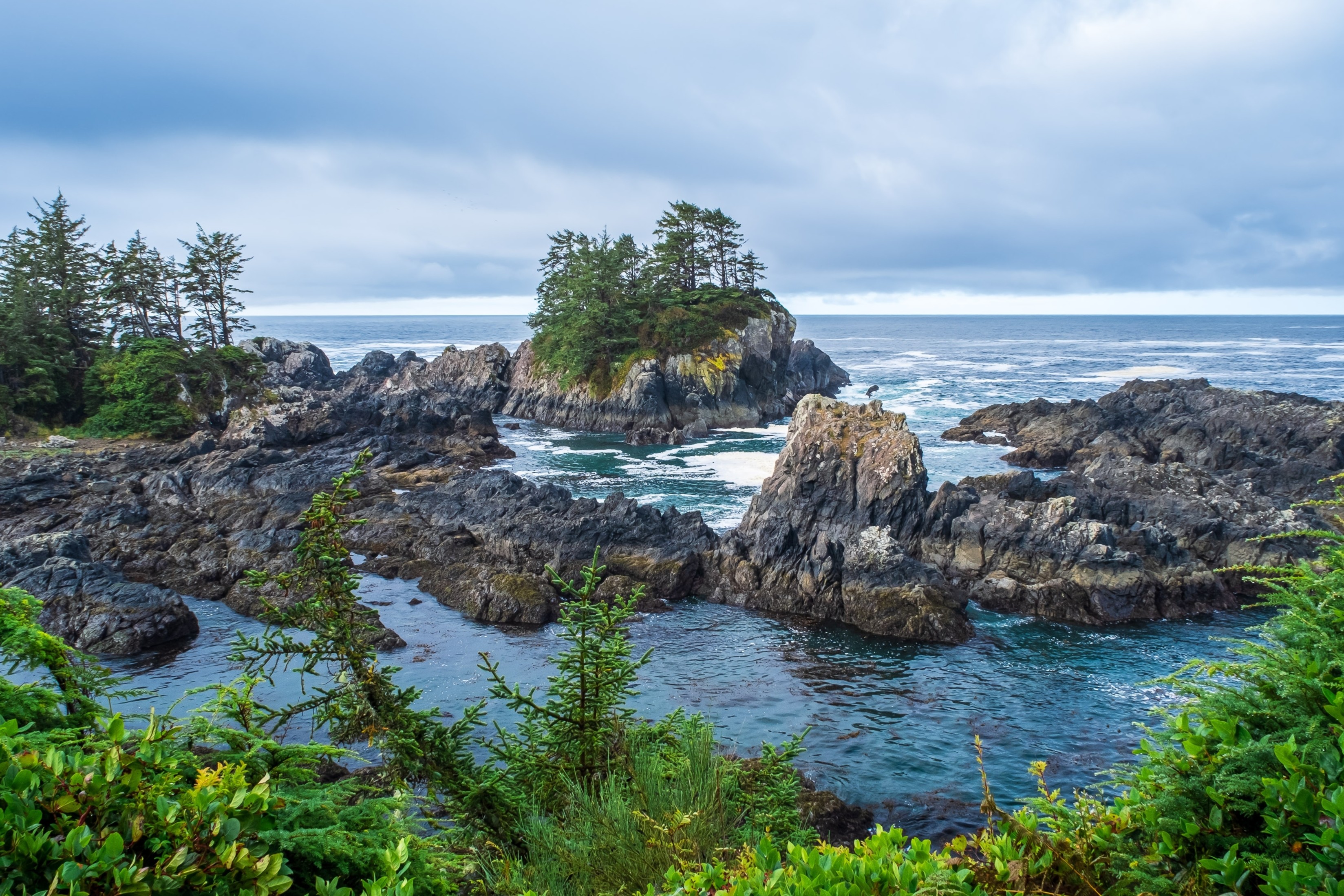
Highway 4 crosses Vancouver Island from east to west, beginning on the calm, sun-warmed beaches of the Strait of Georgia and ending where the open Pacific crashes against rocky headlands fringed with old-growth rainforest. The road passes through 800-year-old Douglas firs at Cathedral Grove, skirts the working harbor of Port Alberni, follows the shore of Kennedy Lake (the largest lake on Vancouver Island), and descends through temperate rainforest to the wild beaches of Pacific Rim National Park Reserve. At the coast, the highway splits: south to the fishing village of Ucluelet, north to the surf town of Tofino. This is a drive through deep time and deep forest, from a landscape shaped by sawmills and fishing boats to one shaped by the Nuu-chah-nulth peoples over thousands of years and, more recently, by the largest act of civil disobedience in Canadian history, which saved the old-growth forests of Clayoquot Sound.
Key Stops
Parksville and Qualicum Beach The drive begins on Vancouver Island's sheltered east coast, where two seaside resort towns face the Strait of Georgia. Parksville is known for its wide sandy beaches (Rathtrevor Beach Provincial Park warms at low tide into some of the mildest swimming water on the island), while Qualicum Beach has a quaint village center. Both sit along the Island Highway (Highway 19); the turnoff onto Highway 4 heading west marks the start of the crossing.
Coombs Old Country Market A Vancouver Island landmark since 1973, when Norwegian immigrant Kristian Graaten installed a traditional sod roof on his market building. Pygmy goats were placed on the roof to keep the grass trimmed, and they have been there ever since, grazing above the heads of shoppers from the May long weekend through late October. The market below sells fresh baking, local produce, international foods, and artisan goods. Open daily from March through December.
Little Qualicum Falls Provincial Park Nineteen kilometers west of Parksville, the Little Qualicum River drops through old-growth Douglas fir forest in a series of upper and lower falls. Six kilometers of trails follow the riverbanks, and the park has 96 campsites. Established in 1940, it is one of the first stops where the character of the drive shifts from coastal resort to island interior.
Cameron Lake A mountain lake along Highway 4 between Little Qualicum Falls and Cathedral Grove. The highway runs along its shore, and several pullouts allow stops for swimming, fishing, or simply watching the wind funnel between the surrounding peaks. The lake drains into the Little Qualicum River.
Cathedral Grove (MacMillan Provincial Park) The most celebrated stop on the drive. The highway passes directly through a stand of old-growth Douglas fir and Western red cedar, some trees over 800 years old, exceeding 75 meters (250 feet) in height and 9 meters (30 feet) in circumference. Two short loop trails (combined distance approximately 2.2 kilometers) explore both sides of the road: the south side contains the largest Douglas firs; the north side features a boardwalk through Western red cedars. Fallen giants from storms in 1997, 2018, and 2024 lie where they dropped, illustrating the natural cycle of the forest. The park was donated to British Columbia by lumber baron H.R. MacMillan in 1944. No admission fee. Parking is very limited, with small pullouts on both sides of the highway. Concrete barriers installed in 2025 prevent shoulder parking. Arrive before 10:00 AM in summer.
Port Alberni A working mill town and deep-sea port at the head of the Alberni Inlet, roughly the midpoint of the drive. Port Alberni's main attraction for travelers is the MV Frances Barkley, a 1958-built cargo and passenger vessel that sails the inlet to Bamfield and, in summer, to the Broken Group Islands in Barkley Sound. The 4.5-hour voyage to Bamfield (Tuesday, Thursday, Saturday year-round) passes through sheltered waters lined with forest and is a memorable side trip. Fill your fuel tank here. There are no gas stations between Port Alberni and the coast, a stretch of approximately 100 kilometers.
Sproat Lake A large recreational lake west of Port Alberni. The provincial park offers camping, swimming, and boating. Petroglyphs carved by the Nuu-chah-nulth peoples can be found along the lakeshore. For decades, the massive Martin Mars flying boats (the world's largest water bombers) were based here; both aircraft have now been relocated to aviation museums.
Kennedy Lake The largest lake on Vancouver Island, with a surface area of 6,475 hectares. Highway 4 follows its northern shore through one of the most dramatic sections of the drive: steep, forested terrain flanked by mountains, the road winding between rock cuts and lake glimpses. Kennedy Lake Provincial Park offers a day-use beach for paddling and swimming. Roosevelt elk frequent this stretch. Drive with particular caution at dawn and dusk.
Ucluelet At the southern fork of the highway junction, Ucluelet (pronounced "yoo-KLOO-let," from the Nuu-chah-nulth for "people of the safe harbor") retains the character of a working fishing village. Its crown jewel is the Wild Pacific Trail, which follows the exposed outer coastline. The Lighthouse Loop (2.5 kilometers, 45 to 60 minutes) passes the Amphitrite Lighthouse with dramatic views of Barkley Sound and the open Pacific. The Brown's Beach section adds another three kilometers of ocean-edge walking. The harbor is active with commercial fishing boats, and the town offers a quieter, less developed alternative to Tofino.
Pacific Rim National Park Reserve (Long Beach Unit) The highway enters the national park and the landscape opens to the Pacific. Long Beach, the signature feature, stretches 22 kilometers of windswept sand facing the open ocean. The Kwisitis Visitor Centre (formerly the Wickaninnish Interpretive Centre) focuses on coastal ecosystems and Nuu-chah-nulth culture. The Rainforest Trail, two separate one-kilometer boardwalk loops through old-growth temperate rainforest, is among the most popular short hikes on the island. Schooner Cove Trail (one kilometer) descends through lush forest to a secluded cove. Day-use fees: CAD 12.25 per adult, youth (6 to 17) free, family/group CAD 24.50. In 2026, free admission and 25% off camping apply from June 19 through September 7 via the Canada Strong Pass. The 75-kilometer West Coast Trail, one of the world's great multi-day backpacking routes, is a separate unit of the park accessible from Bamfield.
Tofino The end of the road and the beginning of the wild coast. Tofino sits on the Esowista Peninsula, surrounded by beaches, old-growth rainforest, and the islands of Clayoquot Sound (a UNESCO Biosphere Reserve since 2000). Cox Bay and Chesterman Beach are Canada's premier surf breaks, with the biggest swells arriving from November through March. Whale watching runs from March through October: approximately 25,000 gray whales migrate past each spring, and humpbacks are common through summer. Hot Springs Cove, in Maquinna Marine Provincial Park, is reached by a 1.5-hour boat ride or floatplane followed by a two-kilometer boardwalk through ancient rainforest to geothermal pools at 38 to 50 degrees Celsius. BC Parks limits access to one boat per day with a maximum of 12 passengers; book well in advance. On Meares Island, a ten-minute water taxi from Tofino, the Big Tree Trail leads to a Western red cedar approximately 18 meters wide and an estimated 2,000 years old. The island was saved from logging in the 1980s when Nuu-chah-nulth First Nations successfully fought the plans in court. Storm watching, from November through February, draws visitors to watch massive Pacific systems crash against the coast from the shelter of beachfront hotels offering winter packages at reduced rates.
Driving Tips
- Fuel: Fill up in Port Alberni. There are no gas stations between Port Alberni and Ucluelet/Tofino, a stretch of approximately 100 kilometers.
- Kennedy Hill section: The most demanding stretch of the drive, approximately 23 kilometers of narrow, winding road with steep grades and single-lane bridges west of Port Alberni. Safety improvement works are ongoing; check for construction delays before departing.
- Cathedral Grove parking: Very limited pullouts on both sides of the highway. Arrive before 10:00 AM in July and August. Do not attempt U-turns.
- Winter tires: M+S rated or better tires are required on Highway 4 from Port Alberni to Ucluelet from October 1 through March 31.
- Wildlife: Roosevelt elk, black bears, and deer frequent the highway corridor, particularly near Kennedy Lake and within the national park. Drive with extra caution at dawn, dusk, and after dark.
- Rain and fog: The west coast receives over 3,000 millimeters of rain annually. Fog is common on the coast. Headlights on at all times.
- Tofino accommodation: Book well in advance for summer (June through September). Storm watching season (November through February) is increasingly popular and fills on weekends.
- Meares Island and Hot Springs Cove: Both are water-access only. Book boat or floatplane tours from Tofino ahead of time, especially for Hot Springs Cove, which has strict daily visitor limits.
- For more information visit: Tourism Tofino