RoadDrive
AboutApp StoreSign In / Up

Oregon Coast Highway

Oregon Coast Highway
Brookings
Astoria
United States
612 km
9h 29m

363 Miles of Public Coast, America's Most Democratic Shoreline

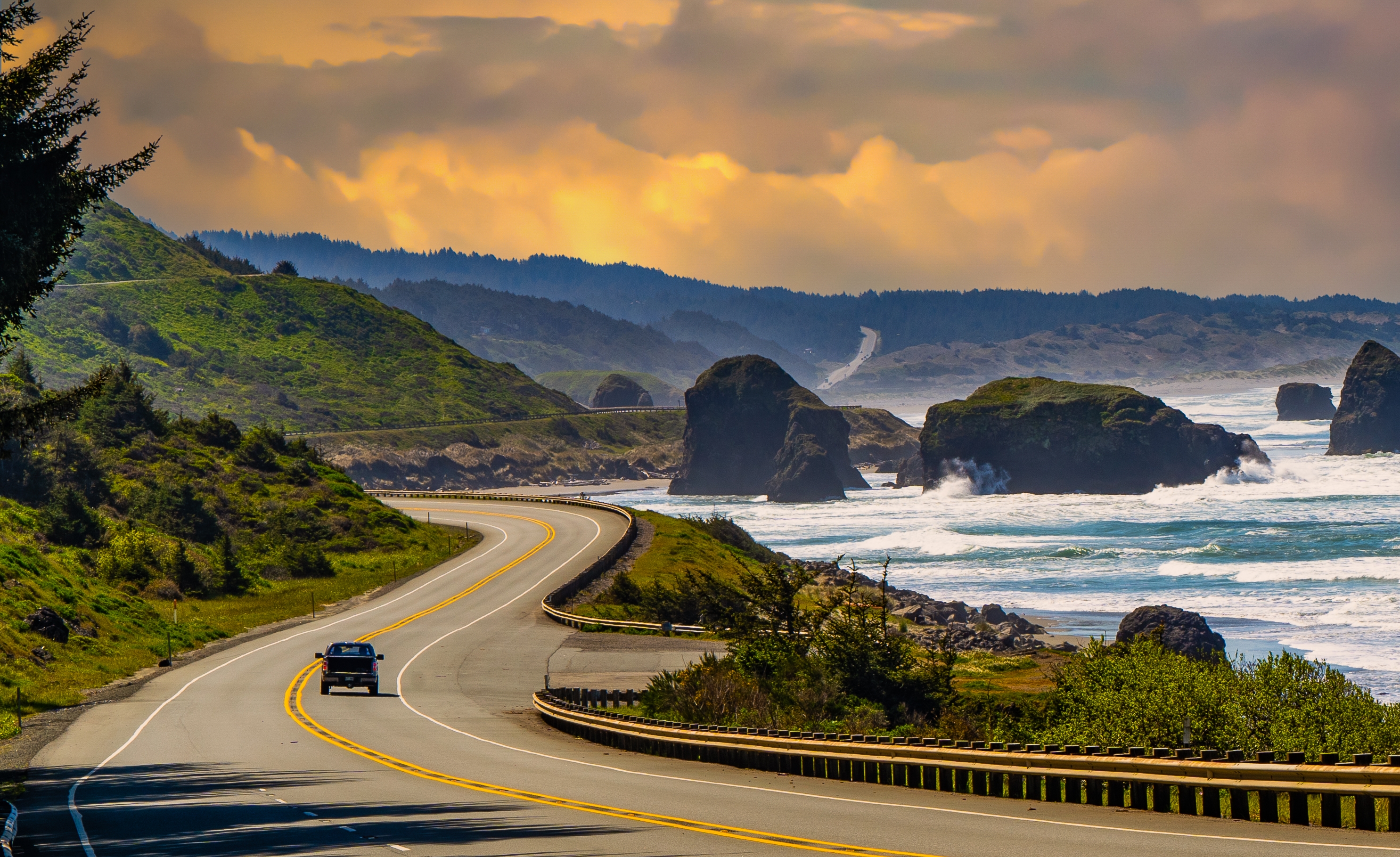
Oregon made a decision in 1913 that no other Pacific state made: it declared its entire coastline a public highway. The 1967 Beach Bill reinforced it, placing all 363 miles of shoreline, from the Columbia River to the California border, in permanent public trust. The result is the most democratic coast in America, where every beach is legally yours, and US-101 threads the full length of it, bending around headlands, climbing over capes, and descending to wide sand beaches below towering sea stacks. The drive passes through a dozen lighthouses, the largest coastal dune field in North America (40 miles of cream-colored sand rising 500 feet above the sea), old-growth rainforest of Sitka spruce and western hemlock, a pillar of black basalt called Haystack Rock so iconic it has become shorthand for the entire coast, and the end point of Lewis and Clark's 4,000-mile journey at Fort Clatsop. In winter, roughly 20,000 gray whales migrate down this coast between December and January, and another 6,000 head back to Alaska from March through June, one of the largest mammal migrations on Earth. Roughly 400 "resident" gray whales stay year-round. The climate is cool and wet even in summer (fog is common until afternoon); pack layers, waterproof shoes, and patience for the weather. This description runs south to north, from Brookings to Astoria, the direction most drivers prefer because it puts your car on the ocean side for unobstructed views.


Key Stops

Brookings The southernmost town on the Oregon coast, known for salmon and steelhead fishing on the Chetco River and for Azalea Park, where 25 acres of native azaleas (some over 400 years old and 20 feet tall) bloom in May. Brookings produces a large share of America's commercial Easter lilies. The unique Chetco Effect creates warmer winter temperatures here than anywhere else on the Oregon coast.

Samuel H. Boardman State Scenic Corridor A 12-mile stretch of coastline north of Brookings that many consider the most beautiful on the entire Oregon coast: sea stacks, hidden coves, arch rocks, and old-growth forests. Key pullouts include Natural Bridges, Thunder Rock Cove, Secret Beach, and Whalehead Beach. Free.

Cape Sebastian State Park A steep road off US-101 leads to the headland with stunning views of craggy cliffs and rocky coves. Tall evergreens form a backdrop for azaleas and rhododendrons.

Gold Beach The mouth of the Rogue River, famous for jet boat excursions running 52 miles upriver into wilderness canyons (half-day to full-day tours, May through October). A good base for whale watching.

Port Orford One of the oldest settlements on the Oregon coast and one of the few open-sea harbors in the US where fishing boats are lifted out of the water by crane. Battle Rock City Park lets you climb an oceanfront monolith for coastline views.

Cape Blanco State Park The westernmost point in Oregon, with an 1870 lighthouse (the state's oldest continuously operating) on a windswept 1,900-acre cape. A trail leads down to a black sand beach.

Bandon-by-the-Sea A small coastal village famous for dramatic sea stacks rising from the surf at Face Rock Wayside, best photographed at sunset. The "Cranberry Capital of Oregon" celebrates with a festival in late September. Bandon Dunes Golf Resort, one of the top-ranked public courses in the world, is just north of town.

Oregon Dunes National Recreation Area The largest expanse of coastal sand dunes in North America, stretching 40 miles from Coos Bay to Florence. Some dunes reach 500 feet tall (the tallest coastal dunes in the United States). Sand boarding, off-road vehicle rides, and dune buggy tours are available. The Oregon Dunes Overlook near Reedsport and the Eel Creek Campground offer the most accessible viewpoints. Tolkien's description of Mordor was reportedly inspired by these dunes.

Umpqua Lighthouse State Park An 1894 lighthouse with the distinctive red-and-white flashing beam still visible 19 miles out to sea. The adjacent whale-watching station provides panoramic dune views.

Florence Known as the City of Rhododendrons for the pink, purple, and white blooms that festoon the town in late May. The restored Old Town historic district along the Siuslaw River has shops, galleries, and seafood restaurants.

Sea Lion Caves The largest sea cave in the United States (12 stories high, a football field long) and one of the few year-round mainland rookeries for Steller sea lions. An elevator descends 208 feet to an observation window. The cave also frames the Heceta Head Lighthouse across the water. Adult admission approximately $18.

Heceta Head Lighthouse Built in 1894, the most powerful beacon on the Oregon coast, visible 21 miles out to sea. The surrounding state viewpoint is among the most photographed on the coast.

Cape Perpetua Scenic Area Towering 800 feet above the Pacific, named by Captain James Cook in 1778 after he felt stranded here forever in a storm. The Devils Churn sends waves surging up a narrow rock channel; Thor's Well is a saltwater "sinkhole" that appears to drain the ocean at high tide; and Spouting Horn blasts seawater through a lava tube. The visitor center sits on the highest road-accessible point on the Oregon coast. A short walk leads to a 600-year-old Sitka spruce.

Yachats A small coastal town where sardine-like silver smelts spawn close to the shore, one of few such places in the world. Known for tidepools and an annual July 4 fireworks over the ocean.

Newport The mid-coast hub, home to the Oregon Coast Aquarium (ranked among the top aquariums in the country, famous for one of the largest outdoor seabird aviaries in North America) and the Hatfield Marine Science Center. The historic Bayfront has seafood markets, Rogue Brewery's pub, and the barking Steller sea lions that claim the docks. Yaquina Bay Lighthouse (1871) is the only remaining Oregon lighthouse combining the tower and keeper's quarters in one building.

Otter Crest Loop (Side Trip) A narrow one-way scenic loop off US-101 leads to Devils Punchbowl State Park (a collapsed cavern that churns with seawater) and Cape Foulweather, where Captain Cook first sighted Oregon in 1778.

Depoe Bay Home to the world's smallest navigable harbor (6 acres) and the self-proclaimed Whale Watching Capital of the Oregon Coast. Resident gray whales can be spotted from the seawall in town year-round. Whale watching boat tours depart from the tiny harbor.

Three Capes Scenic Loop A detour from US-101 connecting Cape Kiwanda (red-and-yellow sandstone cliffs, hang-gliding, and the Pacific City dory fleet), Cape Lookout (a headland jutting two miles into the sea with views 42 miles in each direction), and Cape Meares (a 100-year-old lighthouse and the bizarre Octopus Tree, a giant Sitka spruce with six candelabra-like limbs spreading horizontally up to 30 feet).

Tillamook The famed Tillamook Creamery, Oregon's largest cheesemaking plant, offers free self-guided tours with samples. Draws over 1 million visitors a year. The Tillamook Air Museum, housed in one of the largest clear-span wooden structures in the world (a World War II blimp hangar), displays vintage aircraft.

Oswald West State Park 2,500 acres of old-growth rainforest and a short hike down to Short Sand Beach, a sheltered cove popular with surfers. Named for the Oregon governor who fought to preserve public beach access in 1913. Legend holds that Spanish doubloons are buried somewhere on Neahkahnie Mountain.

Cannon Beach Towering over the beach is 235-foot Haystack Rock, a basalt monolith that is among the most photographed sea stacks in the world. The rock hosts nesting tufted puffins from April through August, and the tide pools at its base are among Oregon's richest. The town itself is an artist colony with galleries, boutiques, and restaurants. Ecola State Park just north offers foggy fir forests, views of the Tillamook Rock Lighthouse, and trails used by Lewis and Clark in 1806.

Fort Clatsop National Memorial (Lewis and Clark National Historical Park) The reconstructed log stockade where the Lewis and Clark Expedition spent the wet, miserable winter of 1805–1806 after their 4,000-mile journey from St. Louis. Interpreters in period dress demonstrate 19th-century crafts in summer. Adult admission approximately $10.

Astoria The drive's northern terminus and the oldest American settlement west of the Rocky Mountains, founded in 1811 by John Jacob Astor's fur-trading company. Over 600 historic homes include Flavel House, an 1885 Victorian mansion. The 125-foot Astoria Column (1926) on Coxcomb Hill offers panoramic views of the Columbia River, the Astoria-Megler Bridge, and the Pacific. The Columbia River Maritime Museum chronicles shipping and fishing on the "Graveyard of the Pacific," where more than 2,000 vessels have sunk. The Goonies (1985) was filmed throughout Astoria.


Driving Tips

  • Drive south to north (Brookings to Astoria) whenever possible. This puts your car in the right-hand lane closer to the ocean, giving you unobstructed views at every pullout and making it easier to pull over.
  • US-101 is a narrow, winding two-lane road with heavy summer traffic. Allow significantly more driving time than mileage suggests, and use the numerous turnouts to let faster traffic pass.
  • Oregon has no sales tax, making it a popular stop for shopping. Gas must be pumped by attendants (self-service is prohibited statewide, though this has relaxed in some areas; stay with your vehicle and let the attendant pump).
  • Check tide charts before visiting tide pools, beaches, or rock formations. Rising tides can trap visitors at Cape Perpetua, Haystack Rock, and other rocky areas. Never turn your back on the Pacific: sneaker waves are a genuine, deadly hazard along the entire coast.
  • Dress in layers. Coastal fog is common until mid-afternoon even in summer. Average July high is only 65°F at the coast. Rain gear is essential outside of July and August.
  • Book lodging well in advance for June, July, and August, especially in Cannon Beach, Newport, Yachats, and Bandon.
  • An Oregon State Parks day-use pass is required at some parks ($5 daily, $30 annual). The Oregon Coast Passport ($35) covers state parks plus Cape Perpetua Scenic Area (US Forest Service), Oregon Dunes, Fort Clatsop, and the Oregon Coast Aquarium.
  • Whale watching is best from mid-December through January (southbound migration) and mid-March through June (northbound). Oregon State Parks runs Whale Watching Spoken Here volunteer programs at 24 sites during peak migration weeks.
  • Cell coverage is good in towns but spotty on remote stretches (especially the Boardman Corridor and Cape Perpetua). Download offline maps.
  • For more information visit: Travel Oregon: Oregon Coast

Waypoints (25)

☰
1
Azalea Park, Brookings
⛰️ 107 m
20 km
21m
☰
2
Whaleshead Beach
⛰️ 63 m
30 km
28m
☰
3
Natural Bridges
⛰️ 0 m
43 km
32m
☰
4
Cape Sebastian State Park
⛰️ 0 m
17 km
21m
☰
5
Jerry's Rogue Jets, Gold Beach
⛰️ 21 m
45 km
37m
☰
6
Battle Rock City Park, Port Orford
⛰️ 55 m
46 km
37m
☰
7
Cape Blanco Lighthouse
⛰️ 0 m
33 km
27m
☰
8
Face Rock, Bandon
⛰️ 0 m
61 km
51m
☰
9
Dunes Overlook, Eel Creek Campground
⛰️ 56 m
20 km
17m
☰
10
Umpqua River Lighthouse
⛰️ 0 m
6 km
9m
☰
11
Florence
⛰️ 45 m
37 km
30m
☰
12
Sea Lion Caves
⛰️ 0 m
2 km
3m
☰
13
Heceta Head Lighthouse
⛰️ 0 m
1 km
2m
☰
14
Cape Perpetua Scenic Area
⛰️ 0 m
16 km
18m
☰
15
Yachats
⛰️ 70 m
64 km
57m
☰
16
Oregon Coast Aquarium
⛰️ 6 m
40 km
39m
☰
17
Yaquina Bay Lighthouse
⛰️ 0 m
7 km
11m
☰
18
Devils Punchbowl Arch
⛰️ 0 m
14 km
15m
☰
19
Depoe Bay
⛰️ 0 m
0.64 km
2m
☰
20
Cape Meares Lighthouse
⛰️ 0 m
46 km
40m
☰
21
Tillamook Creamery
⛰️ 39 m
17 km
15m
☰
22
Oswald West State Park
⛰️ 273 m
36 km
32m
☰
23
Haystack Rock, Cannon Beach
⛰️ 25 m
8 km
9m
☰
24
Fort Clatsop National Memorial
⛰️ 15 m
2 km
4m
☰
25
Columbia River Maritime Museum
⛰️ 0 m