Mount Shasta-Cascade Loop
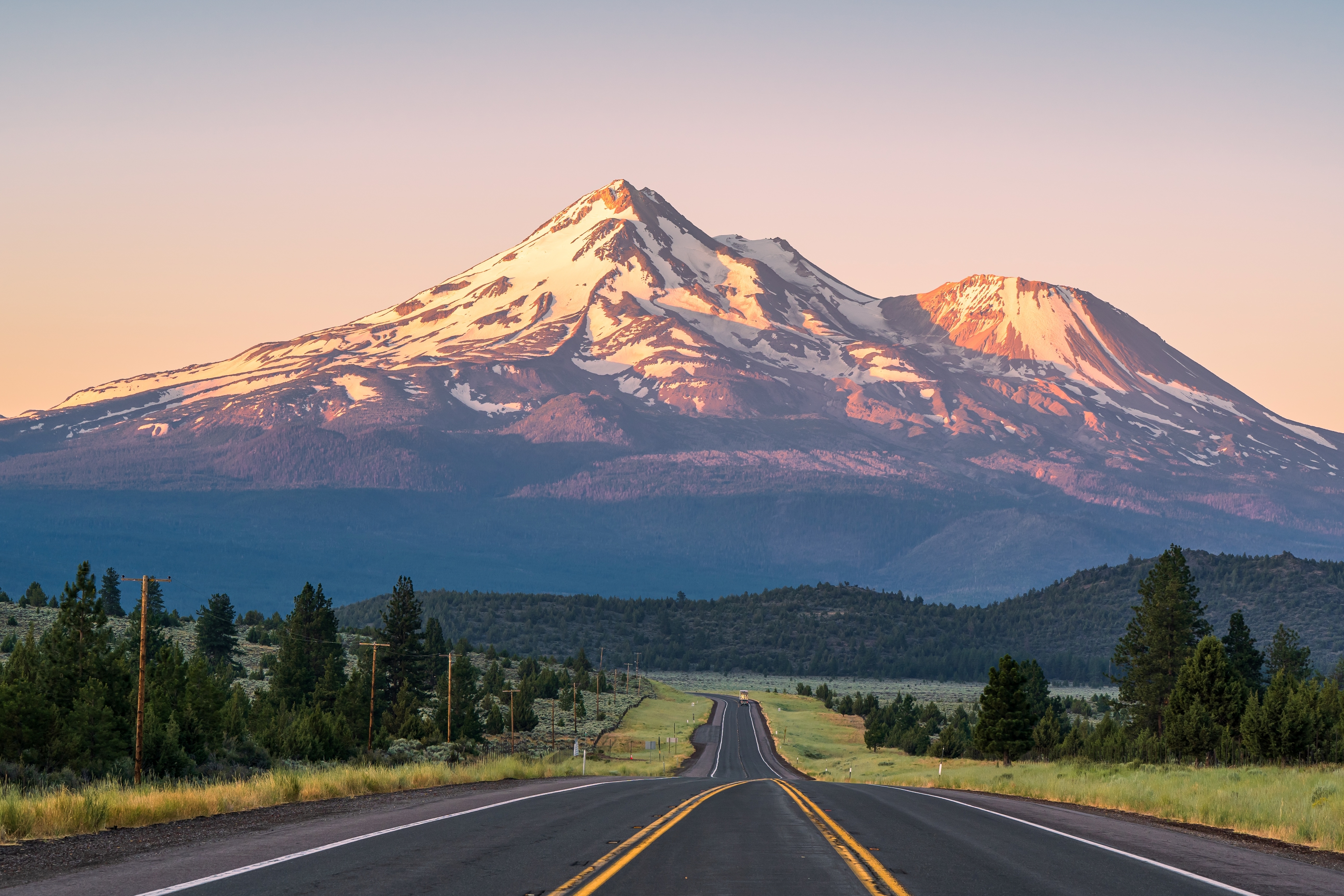
California's Volcano Country
The Mount Shasta-Cascade Loop circles the southern Cascade Range across the wild northeastern corner of California, a region shaped by titanic volcanic forces that remain active today. The route is a 500-mile circuit linking two of the most spectacular volcanoes in the contiguous United States: Mount Shasta (14,179 ft), a massive composite cone built from at least four overlapping volcanoes whose base spans 17 miles, and Lassen Peak (10,457 ft), the southernmost active volcano in the Cascades, which erupted continuously from 1914 to 1921 and still simmers with boiling mudpots, fumaroles, and steam vents. Between them, the loop crosses lava beds where pioneers found rivers of stone, ancient lakes that became wetlands hosting hundreds of bird species, the largest freshwater spring waterfall in California (Burney Falls, declared by Theodore Roosevelt the "eighth wonder of the world"), and the otherworldly underground chambers of Lake Shasta Caverns. This is one of the least-visited corners of California, less than 200 miles north of Sacramento but feeling far more remote, with vast volcanic plateaus, sweeping pine forests, hidden lakes, and a population density approaching zero across long stretches. Native Shasta lore holds that the Chief of the Sky Spirits opened a hole in the heavens with a rock, the falling debris formed Mount Shasta, and he moved his family inside the cone, where their fires still burn.
Key Stops
Redding The loop's gateway and largest city, set in the northern Sacramento Valley. Turtle Bay Exploration Park features the Sundial Bridge, a striking pedestrian bridge designed by Spanish architect Santiago Calatrava that doubles as a working sundial. The 35-mile Sacramento River Trail offers walking and cycling through riverside oak groves. Full services and the most reliable lodging on the loop.
Shasta Lake California's largest reservoir, formed by Shasta Dam (over 600 feet high, one of the largest concrete structures in the country, completed 1945). The lake's branching shoreline stretches into four river arms with red-clay cliffs and pine-covered foothills. Houseboating is the iconic Shasta Lake experience, with hundreds of rentals available. Shasta Dam Visitor Center offers free tours.
Lake Shasta Caverns (National Natural Landmark) Reached by a 15-minute catamaran cruise across the lake, then a bus climb, then a guided 1-hour walk through limestone caverns adorned with fluted columns, spires, and 20-foot stalagmites. The cavern temperature is a constant 58°F year-round. Tours run daily; advance booking recommended. Approximately $32 per adult.
Castle Crags State Park A spectacular formation of granite spires rising 4,000 feet above the Sacramento River canyon, just south of Dunsmuir. The Vista Point Trail offers a short, easy walk to a striking view of the crags with Mount Shasta on the horizon. The Pacific Crest Trail passes through the park.
Dunsmuir A historic railroad town along the upper Sacramento River, nicknamed "Home of the Best Water on Earth" for the spring water that bubbles up from town fountains and is bottled for export. Excellent fly fishing for trout in the river, several historic motels, and a small downtown.
McCloud Falls (Side Trip) Three waterfalls (Lower, Middle, and Upper) on the McCloud River, southeast of Mount Shasta off CA-89. Connected by a 4-mile trail through old-growth forest. Lower Falls has a popular swimming hole in summer.
Mount Shasta The drive's signature peak, visible from over 100 miles away on clear days. The Everitt Memorial Highway (CA-A10) climbs from Mount Shasta City nearly halfway up the mountain to Bunny Flat (6,860 ft), with parking, picnic areas, and access to backcountry trails. Mount Shasta is sacred to multiple Native American tribes (Shasta, Wintu, Achomawi, Atsugewi, and Modoc) and a New Age pilgrimage site. The mountain has seven glaciers, the largest in California south of the Cascades. Climbing routes (such as Avalanche Gulch) are mountaineering objectives requiring crampons, ice axes, and experience.
Weed and the Klamath National Forest Weed is a small lumber town at the foot of Black Butte (a steep volcanic cone). North on US-97, the route enters the Klamath National Forest, climbing past juniper and ponderosa pine to Mt. Hebron Summit before descending into Butte Valley.
Lower Klamath National Wildlife Refuge Just south of the Oregon border on CA-161, the first national wildlife refuge dedicated specifically to waterfowl (established 1908 by Theodore Roosevelt) and one of the world's premier sites for viewing bald eagles. Up to 1 million waterfowl pass through during fall migration. Unpaved auto-tour roads loop through the marshes; visitors can use cars as bird blinds. Spring and fall offer the highest concentrations.
Tule Lake National Wildlife Refuge East of Lower Klamath, another massive refuge with millions of birds in season. Also home to the Tule Lake Segregation Center National Monument, where over 18,000 Japanese Americans were incarcerated during World War II.
Lava Beds National Monument A 47,000-acre preserve atop the Medicine Lake shield volcano, with over 800 lava tube caves, including more than two dozen open for self-guided exploration. The visitor center loans free flashlights and provides safety briefings. The lava tubes are a constant 55°F year-round; bring warm layers, sturdy boots, and helmets (recommended). The monument also preserves Captain Jack's Stronghold, the natural lava fortress where 53 Modoc warriors held off the US Army for five months during the Modoc War of 1872–1873.
Fall River Mills A small mountain town renowned for spring-fed creeks that produce some of the finest fly fishing in California. The Fort Crook Museum displays pioneer artifacts, an old blacksmith shop, and a jail. A natural rest stop with limited services.
McArthur-Burney Falls Memorial State Park Theodore Roosevelt called Burney Falls "the eighth wonder of the world." The 129-foot falls cascade in two sections, with water bursting directly from the basalt cliff face from underground springs that flow at 100 million gallons per day. Even in late summer, when other waterfalls run dry, Burney Falls flows at full volume. A short paved trail leads to the falls overlook, with a longer 1.3-mile loop descending into the gorge. Day-use fee approximately $10 per vehicle.
Lassen National Scenic Byway South of Burney Falls, CA-89 runs through the Hat Creek valley and Lassen National Forest, passing the Hat Creek Rim (a 1,000-foot-tall fault scarp, dramatic visible evidence of geological forces). The byway provides access to alpine lakes and trails through ponderosa pine, lodgepole pine, red fir, and aspen. Lake Almanor, off CA-36, reflects Lassen Peak on calm days.
Lassen Volcanic National Park One of the few places in the world where all four types of volcanoes (shield, composite, cinder cone, and plug dome) are found within a single park. Lassen Peak (10,457 ft) is the largest plug dome volcano in the world and erupted continuously from 1914 to 1921. The 30-mile main park road (CA-89) winds past Bumpass Hell (the largest hydrothermal area in the park, with boardwalks over boiling mudpots and fumaroles), Lake Helen, the Lassen Peak trailhead (a strenuous 5-mile round trip to the summit, 2,000 feet of elevation gain), and Manzanita Lake. The park is one of the National Park System's least-visited treasures, less than half a million visitors annually compared to Yosemite's 4 million. The main park road is typically closed by snow from November through June. Entry fee approximately $30 per vehicle.
Driving Tips
- The loop is best driven counterclockwise from Redding: north on I-5 to Mount Shasta, east on US-97 and CA-161 through the wildlife refuges, south through Lava Beds and Burney Falls, then back to Redding via Lassen Volcanic National Park. This sequence saves the most dramatic stop (Lassen) for last.
- Many high-elevation roads close in winter due to snow. The Lassen Park main road (CA-89 through the park) is typically open only mid-June through October. Lava Beds remains accessible year-round but with limited services in winter. Check current road status at TripCheck or the National Park Service before traveling outside summer.
- Distances between services are long. Fuel up in Redding, Mount Shasta City, Tulelake, Burney, and Chester. Carry water, snacks, and a basic emergency kit. AAA service can take hours to reach remote sections.
- Cell coverage is unreliable across most of the loop and nonexistent in Lava Beds caves and parts of Lassen. Download offline maps before departing.
- An America the Beautiful Pass ($80 annual) covers Lassen Volcanic National Park and Lava Beds National Monument and is more economical than separate entry fees if you visit both.
- Bring layers regardless of season. High-elevation overnight temperatures can drop to freezing even in midsummer. Mount Shasta and Lassen Peak hold snow into July most years.
- For lava tube exploration at Lava Beds, the visitor center provides free flashlights, but bring your own backup. Bump caps or helmets are recommended for caves with low ceilings. Sturdy hiking boots are essential.
- Wildfire smoke is increasingly common in summer and early fall. Check air quality conditions and active fire status (CalFire) before traveling between July and October.
- Watch for deer, black bears, and elk on the road, especially at dawn and dusk.
- For more information visit: Shasta Cascade Wonderland Association