Mount Rainier Drive
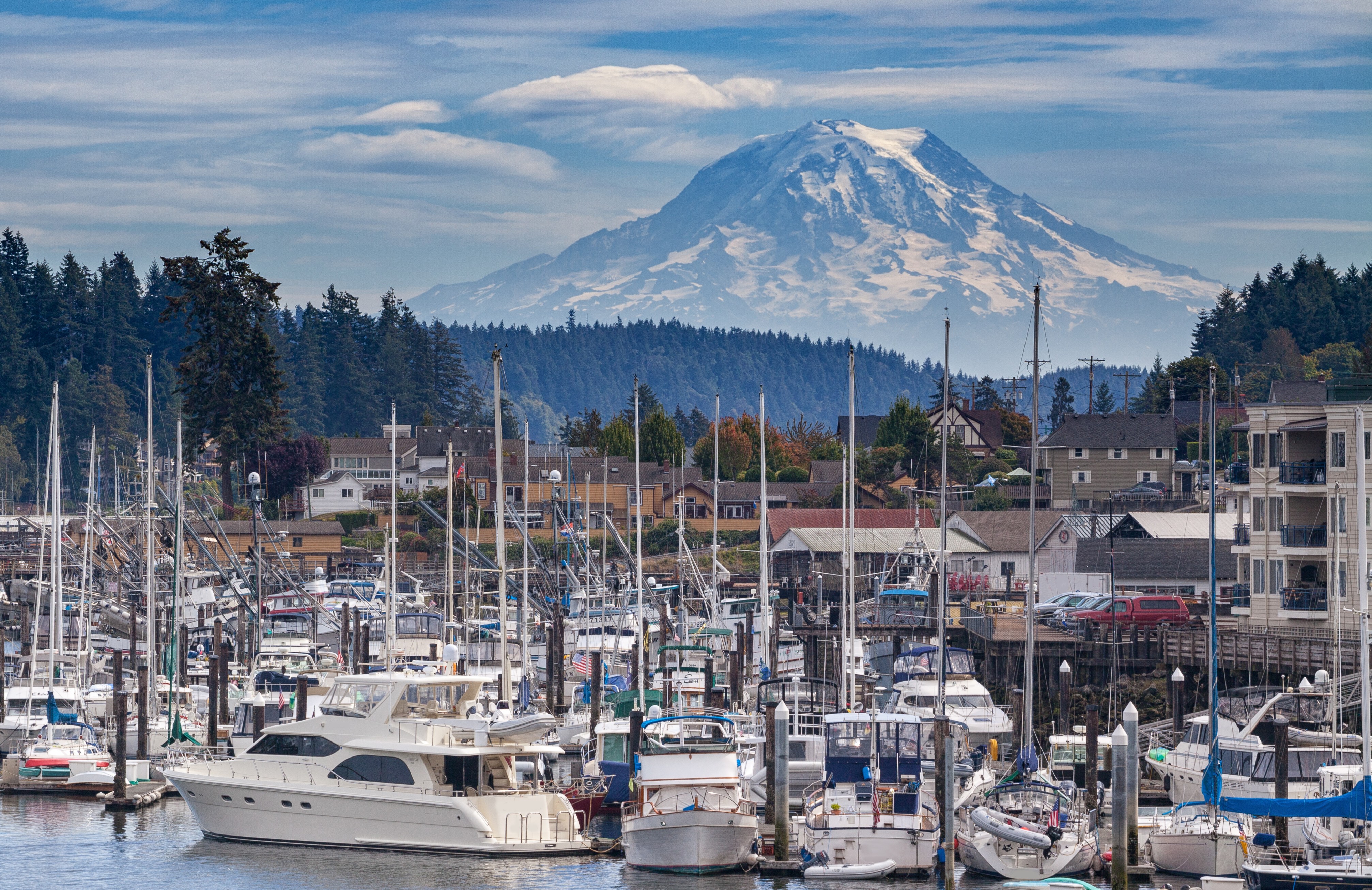
Washington's Iconic Volcano
Mount Rainier rises 14,411 feet above the surrounding lowlands of Washington State, a dormant stratovolcano so massive and so close to Seattle that locals simply call it "the Mountain" and consider its visibility a weather report ("the Mountain is out" means clear skies). With more glacial ice than any other mountain in the contiguous United States (25 named glaciers totaling roughly one cubic mile of ice) and the largest collection of subalpine wildflower meadows in the country, Rainier is the centerpiece of America's fifth national park, established March 2, 1899. The Puyallup, Nisqually, Muckleshoot, Squaxin Island, Yakama, and Cowlitz peoples have known the mountain for thousands of years and call it Tahoma or Tacoma (meaning roughly "the mother of waters" or "snow-covered mountain"), the name British naval captain George Vancouver overruled in 1792 when he named the peak for his friend Rear Admiral Peter Rainier (who never set foot in North America). A movement to restore the Indigenous name persists today.
Key Stops
Elbe (Pre-Park Approach) A tiny lumber-village whose 1906 Lutheran Evangelical Church (the smallest church in America, with seating for 18) and the Mt. Rainier Scenic Railroad (steam-powered 14-mile round-trip excursions through old-growth forest to Mineral Lake) make a worthwhile stop before entering the park.
Nisqually Entrance The park's main southwest entrance and the only entrance open year-round. Entry $30 per vehicle (7-day pass). The park is fully cashless: credit cards only. The America the Beautiful Pass is accepted. Inside the entrance, the road winds through old-growth Douglas fir and western red cedar.
Longmire Six miles inside the Nisqually Entrance at 2,761 feet, Longmire is the park's historic headquarters, founded by James Longmire after he discovered the mineral springs here in 1883. Key sites:
- Longmire Museum (in the 1916 administration building) with exhibits on park history, geology, and natural history
- National Park Inn, the park's year-round lodge, with a restaurant serving classic Pacific Northwest fare
- Longmire Wilderness Information Center for backcountry permits
- Trail of the Shadows, a 0.7-mile interpretive loop past the original mineral springs, the homestead site, and a reconstructed cabin
- Eagle Peak Trailhead, a strenuous 7.2-mile round-trip hike with stunning south-side views of Rainier
Last reliable fuel and groceries before Paradise.
Cougar Rock Campground and Christine Falls About 8 miles north of Longmire, Cougar Rock is one of the park's main campgrounds (reservations through Recreation.gov). A mile and a half farther, Christine Falls plunges 69 feet through a narrow rock chute beneath a graceful stone bridge built in 1928. The best photograph is from the short path below the bridge, framing the falls through the arch.
Narada Falls A short trail descends from the parking area to the base of this 168-foot waterfall on the Paradise River, where the spray often creates rainbows on sunny days. The view from above is also spectacular.
Paradise The park's most-visited area at 5,400 feet on the south flank of Rainier, with subalpine meadows that explode into bloom in late July and early August: lupines, magenta paintbrush, avalanche lilies, glacier lilies, pasqueflowers, magenta heather, and broad-leaved arnica carpet the slopes. Naturalist John Muir spent the night here in 1888 and helped establish Paradise as the park's primary destination. Key sites:
- Henry M. Jackson Memorial Visitor Center (1966, rebuilt 2008) with the park's main museum exhibits, theater, gift shop, and cafe
- Paradise Inn (1916, National Historic Landmark): A massive cedar-shingled lodge with a soaring lobby of exposed Alaska cedar timbers, twin stone fireplaces, and a grandfather clock built by 1916 carpenter Hans Fraehnke. Open May 18 through September 30, 2026. Rooms approximately $313–$559 per night; reservations months in advance for summer.
- Skyline Trail, the classic Paradise hike (5.5 miles round trip, 1,700 feet of elevation gain) to Panorama Point with breathtaking views of the Tatoosh Range, Mount Adams, Mount St. Helens, and on clear days Mount Hood
- Nisqually Vista Trail (1.2 miles, paved and accessible) with views of the Nisqually Glacier
- Myrtle Falls (0.8 miles round trip), with one of the most photographed views of Rainier framed by the falls
Inspiration Point and Stevens Canyon Road East of Paradise, Stevens Canyon Road climbs to Inspiration Point, an overlook with one of the finest road-accessible views of Rainier. The road then scales canyon walls and arrives at:
Reflection Lakes The park's most-photographed location: two small alpine lakes whose still surfaces produce perfect mirror reflections of Rainier on calm mornings. Arrive at sunrise for the best photography (and to avoid the crowds that arrive by mid-morning). Limited roadside parking.
Box Canyon of the Cowlitz Where Stevens Canyon Road crosses a deep, narrow gorge carved by the Cowlitz River through volcanic rock. From the pedestrian bridge, look down into the churning water 180 feet below. The slot is so narrow you can almost touch both walls.
Grove of the Patriarchs This iconic 1.5-mile trail through 1,000-year-old Douglas fir, western red cedar, and western hemlock, accessed by a suspension bridge over the Ohanapecosh River. The adjacent Silver Falls Loop (3 miles round trip) is an excellent trail through old-growth forest, ending at a powerful 75-foot waterfall.
Ohanapecosh (Major 2026 Closure) The entire Ohanapecosh Campground, visitor center, and associated facilities are closed for all of 2026 for a major rehabilitation project running through November. The campground (185 sites) and visitor center will not open this year. The Silver Falls and Eastside trailheads remain accessible from roadside pullouts.
Cayuse Pass and Tipsoo Lake The drive climbs north on SR-123 to Cayuse Pass (4,675 ft), then continues on SR-410 (the Mather Memorial Parkway) over Chinook Pass at 5,432 feet, where Tipsoo Lake sits in an alpine meadow directly beside the road. Tipsoo's wildflower display in late July and early August is among the best in the Cascades, with views of Rainier framed across the lake. The 3-mile Naches Peak Loop Trail crosses the Pacific Crest Trail and circles the peak with continuous Rainier views. SR-410 and SR-123 reopened for the 2026 season on May 22 in time for Memorial Day.
Sunrise At 6,400 feet, the highest point in the park accessible by car and the park's quieter alternative to Paradise. Sunrise Road typically opens late June or early July and closes mid-October. Key sites:
- Sunrise Visitor Center with botanical exhibits and a 3-D scale model of Rainier
- Sunrise Day Lodge with a small cafe and gift shop
- Sourdough Ridge Trail (1.5 miles round trip) for sweeping views of Rainier's east face and Emmons Glacier
- Mount Fremont Lookout Trail (5.6 miles round trip, 900 feet of elevation gain) to a working fire lookout with one of the finest panoramic views in the Pacific Northwest
- Burroughs Mountain Trail (5–9 miles, depending on the destination) onto arctic-alpine tundra (the only true arctic tundra in the contiguous United States outside Alaska)
The view from Sunrise includes Emmons Glacier, the largest glacier by area in the lower 48 states (4.3 square miles), flowing 4 miles down Rainier's east flank. Sunrise Point, just below the parking area on the drive in, is one of the great roadside overlooks in the park.
Driving Tips
- 2026 update: No timed entry reservations required. Mount Rainier's pilot reservation system has been discontinued for 2026; entry to Paradise, Sunrise, and all park areas is first-come, first-served. Parking lots at Paradise fill by 10 a.m. and at Sunrise by 11 a.m. on summer weekends; arrive early.
- Grove of the Patriarchs remains closed in 2026 due to bridge damage from the 2021 flood. Use Silver Falls or other old-growth trails as alternatives.
- Ohanapecosh is fully closed for the entire 2026 season (campground, visitor center, restrooms, amphitheater). Plan an alternative overnight at Cougar Rock, White River, or Paradise Inn.
- Carbon River and Mowich Lake are inaccessible. The Fairfax Bridge on SR-165 was permanently closed in April 2025 due to structural failure; there is no vehicle, bicycle, or pedestrian access to these northwestern park areas. Restoration is not expected before 2031.
- The park is fully cashless. Entry fees ($30 per vehicle, 7 days), lodging, restaurants, and shops accept credit cards only. America the Beautiful Pass accepted at gates.
- Sunrise Road, Stevens Canyon Road, and SR-410 over Chinook Pass open seasonally, typically late June through October. Only the Nisqually-Longmire-Paradise corridor stays open year-round (weather permitting; tire chains may be required in winter).
- The Nisqually-to-Paradise road has active construction May 27 through September 22, 2026, with weekday delays up to 30 minutes (Mon–Fri, 6 a.m. to 6 p.m.). Plan around midday weekend trips for fewer delays.
- Book Paradise Inn and National Park Inn well in advance (often 6 to 12 months ahead, especially for summer weekends).
- Weather changes rapidly. Even in midsummer, Paradise can be snowing in the morning and sunny by afternoon. Pack layers, rain gear, and sunscreen regardless of season. Snowfields linger into July at Paradise and into August at Sunrise.
- Cell coverage is intermittent in the park and largely nonexistent on the eastern half (Stevens Canyon, Ohanapecosh, Cayuse Pass). Download offline maps before entering.
- Wildlife: black bears are common, especially in berry season (August). Mountain goats and elk are seen near Sunrise and the higher meadows. Maintain at least 100 feet from bears, 25 yards from other wildlife. Never approach or feed.
- For wildflower peak timing, target the last two weeks of July through the first week of August at Paradise and the first three weeks of August at Sunrise (higher elevation, later bloom).
- Fuel up in Ashford (before Nisqually Entrance), Packwood (south of Ohanapecosh), or Greenwater (east of White River Entrance). There is no gasoline available inside the park.
- For more information visit: Mount Rainier National Park (NPS)