RoadDrive
AboutApp StoreSign In / Up

Las Alpujarras

Las Alpujarras
Lanjarón
Ugíjar
Spain
113 km
3h 22m

Where the Moors Made Their Last Stand

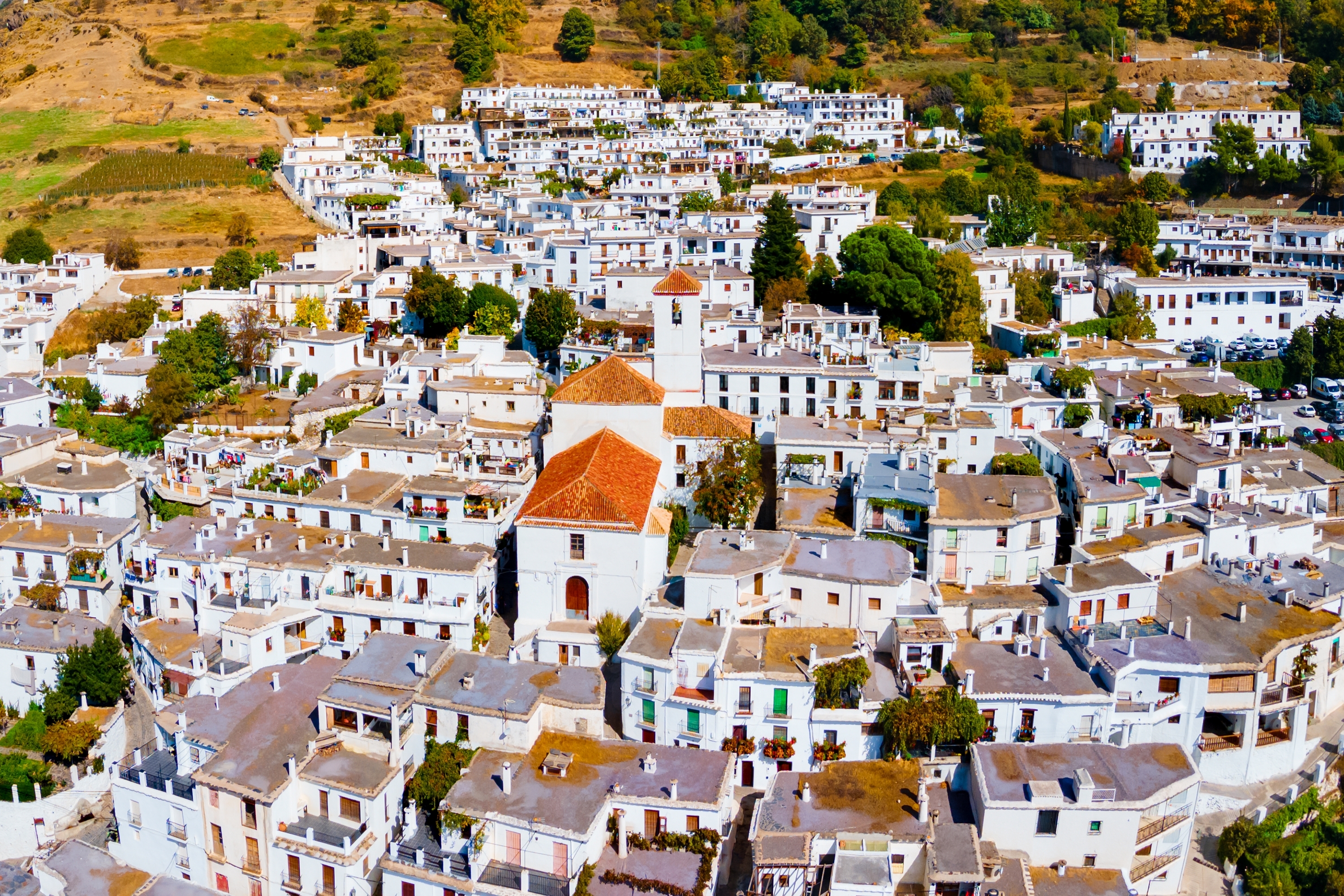
When Granada fell to the Catholic Monarchs in 1492, the Moors did not vanish — they retreated into the deep valleys on the southern face of the Sierra Nevada and held on for another eighty years. The Alpujarras is what they built there: terraced hillsides fed by 3,000 kilometers of hand-cut irrigation channels, flat-roofed villages of stone and chestnut wood indistinguishable from the Berber settlements of Morocco's Atlas Mountains, and a way of life so remote it barely changed until the roads arrived. The drive runs west to east along the A-348 valley road, climbing repeatedly on the A-4132 and GR-421 to reach white villages stacked against mountainsides at over 1,400 meters, before descending to the next gorge and climbing again. Below, the terraces drop toward the distant Mediterranean; above, the snow-capped peaks of Mulhacén and Veleta — the highest points in mainland Spain — fill the skyline.


Key Stops

Lanjarón The western gateway to the Alpujarras, a spa town since the late 18th century when six natural springs were certified for their mineral properties. The balneario (spa) at the town's edge offers treatments drawn from these waters, and the Lanjarón bottled water brand — Spain's first, dating to 1830 — still operates its plant here. Above the town, a ruined Arab castle perches on a rocky outcrop with views down the valley. Every June 23, the Fiesta de San Juan turns the entire town into a midnight water fight — the streets flood with thousands of participants drenching each other until dawn.

Órgiva The commercial capital of the western Alpujarras and the last sizable town before the mountain villages. The twin-towered Baroque church of Nuestra Señora de la Expectación dominates the center, and the Castle-Palace of the Counts of Sástago speaks to the town's administrative importance after the Moorish expulsion. A sizable international community has given Órgiva a bohemian character — the Thursday morning market (approximately 9:00 AM–1:00 PM) mixes local produce, handmade crafts, and a cosmopolitan crowd among the citrus and olive groves. Fill your fuel tank here — reliable stations thin out ahead.

Pampaneira The lowest and first of the three famous villages clinging to the walls of the Barranco de Poqueira — the gorge that defines the Alpujarras in most visitors' imaginations. The Plaza de la Libertad, with its central fountain and restored Arab laundry, is the heart of the village. Narrow streets are lined with shops selling handwoven jarapas (traditional Alpujarran rugs) and handmade chocolate from the Abuela Ili factory. The flat roofs, thick stone walls, and covered passageways called tinaos — where the upper floor of one house bridges the street to connect with the building opposite — are pure Berber architecture, unchanged in form for a thousand years.

Bubión The middle village of the Poqueira trio, the smallest and quietest, with around 400 residents. The Casa Alpujareña museum recreates a traditional Alpujarran household — low ceilings, chestnut beams, the communal fireplace — and the 16th-century parish church retains a Mudéjar-style ceiling from the period just after the Moorish conversion. Bubión is a member of Spain's "Most Beautiful Villages" association. Much of its municipal land falls within the Sierra Nevada National Park, and horseback riding excursions into the high pastures depart from here.

Capileira The highest of the Poqueira villages at 1,436 meters, and arguably the most scenic — on clear days, the mirador on the village's southeastern edge reveals the terraced gorge falling away below and the Costa Tropical coastline glinting in the distance. The Pedro Antonio de Alarcón House-Museum commemorates the 19th-century writer who documented the region. Capileira is the primary trailhead for hiking to the summit of Mulhacén (3,482 meters / 11,424 feet), mainland Spain's highest peak — a National Park shuttle bus runs to higher trailheads in summer. A circular walk connecting all three Poqueira villages via the river bridge below takes approximately three hours.

Pitres, Mecina Fondales & Ferreirola (La Taha) East of the Poqueira gorge, the road enters the municipality of La Taha — its name derived from the Arabic ta'a, the Moorish administrative division. Three small hamlets share this quiet territory. Pitres is the administrative center; Mecina Fondales has a Mozarabic bridge spanning the Trevélez River, reached by a path through chestnut woods; and tiny Ferreirola, perched above the gorge with rooftop views across the valley, has a Fuente de la Gaseosa — a naturally carbonated mineral spring bubbling from the rock, free to taste. These villages see a fraction of the Poqueira crowds.

Portugos A small village known for the Fuente Agria, the most famous medicinal spring in the Alpujarras — an iron-rich acidic alkaline spring that stains the surrounding rocks a vivid reddish-orange. Nearby, the El Chorrerón waterfall drops through ancient chestnut trees. The combination of red stone, falling water, and gnarled chestnuts makes this one of the most atmospheric stops on the drive.

Trevélez One of the highest permanently inhabited villages in mainland Spain, at 1,476 meters. Three neighborhoods — upper, middle, and lower — cascade down the mountainside. Trevélez is famous throughout Spain for its air-cured jamón serrano, which carries a Protected Geographical Indication: the cold, dry mountain air provides natural curing conditions so ideal that Queen Isabel II granted the town permission to stamp the Royal Seals on its hams in 1862. Visit the secaderos (curing houses) to see — and buy — hams hanging in cool stone rooms. The Trevélez River below the village is one of the best trout streams in southern Spain, and the south-face route to the summit of Mulhacén begins here.

Bérchules Known as the "Heart of the Alpujarra Alta," Bérchules sits among working chestnut orchards at 1,322 meters. The village is famous for an unlikely tradition: New Year's Eve in August — born the year a power cut ruined the December 31 celebrations, so the village rescheduled to summer and never stopped. The flat-roofed architecture, flower-filled tinaos, and fountain-centered plaza are among the best-preserved in the region, and the village is just two kilometers from the National Park boundary.

Cádiar Gerald Brenan called it the "navel of the Alpujarra" — the crossroads where all the region's roads converge. The parish church, half-fortress and half-church, retains its 16th-century vaulted ceiling that survived the Morisco revolt. At the mid-October Autumn Fair, the Fuente del Vino replaces water with local wine — a fountain flowing free for all. Cádiar is the transition point between the high western Alpujarras and the lower, drier eastern villages ahead.

Yegen The village where British writer Gerald Brenan lived from 1920 to 1934, hosting visits from Virginia Woolf, Lytton Strachey, and Dora Carrington in a whitewashed house on a street barely wide enough for a mule. His memoir South from Granada (1957) remains the defining literary portrait of Alpujarran life — courtship rituals, harvest festivals, folk medicine, and a world largely untouched by modernity. His house is marked with a plaque. The village has changed remarkably little.

Valor Birthplace in 1520 of Abén Humeya (Fernando de Valor), who in 1568 led the great Morisco Revolt against Philip II — the last major uprising of Spain's remaining Muslim population. Legend holds he was crowned king beneath an olive tree in the neighboring hamlet of Narila. The revolt raged for three years before suppression, after which the entire Morisco population — an estimated 80,000 people — was expelled from the Alpujarras and dispersed across Castile. Every September 14–15, Valor stages one of Spain's most atmospheric Moors and Christians festivals, re-enacting the battles in the streets.

Ugíjar The eastern terminus and commercial center of the Alpujarras, granted city privileges by the Catholic Monarchs in 1493 when this territory was briefly ceded to Boabdil, Granada's last Moorish king. The parish church, red stone cliffs along the Nechite River, and workshops selling traditional Alpujarran woven fabrics make it a practical final stop. From here, you can return west to Granada, continue east toward Almería, or take the spectacular Puerto de la Ragua pass road (1,993 meters) north over the Sierra Nevada to Guadix for a full loop back to Granada.


Driving Tips

  • Road conditions: The A-348 valley road is broad and well maintained. The A-4132 climbing to the Poqueira villages and Trevélez is narrower with hairpin bends and gradients up to 12% — fully paved but demanding. Use your horn on blind curves.
  • Vehicle: A standard car handles all main routes. No 4WD needed unless taking the unpaved forest road to the O Sel Ling Buddhist retreat above Soportújar.
  • Fuel: Fill up in Lanjarón or Órgiva — the last reliable fuel stations before the mountain villages. Ugíjar at the eastern end has a station.
  • Parking: Pampaneira and Capileira have designated lots at the village entrance. In smaller villages, park on the approach road — never attempt to drive into the narrow old-town centers.
  • Altitude and weather: The route ranges from 450 meters (Órgiva) to 1,476 meters (Trevélez). May through October is ideal. In winter, expect ice and possible snow above 1,200 meters — carry chains. Some accommodation closes December through February.
  • Tinaos and village streets: The covered passageways and cobbled lanes are for walking, not driving. Park outside and explore on foot.
  • Local products: Trevélez ham, Alpujarran wine from Cádiar, handwoven jarapas from Pampaneira, almonds, chestnuts, and honey are all worth carrying home.
  • The plato alpujareño: The signature regional dish — fried eggs, blood sausage, ham, chorizo, and potatoes — appears on nearly every village restaurant menu. It is as heavy and satisfying as the mountains demand.
  • For more information visit: Andalusia Tourism — Alpujarras–Sierra Nevada Route

Waypoints (16)

☰
1
Lanjarón
⛰️ 1000 m
10 km
22m
☰
2
Órgiva
⛰️ 833 m
14 km
21m
☰
3
Pampaneira
⛰️ 1293 m
4 km
8m
☰
4
Bubión
⛰️ 1293 m
10 km
18m
☰
5
Capileira
⛰️ 1293 m
5 km
9m
☰
6
Pitres
⛰️ 1254 m
2 km
5m
☰
7
Mecina-Fondales
⛰️ 1254 m
15 km
25m
☰
8
Fuente de la Gaseosa, Ferreirola
⛰️ 1254 m
18 km
28m
☰
9
Fuente Agria, Pórtugos
⛰️ 1254 m
0.33 km
1m
☰
10
Trevélez
⛰️ 1926 m
0.44 km
1m
☰
11
Río de Trevelez Viewpoint
⛰️ 1926 m
6 km
11m
☰
12
Bérchules
⛰️ 1743 m
1 km
4m
☰
13
Fuente del Vino, Cádiar
⛰️ 1066 m
4 km
8m
☰
14
Casa de Gerald Brenan, Yegen
⛰️ 1326 m
9 km
15m
☰
15
Válor
⛰️ 1098 m
12 km
19m
☰
16
Ugíjar
⛰️ 628 m