Going-to-the-Sun Road
The Most Spectacular Mountain Highway in America
Going-to-the-Sun Road is widely considered the most spectacular mountain highway in North America: a 50-mile engineering masterpiece that crosses the spine of Montana's Glacier National Park, climbing from old-growth cedar forest at lake level to alpine tundra at 6,646-foot Logan Pass on the Continental Divide. The road was carved into nearly vertical cliffs between 1921 and 1932, the first major road in the United States built directly over high mountain terrain, and was dedicated on July 15, 1933. It became a National Historic Landmark and a National Historic Civil Engineering Landmark in 1985. The drive traverses three distinct ecological zones in a single afternoon: temperate rainforest of western red cedar and western hemlock on the west side (where moist Pacific air rises and condenses), subalpine forest of Engelmann spruce and subalpine fir, and alpine tundra above timberline at Logan Pass. The road's name comes from the Blackfeet name for nearby Going-to-the-Sun Mountain (9,642 ft); a Blackfeet legend tells of the deity Sour Spirit descending from the sun to teach the Blackfeet braves the basics of hunting before returning to the sun, leaving his image on the mountain as inspiration. Glacier National Park itself was established in 1910, with President Theodore Roosevelt's preservation movement and Conrad Kohrs's lobbying. The park preserves 1,583 square miles of glacier-carved peaks, more than 700 lakes, and approximately 25 remaining named glaciers (down from over 100 in 1850; most are expected to disappear within decades due to climate change). Going-to-the-Sun Road is the only road that crosses the park, threading between Heavens Peak, the Garden Wall, Mount Oberlin, Reynolds Mountain, and Going-to-the-Sun Mountain along a route so dramatic that early visitors compared it to a road across the moon.
Key Stops
West Glacier and Apgar Village The byway's western gateway. Apgar Village sits at the foot of Lake McDonald and houses the Apgar Visitor Center (open late April through October daily, weekends in winter), park information, a gift shop, restaurants, lodges, and Lake McDonald boat tours. The free Apgar Transit Center is the starting point for the park shuttle. Full services in the adjacent town of West Glacier outside the park boundary.
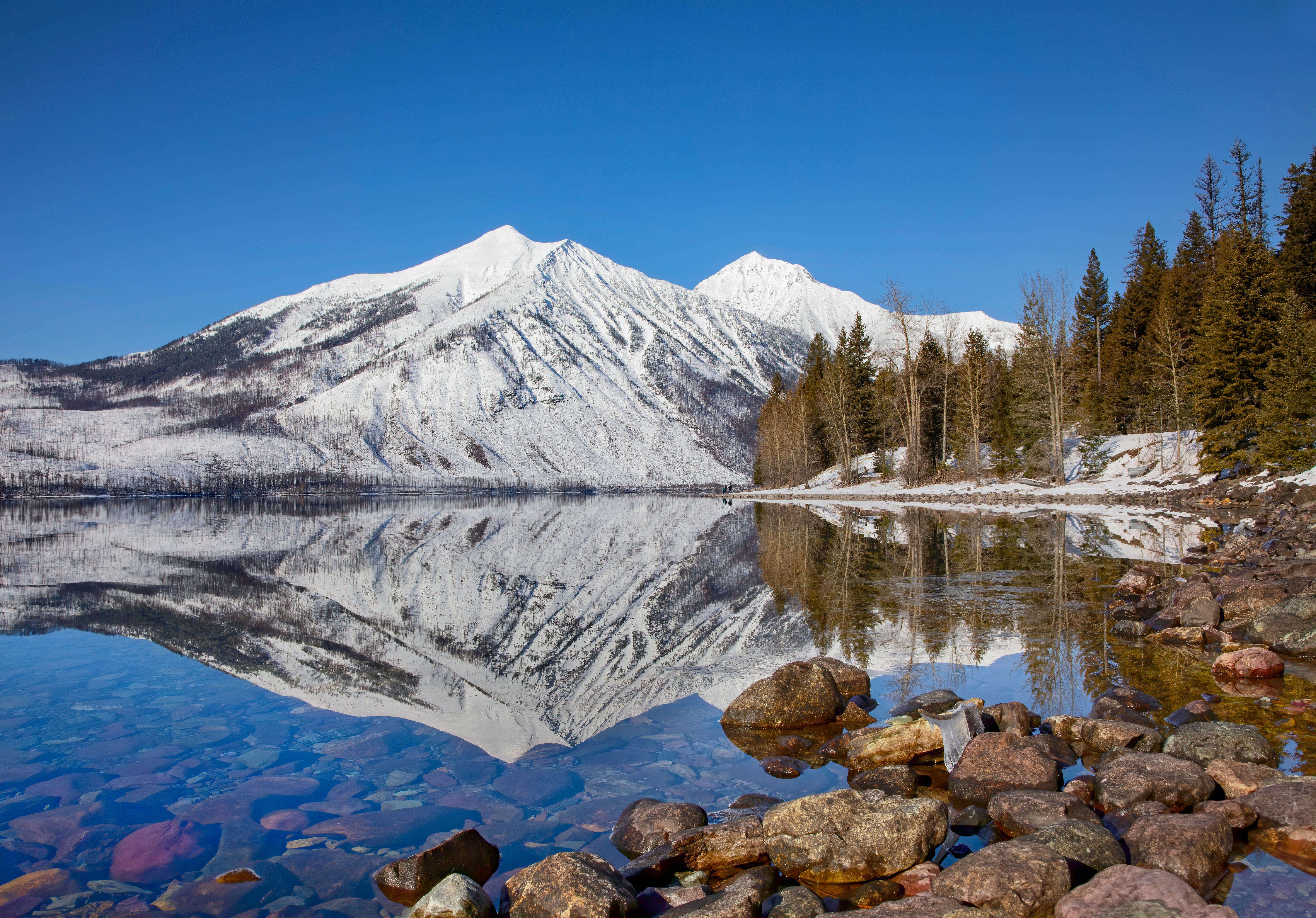
Lake McDonald The road hugs the southern shore of Lake McDonald for about 10 miles, the park's largest lake at 10 miles long, 1.5 miles wide, and 472 feet deep. Lake McDonald Lodge (1913, National Historic Landmark) is a classic Swiss-chalet-style lodge with massive stone fireplaces and pictographs by Hopi and other Indigenous artists carved into the lobby's wood floor. The lake is famous for its colorful pebble shoreline, where erosion has exposed sediment-rich stones in red, green, and white. The 2018 Howe Ridge Fire burned much of the north shore; regenerating lodgepole pine forest is visible across the water.
McDonald Creek and McDonald Falls Beyond the lake, the road tunnels through old-growth forest along McDonald Creek, passing the thunderous cascade of McDonald Falls. Marshy areas nearby are popular moose habitat; the hulking animals (a bull can weigh over 1,000 pounds) are accomplished swimmers and frequently graze in pond shallows in early morning.
Trail of the Cedars and Avalanche Lake A half-mile wheelchair-accessible boardwalk loop winds through an ancient forest of moss-draped western red cedars and western hemlocks, some over 500 years old. At the eastern end, Avalanche Creek slips through a small gorge of polished red argillite. The Avalanche Lake Trail branches off and climbs gently for 2 miles (4.5 miles round trip) to a sparkling cirque lake fed by half a dozen waterfalls cascading down 2,000-foot cliffs from Sperry Glacier above. Note for 2026: The Avalanche Creek area is not served by the park shuttle this year; visitors must drive and park at Avalanche Creek.
The Loop The road's only switchback turn, doubling back beneath the Garden Wall as it climbs out of the McDonald Creek valley. The Loop trailhead accesses the strenuous Granite Park Chalet trail (4 miles one way, 2,300 feet of elevation gain) and offers excellent views of Heavens Peak (8,987 ft) to the west.
The Garden Wall A sheer ridge of red and tan argillite rising thousands of feet, forming part of the Continental Divide. Water falling west of the divide drains to the Pacific; water east of the divide flows to the Atlantic via the Mississippi. The road clings to a shelf cut into the wall, with traffic moving slowly past vertical cliffs and roadside waterfalls. The Highline Trail, one of the park's premier day hikes, runs along the top of the Garden Wall from Logan Pass to Granite Park Chalot (7.6 miles one way).
Bird Woman Falls and the Weeping Wall Bird Woman Falls plunges 492 feet down a hanging valley between Mount Oberlin and Mount Cannon, particularly dramatic during snowmelt season in June and July. A short distance beyond, the Weeping Wall sends meltwater streams cascading directly onto and across the road, drenching cars in spring; later in summer the flow diminishes to a trickle.
Logan Pass The pinnacle of the drive at 6,646 feet, where the road crosses the Continental Divide. The Logan Pass Visitor Center (open mid-June through September, weather-dependent) anchors the alpine zone. The Hidden Lake Overlook Trail (3 miles round trip on boardwalk and natural path) crosses meadows of glacier lilies, shooting stars, and beargrass to an overlook of Hidden Lake far below; mountain goats and bighorn sheep are commonly seen along the trail. The Highline Trail also begins here. Note for 2026: A new 3-hour parking limit at Logan Pass takes effect July 1, 2026. A new ticketed Logan Pass shuttle pilot (operating July 1 through September 7, 2026, reservations through Recreation.gov, $1 processing fee) provides access for hikers who need to exceed the 3-hour limit. Casual drivers stopping briefly do not need a shuttle ticket.
Jackson Glacier Overlook On the descent east of Logan Pass, an overlook frames Jackson Glacier (just under one square mile of ice), one of the most easily viewed remaining glaciers in the park. The glacier has shrunk dramatically since the park's founding; current projections suggest most of the park's named glaciers will be gone by 2030 or shortly after.
St. Mary Lake The road descends through aspen, alder, and birch into the St. Mary Valley, passing the strikingly blue 10-mile-long St. Mary Lake. Blackfeet called the lake "the inside lake." The lake reaches depths of 300 feet and reflects the surrounding mile-high peaks. Sun Point (a quick detour from the road) offers an excellent lake overlook.
Wild Goose Island Overlook The signature shot of St. Mary Lake: a tiny tree-covered island sitting offshore against the backdrop of Little Chief Mountain, Mahtotopa Mountain, and Red Eagle Mountain. Named for a pair of geese that once nested there, it appears on countless park photos.
Triple Divide Peak (Distant View) Visible from the eastern stretches of the road, this 8,020-foot peak is one of the only points on Earth where water can flow from a single summit to three separate oceans: westward to the Pacific via the Columbia, eastward to the Atlantic via the Missouri-Mississippi, and northward to Hudson Bay and the Arctic Ocean via the Saskatchewan River system.
St. Mary The eastern terminus of Going-to-the-Sun Road, where the St. Mary Visitor Center anchors the entrance. The visitor center is open late May through September. The small village of St. Mary outside the park has lodging, restaurants, and fuel. From here, US-89 leads north to Many Glacier (see access note below) and south to Two Medicine, both spectacular but separate park areas.
Driving Tips
- 2026 update: Vehicle reservations for Going-to-the-Sun Road have been discontinued. No timed entry ticket is required to drive the road, though park entrance fees still apply ($35 per vehicle for 7 days; the annual Glacier pass is $80; America the Beautiful pass also accepted). A new $100 international visitor surcharge applies to non-US residents age 16 and older as of January 1, 2026.
- The road is typically open in full (cresting Logan Pass) from mid-June or early July through mid-October, weather dependent. Plowing crews face avalanche risk and snowpack of up to 80 feet at Logan Pass; the road is rarely open before late June. Lower sections open earlier and stay open later.
- Vehicle restrictions between Avalanche Creek and Rising Sun (the road's central, narrowest section): vehicles longer than 21 feet, wider than 8 feet, or taller than 10 feet are prohibited. RVs, large trucks, and most trailers must use US-2 around the southern park boundary (a 75-mile detour from West Glacier to St. Mary).
- A new 3-hour parking limit at Logan Pass takes effect July 1, 2026. A ticketed shuttle pilot replaces the previous free shuttle system, requiring Recreation.gov reservations. Casual drivers stopping briefly at Logan Pass do not need a shuttle ticket; hikers planning to exceed 3 hours of parking should reserve the shuttle.
- The Avalanche Creek / Trail of the Cedars area is not a 2026 shuttle stop. Visitors must drive and park there.
- The park shuttle now operates July 1 through September 7, 2026, reservations through Recreation.gov ($1 processing fee). Tickets release 60 days ahead starting May 2, 2026.
- Many Glacier construction: Major Swiftcurrent water system and road rehabilitation work continues through the 2026 season. Swiftcurrent Motor Inn, Many Glacier Campground, and Swiftcurrent trailhead parking are closed through mid-May 2026 and may remain restricted. Hiking and biking are prohibited on Many Glacier Road from July 1 through September 21 due to construction. Plan accordingly.
- Start early, before 7 a.m., to find parking at Logan Pass and Avalanche Creek; both fill by mid-morning in summer.
- Weather changes rapidly. Logan Pass can be sunny and 75°F at noon and snowing by 4 p.m. Pack layers, rain gear, and sunscreen regardless of season.
- Watch for wildlife: mountain goats and bighorn sheep at Logan Pass, grizzly and black bears throughout, moose in the McDonald Creek wetlands, and elk and white-tailed deer along forest edges. Carry bear spray on all trails; never approach wildlife within 100 yards (bears, wolves) or 25 yards (other species).
- Cell coverage is intermittent in the park, nonexistent above Lake McDonald and on the eastern descent. Download offline maps.
- Fuel up in West Glacier or St. Mary; there is no gasoline available inside the park.
- For more information visit: Glacier National Park (NPS)