Fundy Coastal Drive
Where the Ocean Disappears Twice a Day
The Bay of Fundy holds the highest tides on Earth: 100 billion tons of seawater pour in and drain out twice every day, the water rising and falling up to 16 meters (53 feet) between tides. This drive follows that coastline from the American border to the sculpted rock formations at Hopewell Rocks, and the tides shape everything you see. At one stop, you walk on the ocean floor among sandstone towers; six hours later, those towers are islands. At another, a road to an island vanishes under six meters of water. At a fishing village, lobster boats sit on bare mud at breakfast and float at dock height by lunch. The Fundy Coastal Drive is an officially designated scenic route running west to east through New Brunswick, connecting Loyalist towns, red sandstone sea caves, covered bridges, a river that reverses direction, and a national park where Acadian forest drops to tidal flats. Two natural forces drive it all: the bay's funnel shape compressing the incoming Atlantic, and a resonance cycle where the bay's natural oscillation period (approximately 12 hours) nearly matches the ocean tide cycle (12.42 hours), amplifying every pulse like a perfectly timed push on a swing.
Key Stops
St. Stephen The western starting point, directly across the St. Croix River from Calais, Maine. St. Stephen is Canada's Chocolate Town, home to Ganong Bros. Ltd., the country's oldest candy company, established in 1873 and credited with inventing the heart-shaped chocolate box. The Chocolate Museum occupies the historic factory building with hands-on exhibits and live demonstrations of hand-dipped chocolates. The Chocolate Fest runs each August.
St. Andrews by-the-Sea A beautifully preserved Loyalist-era resort town on Passamaquoddy Bay. Water Street is lined with shops, galleries, and restaurants in buildings dating to the late 18th century. Kingsbrae Garden, one of Canada's top ten public gardens, spans 27 acres with over 50,000 perennials, themed rooms, a cedar maze, and resident peacocks and alpacas. Whale-watching boats depart from the harbor from mid-June through August for minke, finback, and humpback whales in the outer bay. The landmark Algonquin Resort, a Tudor-style hotel, has anchored the town's tourism since 1889.
Ministers Island A 200-hectare island accessible only at low tide via Bar Road, a gravel bar on the ocean floor. At high tide, the road lies under approximately six meters of water. The island was the summer retreat of Sir William Cornelius Van Horne, the man who built the Canadian Pacific Railway; his estate, Covenhoven, and its outbuildings remain. Access hours change daily with the tides. A posted chart at the entrance indicates safe crossing times. Time your visit carefully or risk being stranded until the next low tide.
St. George Founded in 1783 by United Empire Loyalists, historically known as Granite Town for its red-granite quarries that supplied stone for the Ottawa Parliament Buildings and Boston's Cathedral of the Holy Cross. The scenic Magaguadavic River gorge runs through the center of town. The granite industry closed in 1953, but the legacy is visible in the buildings and monuments.
Blacks Harbour and Grand Manan Island Blacks Harbour is the departure point for the Coastal Transport ferry to Grand Manan Island, a 32-kilometer, 1.5-hour crossing. Grand Manan is famous for Dark Harbour, which produces what is widely considered the world's finest dulse, a purple-red edible seaweed rich in vitamins and minerals, harvested from rocks at low tide. No reservations or fares are required for travel to the island; fares are collected on departure from Grand Manan.
New River Beach Provincial Park A spectacular tidal beach between Blacks Harbour and Saint John with tide pools where visitors find crabs, periwinkles, and starfish at low water. The Barnaby Head Trail follows the rocky coastline through bogs with carnivorous sundew plants and Labrador tea. The park has 99 campsites.
Saint John Canada's first incorporated city (1785, by Royal Charter), settled by approximately 14,000 United Empire Loyalists who arrived in a single wave after the American Revolution. Market Slip is their landing site. The Saint John City Market, established 1785 under Royal Charter, is the oldest continuously operating farmers' market in North America; its current building (1876) has a distinctive roof shaped like an inverted ship's hull, honoring the city's shipbuilding heritage. Slocum and Ferris, inside the market, has sold dulse since 1895. The Reversing Rapids on the Saint John River are the city's most dramatic natural feature: at low tide, the river creates fierce rapids flowing downstream through a narrow gorge; at high tide, the Bay of Fundy's waters overpower the river and reverse its flow, creating upstream rapids. During the brief slack tide between, the water is calm. The full cycle takes roughly 12.5 hours.
St. Martins A picturesque fishing village about 45 minutes east of Saint John, and the gateway to the Fundy Trail Parkway. Red sandstone sea caves, carved by 250 million years of tidal erosion, are accessible on foot only at low tide; at high tide they are submerged and can be explored by kayak. The tidal difference here is approximately 15 meters (50 feet). The harbor has two historic covered bridges, including the province's only double-barreled covered bridge, built in 2022. New Brunswick has more than 50 surviving covered bridges, locally known as "kissing bridges" from the horse-and-wagon era when young couples used the privacy of the covered crossing to steal a kiss.
Fundy Trail Parkway A 30-kilometer scenic road along the Bay of Fundy coast, 25 years in the making (construction began 1995, the final connection to Fundy National Park completed in 2020, costing approximately CAD 100 million). The parkway hugs the coastline with more than 20 lookouts, access to secluded beaches, waterfalls including the Big Salmon River, suspension bridges, and connections to the historic Fundy Footpath backcountry trail. Entrance fee: CAD 12.17 per adult, CAD 6.96 for youth (5 to 18), free under 5. Open mid-May to mid-October. The completion of this road means the entire Fundy coast from St. Martins to Alma is now continuous; previously, drivers had to backtrack inland.
Fundy National Park A Parks Canada national park covering 207 square kilometers of Acadian forest along the Bay of Fundy coast. The Dickson Falls Trail (1.5 kilometers, easy, boardwalks through a lush forest gorge to a waterfall) is the park's most popular hike. Laverty Falls (2.5 kilometers one way, moderate) drops 12 meters over a sheer rock face. Third Vault Falls (3.7 kilometers one way, the park's tallest at 16 meters) plunges into a natural amphitheater reached by staircases and streambed scrambling. Multiple campgrounds range from full-service frontcountry to backcountry wilderness. Daily admission: CAD 10.00 per adult, youth (6 to 17) free, family/group CAD 19.50. In summer 2026, the Canada Strong Pass offers free admission and 25% off camping from June 19 through September 7.
Alma A tiny fishing village at the eastern gate of Fundy National Park, famous for fresh lobster served at wharfside restaurants. Alma's harbor is the most vivid illustration of the Fundy tides on the entire drive: at low tide, the harbor drains completely, leaving lobster boats sitting on bare mud; at high tide, the same boats float high at dock level. Sticky bun bakeries are a local tradition. Basic services include gas, restaurants, and a general store.
Cape Enrage A lighthouse established in 1838 on a dramatic headland jutting into the bay. The Cape Enrage Adventure Centre offers guided rappelling down a 43-meter (140-foot) cliff face over a fossil beach washed by Fundy tides (CAD 90 per person, approximately two hours), zip-lining (CAD 45), and guided fossil tours on the beach below. Open late May through mid-October. One of the most dramatic viewpoints on the entire coast.
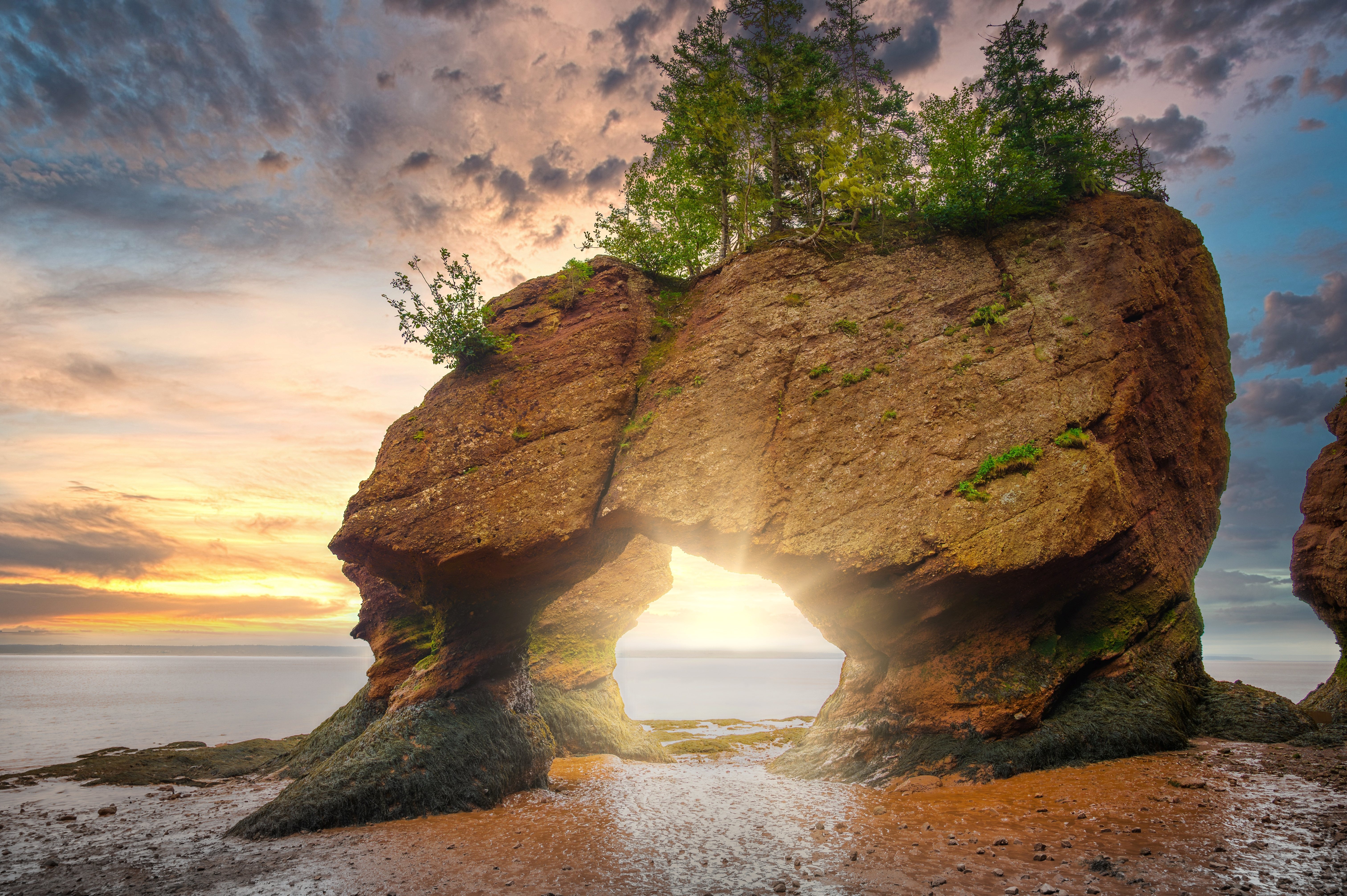
Hopewell Rocks The culmination of the drive. Towering sandstone and conglomerate formations, sculpted by tidal erosion into shapes resembling enormous flowerpots (some topped with trees), stand up to 15 meters tall. At low tide, visitors descend stairs and walk on the ocean floor among the bases of these formations. At high tide, the same formations are islands, only their tree-topped crowns visible above the water. The tidal range here averages 14 to 16 meters. The ocean floor is accessible for approximately three hours on either side of low tide (a roughly six-hour window). Arrive two to three hours before low tide for the best experience. The tide returns quickly; park staff monitor conditions and restrict access as needed. Admission: CAD 15.54 per adult, CAD 8.00 for children (5 to 18), valid for two consecutive days. Open mid-May to mid-October.
Driving Tips
- Check the tides: This is the single most important planning detail for the entire drive. Ministers Island, St. Martins sea caves, Hopewell Rocks, Alma harbor, and Cape Enrage are all tide-dependent experiences. The Canadian Hydrographic Service at tides.gc.ca provides free predictions for stations along the coast. Many attractions also post daily schedules.
- Fog: The Bay of Fundy coast is significantly cooler than inland areas, and fog is common from June through August when warm inland air meets cold bay water. Bring layers and rain gear even in summer. Fog can reduce visibility dramatically. Use low-beam headlights and reduce speed.
- Services: Between St. Martins and Alma (via the Fundy Trail Parkway), services are very limited. Fill your fuel tank and bring food and water before entering this stretch. Alma has basic services but is a tiny village.
- Two to three days: The drive covers 460 kilometers with tide-dependent attractions. Rushing it in a single day means missing the tides at key stops. Plan overnight stays (St. Andrews, Saint John, and Alma are the best bases) and time your itinerary around low tides at Hopewell Rocks and St. Martins.
- Seasonal openings: Hopewell Rocks, the Fundy Trail Parkway, and Cape Enrage operate only from mid-May to mid-October. Fundy National Park is open year-round but many facilities are seasonal.
- Covered bridges: If you enjoy covered bridges, detour through the Sussex area (Kings County), the Covered Bridge Capital of Atlantic Canada with 15 surviving bridges. The world's longest covered bridge is at Hartland (390 meters), on the Saint John River north of the Fundy route.
- Parks passes: Fundy National Park requires a Parks Canada entry pass (daily or Discovery Pass). The Fundy Trail Parkway and Hopewell Rocks are provincial parks with separate admission fees. Budget for multiple entrance fees across the drive.
- For more information visit: Tourism New Brunswick, Fundy Coastal Drive