RoadDrive
AboutApp StoreSign In / Up

England's Atlantic Edge

England's Atlantic Edge
Barnstaple
Newquay
United Kingdom
184 km
4h 29m

Where Devon Meets Cornwall and England Meets the Atlantic

The A39 runs southwest from Barnstaple in North Devon to Newquay in Cornwall, loosely paralleling one of the most dramatic stretches of coastline in England. The road itself runs largely inland through market towns and farmland, but the famous coastal villages, each a short detour on narrow Devon and Cornwall lanes, are the reason to drive it. The coast faces the full force of the Atlantic, and the sea has been shaping it for millennia: cliffs folded and buckled by 300-million-year geological forces, harbors destroyed by storms, caves carved beneath castles claimed by Arthurian legend. Along the way, the 630-mile South West Coast Path traces every headland and cove on foot, and drivers can park and walk sections for the views the A39 cannot provide. You cross from Devon into Cornwall near Bude, and the shift is palpable: the place names change (Tre-, Pol-, Pen-), the St. Piran's flag appears, and a distinct Celtic identity asserts itself. This is a coastline built on fishing, smuggling, and surfing, roughly in that order.


Key Stops

Barnstaple One of England's oldest boroughs, with a market charter dating to 930 AD. The Barnstaple Pannier Market, named for the baskets vendors once used to carry goods, is the largest covered market in the area, with over 70 stalls selling local produce, antiques, and crafts. The Museum of Barnstaple and North Devon covers the town's long history as a trading port on the River Taw.

Bideford Nine miles southwest, a historic port town on the River Torridge that was once Britain's third-largest port. The medieval Long Bridge, dating from roughly the 13th century, crosses the river. The Victorian Pannier Market (1884) has market rights tracing back to 1204. From Bideford, the MS Oldenburg sails to Lundy Island, 18 miles offshore in the Bristol Channel: a designated Marine Conservation Zone whose name means "puffin island" in Old Norse. Puffin season runs April through July. Crossings take approximately 2 hours and operate from late March to late October.

Clovelly A detour 12 miles west of Bideford leads to one of the most photographed villages in England. Clovelly clings to a 400-foot cliff, with a single cobbled main street (known as "Up-a-long" and "Down-a-long") plunging steeply to a tiny harbor. No cars are permitted. The gradient is so severe that goods are delivered on wooden sledges pulled by hand, and refuse is collected the same way. Rescue donkeys reside in stables that have housed working animals for over a century. Clovelly has been privately owned and associated with only three families since the mid-13th century. Entry fee: 9.50 pounds per adult, collected at the Visitor Centre at the top. The walk down is steep; the walk back up is steeper. A Land Rover service runs for those who need it. Allow 2 to 3 hours.

Hartland Point and Hartland Quay The northwestern tip of Devon, where a 325-foot rocky headland marks the western limit of the Bristol Channel. The Hartland Point Lighthouse, built in 1874, is Grade II-listed. At Hartland Quay, a former harbor dating to the time of Henry VIII was completely destroyed by storms by 1887; the old Customs House has been a hotel since 1886. Spectacular folded rock formations over 300 million years old are visible in the cliffs. This is one of the most dramatic and remote stretches of coastline in England.

Bude The first town across the Cornwall border and a popular surfing destination. Summerleaze Beach and Widemouth Bay are excellent for beginners, with multiple surf schools operating on both. The Bude Sea Pool, a semi-natural tidal pool on Summerleaze Beach built in the 1930s, fills naturally with seawater at high tide and provides safe swimming away from Atlantic currents. The Bude Canal, a 35-mile man-made waterway beginning right at the beach, is sheltered and non-tidal: ideal for kayaking, canoeing, and stand-up paddleboarding.

Boscastle A tiny village in a deep valley where the rivers Valency and Jordan meet, forming the only natural harbor for 20 miles on this coast. On August 16, 2004, Boscastle was hit by catastrophic flash flooding: approximately five inches of rain fell in a few hours, destroying six buildings, sweeping 50 cars out to sea, and requiring seven helicopters to airlift over 60 people. Remarkably, no one died. The Museum of Witchcraft and Magic, one of the world's largest collections of witchcraft-related artifacts, lost half its collection in the flood and reopened after restoration in 2005. The harbor and village have been rebuilt and are atmospheric again.

Tintagel The epicenter of the King Arthur legend. Geoffrey of Monmouth's 12th-century Historia Regum Britanniae identified Tintagel as the place where Arthur was conceived. The castle ruins on the dramatic headland actually date from the 13th century (built by Richard, Earl of Cornwall, likely to exploit the Arthurian connection), but archaeological evidence shows high-status occupation in the 5th and 6th centuries, with imported Mediterranean pottery suggesting a genuine seat of power. A stunning modern footbridge, opened in 2019, spans approximately 70 meters to reconnect the mainland and island halves of the site. Merlin's Cave, at the base of the headland, is accessible from the beach at low tide (free, no castle ticket needed; check tide times). Managed by English Heritage. Adult entry approximately 16 pounds; book online for a 15% discount. Free for English Heritage members.

Port Isaac A small fishing village that served as the fictional "Portwenn" in the ITV series Doc Martin from 2004 to 2022. The narrow cobbled Fore Street, lined with pastel-colored cottages, descends to a tiny harbor where fishing boats still land. Key filming locations include Fern Cottage (the doctor's surgery) and the Old Schoolhouse Hotel. Port Isaac is also home to The Fisherman's Friends, a group of local fishermen who sing sea shanties and secured a major record deal. Parking is very limited; arrive early.

Padstow A working fishing port on the Camel Estuary that Rick Stein transformed into a nationally famous gourmet destination. Stein and his then-wife Jill opened The Seafood Restaurant in 1975; his empire has since expanded to multiple restaurants, a deli, a patisserie, a cookery school, and a gift shop, earning the town the nickname "Padstein." The Camel Trail, a flat, traffic-free walking and cycling path following a disused railway line along the estuary, runs 5.5 miles from Padstow to Wadebridge (bike hire available in both towns). The National Lobster Hatchery, a conservation charity, hatches and rears juvenile lobsters before releasing them. Prideaux Place, an Elizabethan manor house overlooking the harbor, is open to visitors on certain days. Every May Day, the 'Obby 'Oss Festival fills the streets with two hobby horses danced to accordion music and singing in one of Cornwall's oldest and most exuberant folk celebrations.

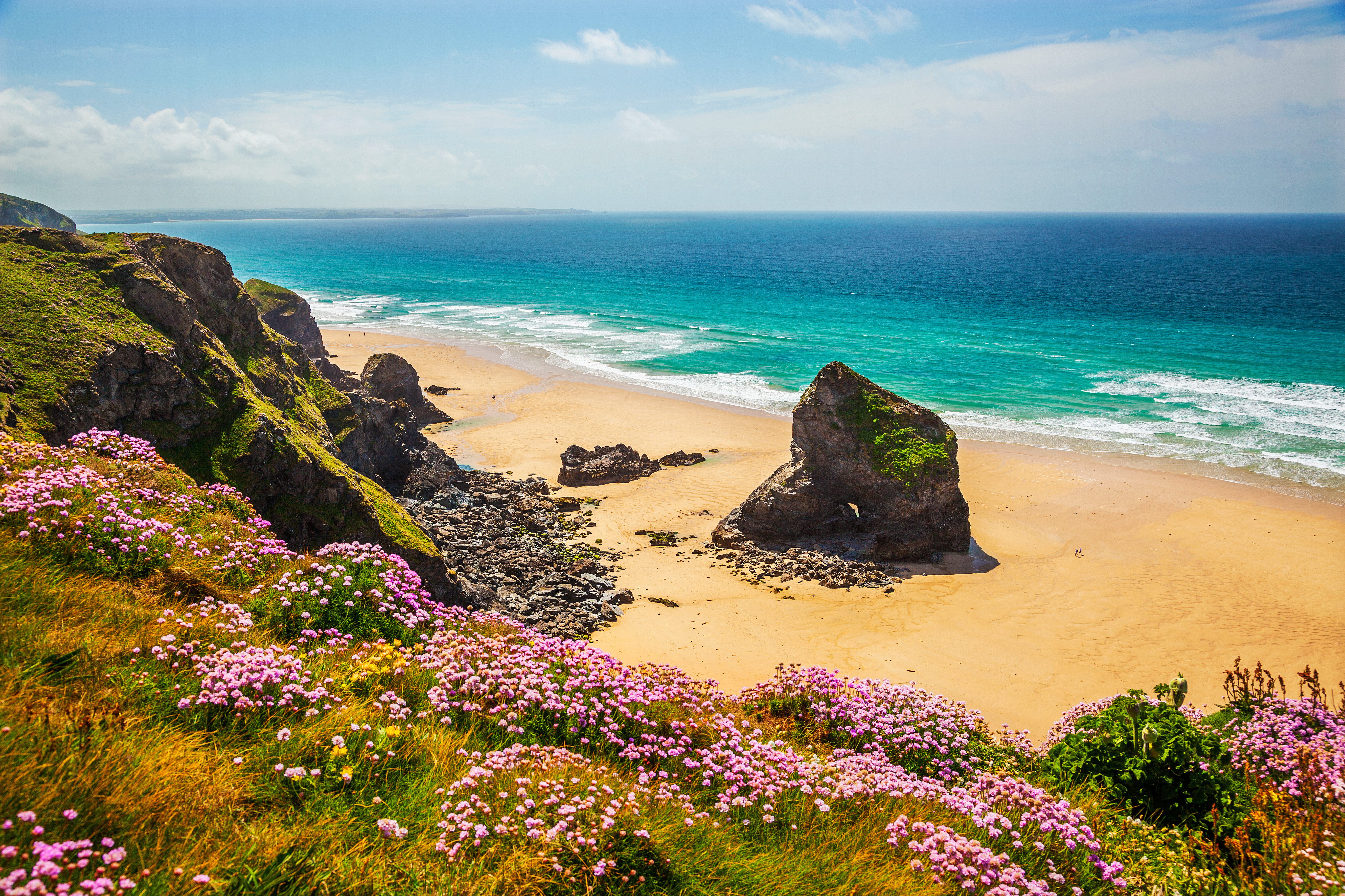
Bedruthan Steps Between Padstow and Newquay (a short detour off the B3276 coast road), a dramatic stretch of coastline with enormous rock stacks on the beach below towering cliffs. According to legend, the stacks were stepping stones used by the giant Bedruthan. Managed by the National Trust, with a steep staircase of 149 steps carved into the cliff leading to the beach. Access can be closed due to rockfalls and dangerous conditions; check before visiting.

Newquay The surfing capital of the United Kingdom. Fistral Beach, considered the home of British surfing, benefits from a natural reef and a funnel effect between headlands that produces consistent, high-quality waves. It hosts annual national and international competitions, including the Boardmasters Festival (surfing and music). Multiple other beaches serve different abilities: Towan, Great Western, Lusty Glaze, and Watergate Bay. A lively resort town with surf shops, board shapers, and beachside cafes. The surfing culture here is year-round, not seasonal, with wetsuit-clad riders in the water in every month.


Driving Tips

  • The A39 is mostly single carriageway (one lane in each direction), with only brief dual-carriageway segments near interchanges. It is not a fast road. The stretch through Camelford on a narrow street is a notorious bottleneck.
  • Narrow lanes: The famous coastal villages (Clovelly, Boscastle, Tintagel, Port Isaac) are reached by narrow, single-track Devon and Cornwall lanes with passing places. Pull into a passing place on your left to let oncoming traffic through. These lanes can be intimidating for drivers unfamiliar with them, but they are the only way to reach the coast.
  • Parking: In summer, parking in small villages is extremely limited and fills early. Clovelly, Port Isaac, Padstow, and Tintagel all have small parking areas. Arrive before 10:00 AM in peak season or use park-and-ride services where available. Padstow operates a summer park-and-ride.
  • Summer congestion: July and August (school holidays) bring severe traffic, especially on Saturdays (changeover day for holiday rentals). Plan around it or visit in shoulder season.
  • Best time to visit: Late May through June or September for the best balance of weather, daylight, and manageable crowds. April and October can be lovely but cooler.
  • Fuel: Available in Barnstaple, Bideford, Bude, Camelford, Wadebridge, and Newquay. Fill up in towns; there are no fuel stations in the smaller villages.
  • Cream tea protocol: You will cross from Devon into Cornwall near Bude. In Devon, cream goes on the scone first, then jam. In Cornwall, jam goes first, then cream. Both sides claim historical precedent. The debate is conducted with surprising intensity. Try it both ways and keep your preference to yourself.
  • Tractors and farm vehicles: Common on the A39 and side roads. Be patient.
  • The South West Coast Path: The 630-mile National Trail runs along this entire coastline. Park at any coastal village and walk a section for the views the A39 cannot provide. The North Devon and North Cornwall sections are widely considered the most dramatic stretches of the entire trail.
  • For more information visit: Visit Cornwall

Waypoints (14)

☰
1
Barnstaple Pannier Market
⛰️ 96 m
2 km
6m
☰
2
Museum of Barnstaple & North Devon
⛰️ 96 m
16 km
18m
☰
3
Bideford Long Bridge & Pannier Market
⛰️ 88 m
27 km
31m
☰
4
Clovelly Visitor Centre
⛰️ 70 m
10 km
18m
☰
5
Hartland Point
⛰️ 0 m
28 km
38m
☰
6
Hartland Quay
⛰️ 15 m
3 km
8m
☰
7
Bude
⛰️ 119 m
30 km
36m
☰
8
Boscastle
⛰️ 21 m
13 km
21m
☰
9
Tintagel
⛰️ 21 m
9 km
17m
☰
10
Port Isaac
⛰️ 138 m
18 km
23m
☰
11
Padstow
⛰️ 36 m
21 km
30m
☰
12
Bedruthan Steps
⛰️ 36 m
5 km
10m
☰
13
Fistral Beach
⛰️ 36 m
2 km
8m
☰
14
Newquay
⛰️ 36 m