Coronado Trail Scenic Byway
Arizona's Windiest Road, From Sonoran Desert to Spruce Forest
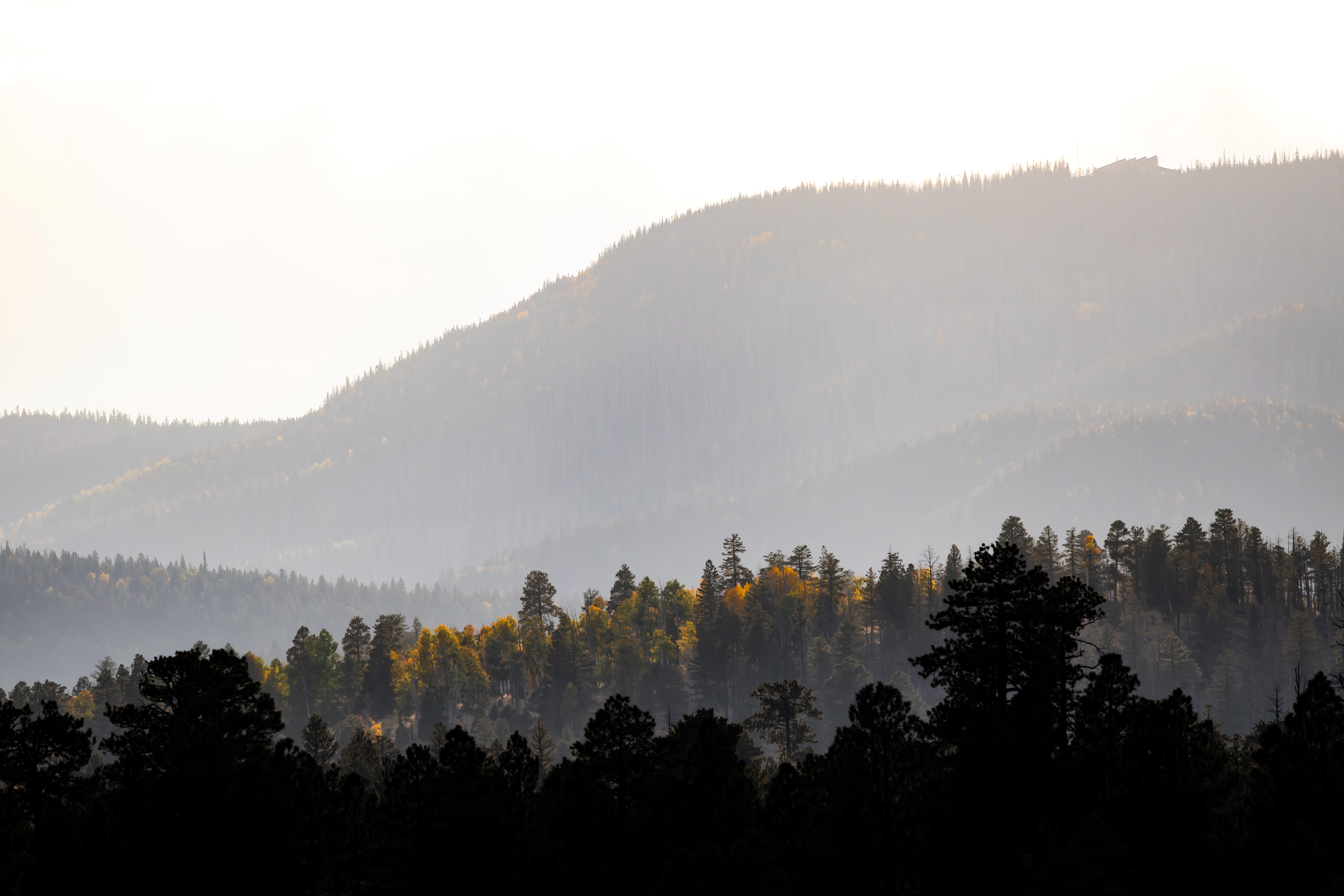
The Coronado Trail Scenic Byway is the windiest road in Arizona and one of the least-traveled scenic drives in the American Southwest, climbing 123 miles through more than 460 curves between the copper-mining town of Clifton at 3,500 feet and the volcanic plateau town of Springerville at 7,000 feet. The road traces, loosely, the northward route taken by Francisco Vázquez de Coronado in 1540 when he led 1,000 conquistadors and 1,500 horses through this country in search of the legendary Seven Cities of Gold (Cíbola). He found stone pueblos instead of gold, and his expedition became one of the great failed treasure hunts of the Spanish era. The byway crosses the Apache-Sitgreaves National Forests, climbing from Sonoran Desert scrub through pinyon-juniper woodland into ponderosa pine, then aspen, and finally into the dark spruce-fir forest of the Mogollon Rim, cresting near 9,400 feet at Hannagan Meadow. At Blue Vista, the road perches on the rim's edge with a 7,000-foot drop to the desert and views stretching 70 miles to Mount Graham. The route was originally designated US-666 and known as the "Devil's Highway" for its hairpins and avalanche of sign theft; it was renumbered US-191 in 1992. The road passes through the Blue Range Wolf Recovery Area, where Mexican gray wolves were reintroduced in 1998 and now number 319 across Arizona and New Mexico (the population reached a record high in early 2026). Much of the forest the byway crosses was burned in the 2011 Wallow Fire, the largest wildfire in Arizona history (538,000 acres), and the recovering landscape, with young aspen groves rising through skeletal stands of dead conifers, is visible for long stretches between Alpine and Hannagan Meadow.
Key Stops
Clifton (Southern Terminus) Founded in 1873 at the confluence of the San Francisco River and Chase Creek when the Lesinsky brothers built the first smelter to process copper from the surrounding hills. The Historic Chase Creek Street District, listed on the National Register, preserves 37 acres of late-Territorial brick architecture (much of it rebuilt after the April 1913 fire). Don't miss the Cliff Jail (blasted into solid cliff face), the restored Coronado Railroad locomotive nicknamed "Copper Head" on Coronado Boulevard, and the Greenlee County Historical Museum. Last fuel and full services on the southern approach.
Morenci Mine Overlook About 10 miles north of Clifton, US-191 climbs above one of the largest open-pit copper mines in North America, operated by Freeport-McMoRan. The pit is roughly 3 miles wide and 6 miles long, with terraced benches striped in pink, gold, and white, and haul trucks carrying 125,000 tons of copper a day that look like toys from the overlooks. Morenci is the largest copper producer in North America and globally second only to Chile's Escondida. Note: Formal guided mine tours have been discontinued for safety reasons; visitors must rely on the public overlooks along the highway.
Chase Canyon North of Morenci, US-191 enters a colorful sandstone canyon, winding through the tightest stretch of switchbacks on the entire route. The first 10 miles north of Clifton are reported as the most challenging driving, with many curves posted at 10 to 15 mph.
Cherry Lodge Picnic Area A pleasant Forest Service picnic ground about 20 miles north of Clifton, sheltered by mature ponderosa pine, with restrooms, a few tables, and a creek. A good rest stop after the climb out of Chase Canyon.
Rose Peak Lookout Tower At 8,786 feet, an active Forest Service fire lookout reached by a half-mile hike from the highway parking area. When staffed during fire season, lookouts often invite visitors up into the glass-enclosed tower room for panoramic views of the Mogollon Rim's limestone cliffs and the Blue Range Primitive Area, one of the largest roadless wilderness areas in the lower 48 states.
Blue Vista Overlook The signature view of the byway, at milepost 225, just south of Hannagan Meadow at 9,184 feet. The overlook stands on the very edge of the Mogollon Rim, with a 7,000-foot drop to the desert below and an endless parade of ridges and canyons stretching southeast and west. On clear days, Mount Graham (the Pinaleño Mountains) is visible 70 miles away, and the view extends into western New Mexico.
Hannagan Meadow Lodge A historic Forest Service-permitted lodge at 9,200 feet, the only commercial lodging on the entire 123-mile byway. The lodge was established in 1926 (its formal dedication coincided with the June 1926 opening of the Clifton-to-Springerville Highway) and has been continuously operating since. Eight log cabins, a dining room (among the longest continuously operating restaurants in Arizona, dating to the 1930s), and a small general store. Open 365 days a year, with reservations accepted up to a year in advance. Winter activities include guided snowshoeing, cross-country ski rentals, and a tubing hill. Phone (928) 339-4370.
Alpine A small alpine village at 8,000 feet settled in the 1870s by Mormon ranchers, nicknamed the "Switzerland of Arizona" for its meadow setting beneath surrounding peaks. Alpine has lodging, a few restaurants, fuel, and groceries, the last reliable services heading south for the next 90 miles.
Escudilla Mountain North of Alpine, US-191 skirts the base of Escudilla Mountain (10,912 ft), an ancient volcano and Arizona's third-highest peak, at the heart of the 5,200-acre Escudilla Wilderness Area. Aldo Leopold immortalized Escudilla as the home of "Old Bigfoot," the last grizzly bear in the area, killed in the 1930s, in his essay collection A Sand County Almanac. A trail leads to the summit fire lookout (~6.4 miles round trip, 1,300 feet of elevation gain).
Nelson Reservoir A small reservoir popular for trout fishing and quiet paddling, just south of Springerville on US-191. A pleasant lakeside picnic stop with views back toward the White Mountains.
Springerville and Eagar (Northern Terminus) The twin towns of Springerville and Eagar sit on the volcanic plateau at the foot of the White Mountains. Springerville's Renee Cushman Art Museum holds an unexpected collection of European masterpieces. Two miles north of Springerville on US-191 lies Casa Malpais Archaeological Park, a National Historic Landmark and a remarkable Mogollon culture pueblo occupied roughly 1240 to 1400 CE. Built atop a shield-volcano lava flow, the site includes a Great Kiva, a solar calendar, a 50- to 60-room pueblo, an ancient staircase carved into basalt, and a catacomb-like cave system beneath the structure. The pueblo was mysteriously abandoned around 1400. Visits are by guided tour only, originating at the Casa Malpais Museum (418 E. Main Street, Springerville). Tours run roughly 2 hours and include a steep three-quarter-mile hike. Museum admission is free.
Greer (Side Trip) A small alpine village on the Little Colorado River, reached via AZ-373 off AZ-260 west of Springerville. At 8,500 feet, surrounded by 22 trout lakes and 630-plus miles of trout streams. Fishing, hiking, mountain biking, and cross-country skiing at the nearby Sunrise Park Resort.
Driving Tips
- The byway is famously the windiest road in Arizona, with over 460 curves and switchbacks. Many sections are posted at 10 to 25 mph and the road rarely exceeds 25 mph in mountainous stretches. Plan a minimum of 4 to 5 hours of driving and add stops generously.
- Vehicles longer than 40 feet are prohibited. The road is not recommended for large RVs, trailers, or inexperienced mountain drivers. No shoulders, sheer drop-offs, and sections without guardrails are common.
- Services are essentially nonexistent between Alpine (north) and Clifton (south), roughly 90 miles. Fill up at one end before departing. Hannagan Meadow Lodge has a small store and restaurant but no fuel pumps.
- Cell coverage is spotty to nonexistent through most of the mountainous middle section. Tell someone your itinerary, carry a paper map, plenty of water, food, and consider a satellite messenger.
- The road is open year-round but plowed only weekdays 8 a.m. to 5 p.m. Expect snow and ice from November through April, sometimes into June at higher elevations (annual snowfall at the rim averages around 200 inches). Carry chains and emergency supplies in winter.
- Temperatures can swing 30 degrees or more between desert lowlands and the alpine ridge. Pack layers regardless of season. Summer afternoon thunderstorms produce intense lightning at the high overlooks; descend below the rim if storms develop.
- Elk on the road are the biggest hazard, especially at dawn, dusk, and after dark. Mule deer, black bear, wild turkey, and occasionally bighorn sheep also use the highway. Drive cautiously around blind curves.
- Mexican gray wolves are protected by federal law. If you spot one, observe quietly from your vehicle, do not approach, and report sightings to the US Fish and Wildlife Service to support recovery monitoring.
- Real-time road conditions: az511.gov or dial 511 from any phone within Arizona.
- For more information visit: Arizona Highways: Coronado Trail