Bow Valley Parkway
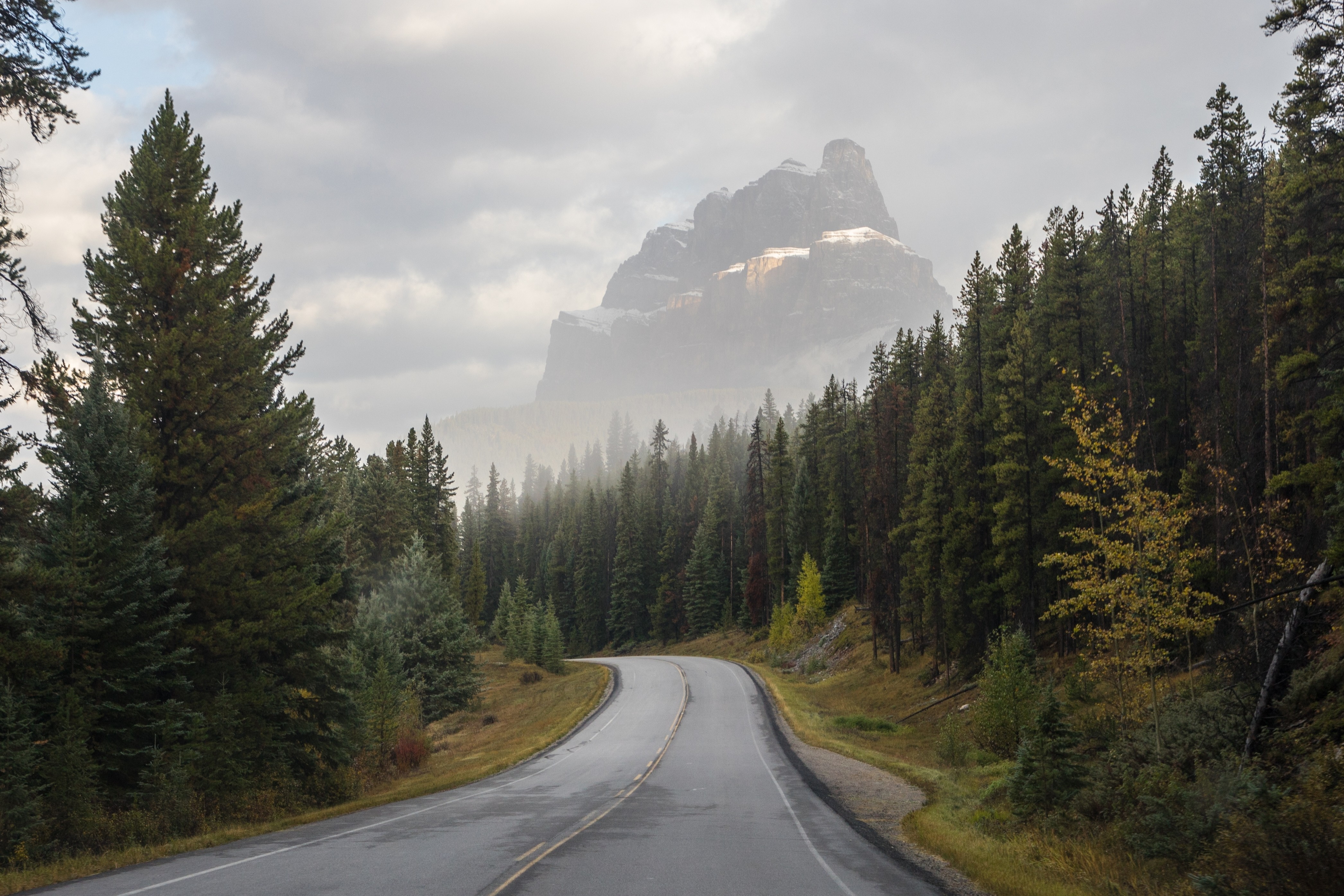
The Quieter Road Through the Rockies
When the Trans-Canada Highway was completed through Banff in the 1960s, the original 1920 motor road between Banff and Lake Louise lost its traffic and gained something better: solitude. The Bow Valley Parkway follows the valley floor through montane forest along the Bow River, the lowest and richest ecological zone in the park, where elk graze in open meadows, black bears forage at forest edges, and wolves move through one of the most important wildlife corridors in the Canadian Rockies. The road passes iron catwalks bolted into the walls of Johnston Canyon, climbs past the fortress-like face of Castle Mountain, and ends near the turquoise waters of Lake Louise. At 60 km/h, this is a drive designed for looking, not for getting somewhere fast.
Key Stops
Backswamp Viewpoint Three kilometers into the drive, a small pullout overlooks marshland and the Bow River with Mount Bourgeau (2,930 meters) rising behind. The wetlands here support nesting osprey and a variety of waterfowl. It is an easy stop to miss, but it sets the tone: this is a road where the rewards go to those who slow down.
The Sawback Burn Around the four-kilometer mark, the forest opens into a five-kilometer stretch of regenerating landscape from a 1993 Parks Canada prescribed burn. The open terrain is one of the best wildlife viewing corridors on the parkway. New growth of fireweed, grasses, and young lodgepole pines attracts elk and deer, and the lack of dense canopy makes animals easier to spot.
Muleshoe Picnic Area A large picnic area with tables, washrooms, and views of Muleshoe Lake, an old oxbow of the Bow River. The surrounding old-growth aspens and towering evergreens represent the rare montane ecosystem that makes this valley so ecologically important. Good birding: look for woodpeckers and osprey.
Hillsdale Meadows An open meadow of aspen with views of Pilot Mountain (2,935 meters). This is one of the most photographed spots on the parkway, particularly in autumn when the aspens turn gold. At dawn and dusk, elk gather to graze in the meadow, framed by the mountain wall behind.
Johnston Canyon The most popular stop on the parkway, located approximately 25 kilometers from Banff. A paved trail follows iron catwalks bolted into the limestone canyon walls above Johnston Creek. The Lower Falls (1.1 kilometers from the trailhead, 20 to 30 minutes) drop 10 meters into a turquoise pool; a short tunnel through the rock leads to a viewing platform at the base. The Upper Falls (2.4 kilometers, 45 to 60 minutes) plunge 30 meters and are the more dramatic of the two. Beyond the Upper Falls, the trail climbs through subalpine forest to the Ink Pots (5.7 kilometers, 1.5 to 2 hours): a collection of vivid green and blue cold-water mineral springs bubbling up through an alpine meadow, far quieter than the falls below. In winter, the canyon transforms into a frozen corridor of ice-encased walls and frozen waterfalls; microspikes are essential, and guided ice walk tours are available. In summer, arrive before 8:00 AM or after 5:00 PM to avoid the heaviest crowds.
Silver City (Ghost Town Site) An interpretive plaque marks the site of an 1880s boomtown that exploded to roughly 3,000 residents when prospector John Healy staked a copper claim at the base of Castle Mountain in 1882. By 1883, Silver City had a hotel, six saloons, a pool hall, and a North-West Mounted Police barracks. The boom collapsed when swindlers named Patton and Pettigrew were caught salting the Homestake Mine, firing silver-bearing ore into the rock with shotguns to deceive investors. By 1885, the town was abandoned. One original prospector, Joe Smith, lived among the ruins for over fifty years before being moved to a Calgary nursing home in 1937, at age ninety.
Castle Mountain and Castle Junction Castle Mountain (2,766 meters) dominates the skyline with dramatic, fortress-like cliff bands visible for kilometers in both directions. The mountain was named in 1858 by geologist James Hector of the Palliser Expedition, renamed Mount Eisenhower in 1946 by Prime Minister Mackenzie King to honor the Allied Supreme Commander, and renamed back to Castle Mountain in 1979 after decades of public protest. As a compromise, the prominent southeastern tower retains the name Eisenhower Peak. Castle Junction connects to Highway 93 South toward Kootenay National Park. Nearby, the Castle Mountain Internment Camp Memorial commemorates Ukrainian and Eastern European immigrants held as "enemy aliens" and used as forced labor to build park infrastructure from 1915 to 1917.
Castle Cliffs Viewpoint A parking area offering close-up views of the terraced, layered face of Castle Mountain. The scale of the cliff bands is difficult to grasp until you are standing beneath them.
Storm Mountain Viewpoint A picnic area set above the Bow River with views of Storm Mountain (3,161 meters), interpretive signage, and a close-up view of the Canadian Pacific Railway tracks curving through the valley below. The CPR line, completed through here in 1884 to 1885, predated the road by nearly four decades and led directly to the creation of Banff National Park after railway workers discovered the hot springs in 1883.
Baker Creek A picturesque pullout next to Baker Creek with views of Mount Temple. The Baker Creek Mountain Resort offers cabin accommodation and a creekside cafe, making it one of the few places to stop for food along the parkway.
Morant's Curve One of the most photographed spots in all of Banff National Park. Named after Nicholas Morant (1910 to 1999), the official Canadian Pacific Railway photographer whose images of trains curving through the Rockies became some of the most reproduced photographs of the Canadian West. The viewpoint captures the railway sweeping through the Bow Valley with mountain peaks rising behind. If you have a telephoto lens and patience, wait for a freight train.
Lake Louise Village The parkway ends as it rejoins the Trans-Canada Highway near Lake Louise. The lake itself lies about five kilometers west of the village, cradled below Mount Temple and the Victoria Glacier, which feeds the water and gives it its luminous turquoise color. The Fairmont Chateau Lake Louise stands on the eastern shore. Walking trails skirt the lake and lead into the mountains beyond.
Driving Tips
- Speed limit: 60 km/h (37 mph), with many sections posted at 50 km/h or lower. This is deliberate. The parkway is designed for scenic driving and wildlife protection, not speed.
- Wildlife distances: Parks Canada requires a minimum distance of 100 meters from bears, wolves, cougars, and coyotes, and 30 meters from elk, deer, sheep, and moose. Carry bear spray and know how to use it.
- Wildlife jams: If you spot an animal, pull over safely at the nearest pullout. Do not stop in the travel lane, do not approach the animal, and move on promptly.
- Seasonal closures: The eastern 17-kilometer section (Fireside to Johnston Canyon) is closed to all users from 8:00 PM to 8:00 AM between March 1 and June 25 to protect wildlife during spring denning and feeding. From May 1 to June 25 and August 28 to October 2, this same section is vehicle-free for a cycling pilot program. Johnston Canyon can still be reached by vehicle from the Castle Junction (western) end during these closures.
- Parks Canada pass: A valid entry pass is required for all visitors. Daily: CAD 12.25 per adult, youth (17 and under) free, family/group CAD 24.50. The annual Discovery Pass (CAD 83.50 adult / CAD 167.50 family) covers all national parks and historic sites across Canada. In 2026, admission is free from June 19 through September 7 under the Canada Strong Pass.
- Fuel: There are no fuel stations on the parkway itself. Fill up in Banff before departing, or at Lake Louise village.
- Winter driving: The parkway is open year-round but can be snow-covered and icy. Winter tires are legally required in Banff National Park from November 1 through March 31. Some pullouts and picnic areas may be unplowed.
- Cycling: The parkway is excellent for cycling even when open to vehicles, with wide shoulders and low speed limits. During the cycling pilot closures, the eastern section is entirely vehicle-free. Cyclists should travel in groups when possible, make noise, carry bear spray, and avoid using headphones.
- For more information visit: Parks Canada, Banff National Park