Arkansas Scenic Highway 7
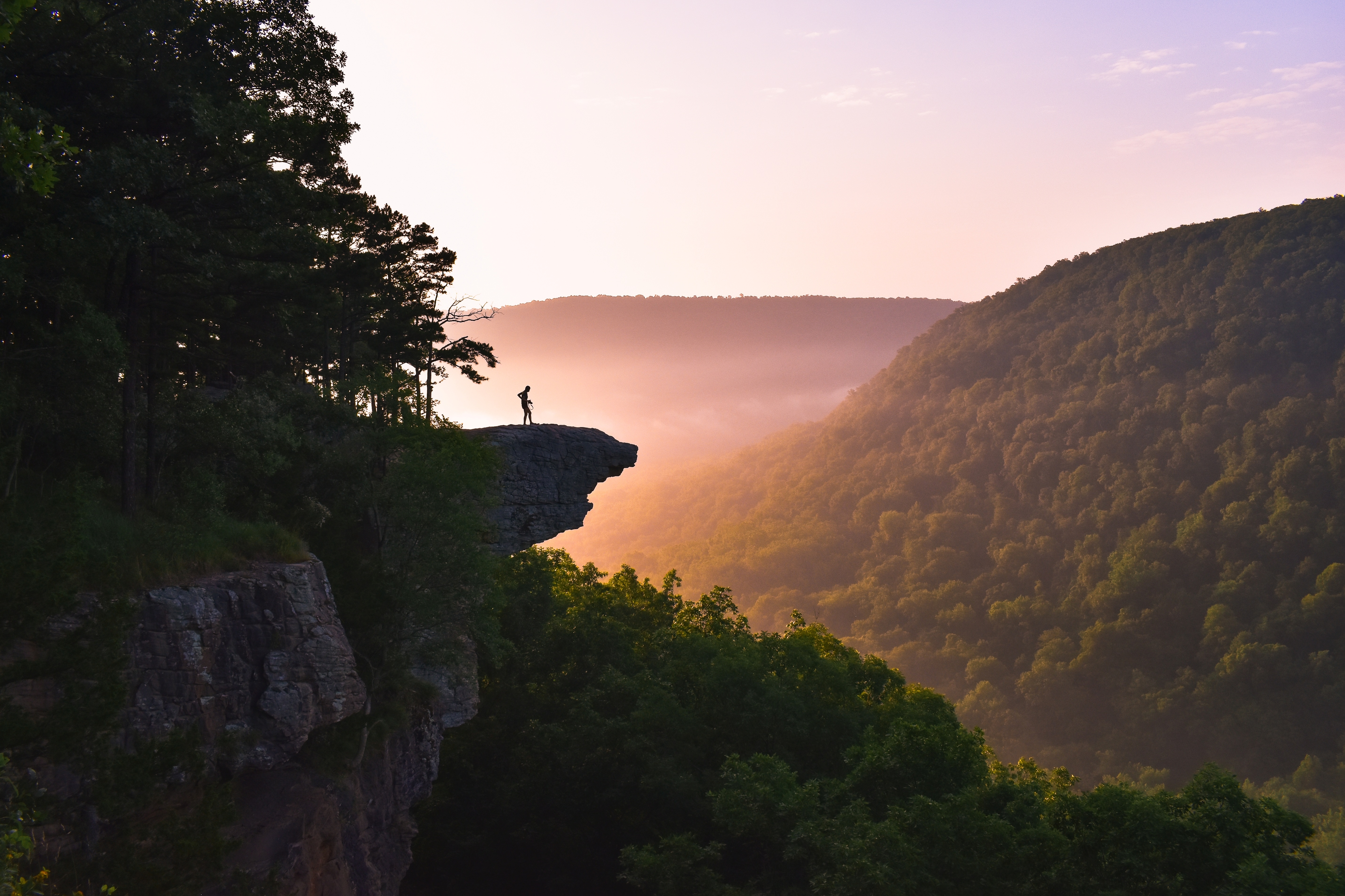
Across the Ouachitas and Ozarks: America's Underrated Mountain Drive
Arkansas Scenic Highway 7 is consistently ranked among America's top 10 scenic drives but remains largely unknown outside the Mid-South. Running 290 miles from the Louisiana border at El Dorado to the Missouri border at Diamond City, the road traverses the only major mountain ranges between the Rockies and the Appalachians: the Ouachita Mountains (an unusual east-west range, the only major US mountain range that runs east-west rather than north-south, the result of an ancient collision between the North American and South American plates 300 million years ago) and the Ozark Mountains (a deeply dissected plateau of limestone, sandstone, and dolomite carved by clear-running rivers into one of the most rugged landscapes east of the Rockies). The classic scenic stretch runs 160 miles from Hot Springs (where 47 thermal springs flow from the southern flank of Hot Springs Mountain at a constant 143°F, used by Native peoples for over 8,000 years and protected as the country's oldest federal reservation, designated by Congress in 1832, four decades before Yellowstone became the first national park) north across the Arkansas River valley to Harrison, gateway to the Buffalo National River, the first National River in the United States, protected in 1972 to prevent damming. Highway 7 itself was designated a state scenic byway in 1994, and the road's character is intimate rather than monumental: roadside cabins selling quartz crystals (the Ouachitas hold some of the world's finest quartz deposits), pickled okra and honey at family-run produce stands, hollow-eyed barns in folded valleys, dogwood and redbud in spring, sumac and maple in fall, and switchback climbs over the Ozarks that produce views all the way to the Boston Mountains. Black bears, elk (reintroduced to Boxley Valley in 1981), white-tailed deer, bobcats, and wild turkeys range across the route. The drive crosses two national forests (Ouachita, established 1907, the oldest national forest in the southern United States; and Ozark, established 1908), one national park (Hot Springs), one national river (Buffalo), and five state parks, making it perhaps the most diverse 160 miles of scenic byway in the American South.
Key Stops
Hot Springs (Start) A small city built around 47 thermal springs flowing from the slopes of Hot Springs Mountain in the Ouachitas. The springs have been used by Native peoples for over 8,000 years and were federally protected by Congress in 1832, making Hot Springs National Park the oldest federally protected natural area in the United States (40 years before Yellowstone). The park is the only national park entirely within a city. Key sites:
- Bathhouse Row (National Historic Landmark District): Eight ornate early-20th-century bathhouses lining Central Avenue (AR-7). The Buckstaff Bathhouse (1912) is the only one operating continuously since opening and offers traditional thermal mineral baths. The Quapaw Bathhouse also offers modern spa services. The Fordyce Bathhouse (1915) is the park's main visitor center, preserved with original tile, marble, and stained glass interiors.
- Museum of Contemporary Art (MOCA) in the Ozark Bathhouse, Arkansas's first contemporary art museum
- Grand Promenade, a brick walkway behind Bathhouse Row past the thermal springs themselves
- Hot Springs Mountain Observation Tower (216 feet tall, with elevator) for panoramic views
- Garvan Woodland Gardens, 210 acres of botanical gardens on a peninsula in Lake Hamilton designed by the University of Arkansas Landscape Architecture program
Hot Springs was a gangster haven from the 1920s through the 1940s; Al Capone made it his summer retreat. The Gangster Museum of America tells the story. Oaklawn Racing Casino Resort offers thoroughbred horse racing January through May. The town is also the boyhood home of President Bill Clinton; a self-guided tour visits his early homes.
Lake Ouachita (Side Trip) West of Hot Springs on AR-270, Lake Ouachita is the largest lake in Arkansas at 40,000 surface acres, famous for its exceptional water clarity (one of the cleanest lakes in the South) and bass and trout fishing. Lake Ouachita State Park offers cabins, camping, and the Caddo Bend Trail.
Ouachita National Forest North of Hot Springs, AR-7 climbs into the Ouachita National Forest, established in 1907 as the first national forest in the southern United States. The road passes shortleaf pine forests, hardwood ridges, and rushing creeks. Numerous roadside quartz shops sell raw and polished crystals; the Ouachitas hold one of the world's largest deposits of high-grade quartz. Wildlife includes white-tailed deer, beavers, great blue herons, wild turkeys, and (rarely seen but present) the recently reintroduced eastern collared lizard and black bears.
Jessieville and Iron Mountain Small communities along Highway 7 as it climbs north through the Ouachitas. The Iron Mountain Hardwoods sign marks the highest point in this section.
Holla Bend National Wildlife Refuge (Side Trip) A short detour east on AR-154 near Centerville leads to the 7,000-acre refuge, set in a 14-mile bend of the Arkansas River cut off when the river was straightened by the Corps of Engineers in 1953. An 8-mile auto-tour route loops through levees, wetlands, croplands managed for wildlife, and forest. Best in winter (November through February) when up to 100,000 ducks and geese gather, and bald eagles roost in the cottonwoods. Free.
Petit Jean State Park Reached by a 17-mile detour east on AR-154 from Centerville, Arkansas's first state park (established 1923) sits atop Petit Jean Mountain, a 1,200-foot mesa overlooking the Arkansas River. Key sites:
- Cedar Falls, a 95-foot waterfall plunging into Cedar Creek Canyon, viewed from an easy overlook or accessed by a strenuous 2-mile round-trip hike to the base
- Mather Lodge (1933, CCC-built), a historic stone-and-log lodge with rooms, dining, and panoramic valley views
- Bear Cave Trail through rock crevices and tunnels
- Grave of Petit Jean, the legendary French girl who reportedly disguised herself as a boy to follow her sailor sweetheart to the New World and died on the mountain; the story is folklore but the marked grave is a popular stop
- Museum of Automobiles founded by Governor Winthrop Rockefeller (his estate sits atop the mountain), with 50+ vintage and antique cars in rotating exhibits
Park entry is free. Lodge accommodations book months in advance.
Mount Magazine State Park (Side Trip) A longer side trip leads to Arkansas's highest peak at 2,753 feet via AR-22 west and AR-309 south. Mount Magazine State Park features the Lodge at Mount Magazine (60 modern rooms with balconies and panoramic views; the cliff-edge dining room is one of the most spectacular in the South), 13 cabins, hiking trails, hang-gliding launches, and rock climbing. The mountain is home to the rare maple-leaved oak (found only here) and the middle-toothed land snail. Cooler temperatures (10°F cooler than the lowlands in summer) make this a welcome retreat. Free park entry; lodge book well in advance.
Mount Nebo State Park (Side Trip) West of Dardanelle on AR-155, Mount Nebo rises to 1,350 feet with a switchback road climbing to the summit. The mountaintop has cabins, campgrounds, panoramic overlooks of the Arkansas River valley, and Sunrise Point, where hang gliders launch from the eastern bluff. The original CCC-era lodge is no longer standing, but stone cabins from the 1930s remain in use.
Dardanelle and Russellville The drive returns to AR-7 and crosses the Arkansas River at Dardanelle. Russellville is the largest town between Hot Springs and Harrison, with full services and the campus of Arkansas Tech University. The Arkansas River here is dammed to form Lake Dardanelle, a popular bass fishing destination.
Long Pool Recreation Area North of Russellville on AR-7, then west on AR-164 and AR-1801, the Long Pool campground on Big Piney Creek offers a popular swimming hole at the base of 100-foot bluffs and trails into the surrounding Ozark National Forest. Big Piney Creek is a popular spring float for canoeists and kayakers (Class I and II rapids).
Ozark National Forest Returning to AR-7 north of Dover, the highway enters the Ozark National Forest, 1.2 million acres of mountains, springs, caves, waterfalls, and oak-hickory hardwood forests. Spring brings blooming dogwoods, redbuds, and serviceberries; fall produces brilliant orange-and-red foliage in mid-to-late October.
Moccasin Gap and Rotary Ann Overlook AR-7 climbs over Moccasin Gap and reaches the Rotary Ann Overlook, a 1930s viewpoint developed by the wives of Russellville Rotary Club members. The overlook offers sweeping views of the Boston Mountains (the highest part of the Ozark plateau) and has picnic tables and interpretive signs.
Pedestal Rocks Scenic Area (Side Trip) A short detour east from Pelsor on AR-16, then a 1-mile easy trail leads to dramatic sandstone "pedestal rocks": massive boulders perched atop narrow stone pillars carved by 300 million years of erosion. The companion Kings Bluff Trail at the same trailhead offers a 1.5-mile loop to a 200-foot waterfall (best in spring).
Alum Cove Natural Bridge (Side Trip) West on AR-16 and AR-1206, a short trail leads to a 130-foot sandstone natural bridge with a 20-foot deck. The Alum Cove valley shelters rare wildflowers, including French's shooting star and the cave-dwelling Ozark blind cavefish.
The "Grand Canyon of the Ozarks" North of the Ozark National Forest boundary, AR-7 opens onto the Grand Canyon of the Ozarks, the deep valley carved by the Buffalo River through red sandstone bluffs and the Boston Mountains. The Cliff House Restaurant (a longtime roadside institution south of Jasper) offers one of the finest scenic dining viewpoints in Arkansas, with the canyon opening directly off the deck.
Jasper A small Ozark town in a steep valley along the Buffalo River, with rustic lodges, the historic Arkansas House restaurant and the Ozark Cafe (operating continuously since 1909). Jasper is the main staging point for Buffalo National River canoe outfitters.
Buffalo National River The country's first National River, designated March 1, 1972, after a decade-long fight by conservationists (including future Buffalo River namesake Neil Compton) to prevent the US Army Corps of Engineers from damming the river. The Buffalo runs 153 miles through the Ozarks, with three management zones (Upper, Middle, Lower) and excellent canoeing, kayaking, fishing, and swimming. AR-7 crosses the river at Pruitt and at Carver. Spring (April–May) brings high water for whitewater canoeing; summer offers gentler float trips. The upper Buffalo's bluffs reach 500 feet, the tallest river bluffs between the Appalachians and the Rockies. Key access points:
- Pruitt Ranger Station for visitor information and access to the upper river
- Ponca Wilderness (west on AR-43), the most remote and wild section
- Boxley Valley (south of Ponca via AR-43), home to a herd of reintroduced elk (released 1981; now numbering about 500); fall mating season (mid-September to late October) is the best viewing time when bulls bugle in the valley meadows
- Lost Valley Trail, one of the finest day hikes in the Ozarks, with multiple waterfalls and a natural bridge
Harrison (Northern End of Scenic Section) The drive's northern hub, a small Ozark city of about 13,000 with full services, several historic theaters, and access to Mystic Caverns (limestone cave tours). AR-7 continues 30 more miles north to the Missouri border at Diamond City, but most travelers consider Harrison the natural endpoint of the scenic experience.
Driving Tips
- AR-7 is a two-lane paved highway throughout its length, with significant elevation changes, hairpin curves, and steep grades through the Ouachita and Ozark mountain sections. Vehicles longer than 30 feet may struggle on some grades; RVs should plan around the steeper switchback sections (especially north of Russellville and between Jasper and Harrison).
- Best driving direction: South to north (Hot Springs to Harrison) for the most dramatic narrative arc, starting with the historic baths, climbing through the Ouachitas, crossing the Arkansas River valley, and finishing in the deeper, more rugged Ozark country with the Buffalo National River.
- Allow 2 to 3 days minimum. The drive can be completed in a long single day, but doing so misses the side trips that make this route exceptional (Petit Jean, Mount Magazine, Boxley Valley elk).
- Spring (April through mid-May) brings dogwood and redbud bloom, wildflower carpets, and high water on the Buffalo and Big Piney for canoeing. Fall (mid-October to early November) brings stunning foliage of maple, oak, hickory, and sumac. Summer is hot and humid; expect 90°F-plus afternoons. Winter is mild but with potential for ice storms.
- Cell coverage is reliable in Hot Springs, Russellville, and Harrison, but spotty to nonexistent through the Ouachita and Ozark forest sections and along the Buffalo National River. Download offline maps.
- Fuel up in Hot Springs, Russellville, Jasper, and Harrison. The Ouachita and Ozark forest stretches have sparse fuel options.
- The Buckstaff and Quapaw Bathhouses in Hot Springs are the only places where you can still experience the historic thermal baths in their original setting. Reservations are recommended, especially for the more elaborate Quapaw spa packages.
- Boxley Valley elk are most visible in early morning and late evening during the September–October rut. Visitors must observe from designated pullouts; do not approach. Park at the Ponca Elk Education Center for the best access.
- The Buffalo National River canoe rental operators (Buffalo Outdoor Center in Ponca, Wild Bill's Outfitters in Yellville, and others) typically operate March through October, with peak season May through August. Spring float trips require previous canoe experience due to higher water; summer is suitable for beginners.
- Roadside quartz shops along the Ouachita section are a regional tradition. Some sell genuine local quartz, others sell imported product; ask about provenance if buying high-end pieces.
- Tick season (April through October) is real in Arkansas. Wear long pants, use repellent, and check yourself after any time off the road.
- For more information visit: Arkansas Scenic 7 Byway | Arkansas.com