Arizona's Original Route 66
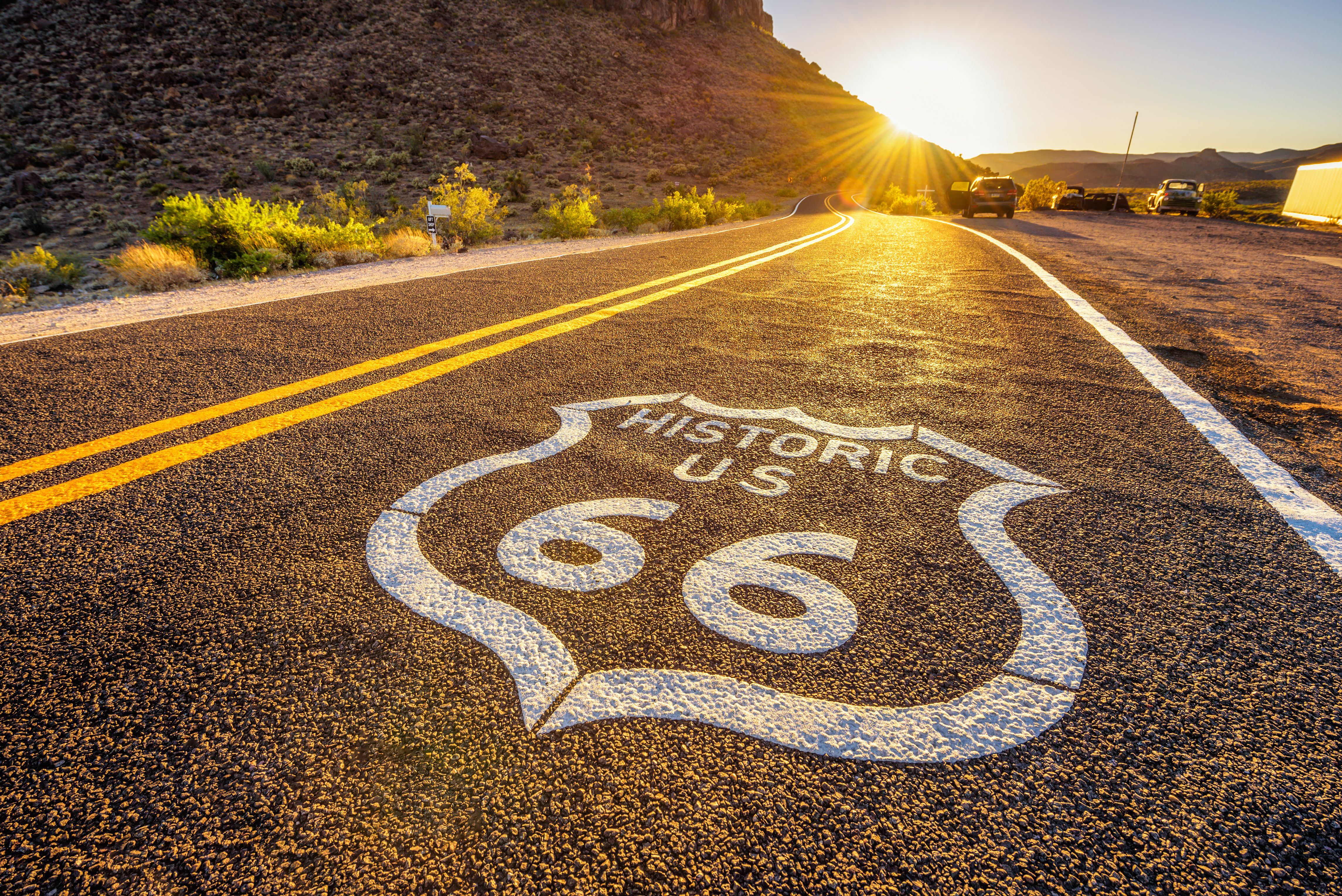
The Longest Surviving Stretch of the Mother Road
The 115-mile run from Seligman to Oatman is the longest unbroken stretch of original Route 66 still drivable in the United States, a continuous time-warp through the postwar American roadside that runs across northwestern Arizona without ever rejoining the interstate. The road was bypassed in 1978 when I-40 opened from Seligman to Kingman, killing the small businesses along the route almost overnight. Seligman barber Angel Delgadillo (born 1927, still alive and still talking with visitors at his original shop) organized the survivors, lobbied the State of Arizona, and on November 18, 1987, succeeded in having this corridor designated as Historic Route 66. The Historic Route 66 Association of Arizona was founded that same year. Their work launched a national preservation movement: every Route 66 anniversary celebration, every "Get Your Kicks" festival, every revival of a derelict motel from Tulsa to Barstow traces back to what one barber in a town of 450 people accomplished. Today this stretch holds the best concentration of authentic, working Route 66 culture left in America: a 1953 drive-in still serving "cheeseburgers with cheese" at the Snow Cap, a 1934 general store frozen in time at Hackberry, a Cold War-era fallout shelter in a 21-story-deep cavern outside Peach Springs, the museum at Kingman where Andy Devine's voice still echoes, the precipitous Sitgreaves Pass that broke truck drivers and broke down their rigs, and Oatman itself, where wild burros descended from 1942 abandoned mining stock still wander Main Street looking for carrots. The drive climaxes the year of the Route 66 Centennial: the road was commissioned November 11, 1926, and 2026 marks 100 years on the books.
Key Stops
Seligman The "Birthplace of Historic Route 66" and the spiritual home of the entire Route 66 preservation movement. The town's main drag (Historic Route 66) is barely a third of a mile long but packed with classic Route 66 iconography: vintage cars on display, neon signs, Burma-Shave-style roadside ads, and Route 66 shields painted on every available surface.
- Angel & Vilma Delgadillo's Original Route 66 Gift Shop (formerly his barbershop) on Main Street is still operating. Angel, now in his 90s, still drops in to chat with visitors and sign books. The shop preserves his barber chair and a wall of letters from around the world.
- Snow Cap Drive-In (founded 1953 by Angel's late brother Juan Delgadillo, who died in 2004) is famous for whimsical decoration, prank menus ("cheeseburgers with cheese"), and an outdoor patio fitted with mismatched chairs. Now run by Juan's family, the Snow Cap is essentially a sacred site for Route 66 pilgrims.
- Roadkill Café, the Historic Route 66 General Store, and several motels including the Supai Motel and Stagecoach 66 Motel carry the theme.
Pixar artists toured Seligman during research for the 2006 film Cars; the fictional Radiator Springs draws heavily from the town's layout and characters, and Sally Carrera's monologue about the bypass references the real history.
Grand Canyon Caverns About 25 miles west of Seligman, one of the largest dry caverns in the United States, discovered in 1927 when a local cowboy named Walter Peck fell into the entrance hole while walking home in the dark. The cavern operates an elevator that descends 21 stories to a network of dry limestone chambers stocked during the Cold War as a fallout shelter for 2,000 people (the rations are still down there, well past their expiration dates). Guided walking tours run year-round. The site also offers the Grand Canyon Caverns Suite, the world's deepest, darkest, quietest hotel room (220 feet underground), if you're brave enough; above ground there's a more conventional motel, a restaurant, gift shop, and pool.
Peach Springs and the Hualapai Nation Peach Springs is the capital of the Hualapai Nation, whose 1-million-acre reservation extends north to the Colorado River and includes the western Grand Canyon. Hualapai Lodge offers comfortable rooms and is the only authorized starting point for Grand Canyon West and Skywalk access (a separate 4-hour drive each way; the Skywalk is a glass-floored horseshoe extending over the canyon rim, $84 per adult or higher with extras). The Hualapai River Runners offer the only one-day commercial whitewater trips on the Colorado River through the Grand Canyon, departing from Peach Springs Canyon (Diamond Creek Road is the only road access to the Colorado River in the Grand Canyon).
Truxton and Valentine Two near-ghost towns between Peach Springs and Hackberry, with the haunting ruins of vintage motels, gas stations, and the abandoned Truxton Canyon Indian Boarding School (a sobering relic of the federal Indian education program). The Frontier Motel in Truxton is partially still operating.
Hackberry General Store Twenty-three miles east of Kingman, this perfectly preserved 1934 Route 66 trading post is one of the most photographed spots on the entire Mother Road. Restored to its 1950s appearance with vintage gas pumps (no longer functional but perfect for photos), a yard of classic cars and pickups (including a red 1957 Corvette that has become the store's mascot), and stacks of weathered Route 66 ephemera scattered across the porch and parking lot. The interior is essentially a free museum: license plates, vintage road signs, old gas pump globes, advertising, and Route 66 souvenirs. Cold sodas, snacks, and clean restrooms. Owner John Pritchard has been welcoming travelers since the 1990s.
Kingman The largest town on this stretch and a worthy overnight stop. Kingman's downtown preserves dozens of original Route 66-era motels, neon signs, and storefronts along Andy Devine Avenue (named for the gravel-voiced Hollywood character actor who grew up here).
- Arizona Route 66 Museum (inside the Historic Powerhouse Visitor Center) is the largest and best Route 66 museum in Arizona, with life-size dioramas, vintage vehicles, neon, and a thorough history of the Mother Road from horse-drawn freight to Dust Bowl migration to the Eisenhower-era interstate revolution. Approximately $5 per adult.
- Mohave Museum of History and Arts displays Hualapai and Mojave Indigenous artifacts, mining history, and an Andy Devine memorabilia wing.
- Hotel Beale, the Hilltop Motel, and the Brunswick Hotel are all classic Route 66-era buildings, with varying degrees of restoration.
Full services and the best lodging options on the corridor. Note: The town of Kingman experienced devastating flooding in August 2025 that damaged some Route 66 businesses; most have since reopened, but verify current status before booking.
Cool Springs Camp About 10 miles southwest of Kingman on the Oatman Highway, a 1927 stone-and-mortar trading post and gas station that was a critical fuel stop for travelers crossing Sitgreaves Pass. The original Cool Springs was largely destroyed in the 1991 movie Universal Soldier (blown up on camera with the owner's permission for $20,000). It has since been partially rebuilt into a museum and gift shop, with a 1930s-era gas pump and dramatic views of the Black Mountains rising behind. Open seasonally.
Sitgreaves Pass Beyond Cool Springs, the Oatman Highway climbs into the Black Mountains via Sitgreaves Pass (3,556 ft), one of the most challenging stretches of original Route 66 anywhere on the route: a narrow, two-lane road with sharp switchbacks, steep grades, no guardrails, and a sheer drop-off in many places. Loaded trucks in the 1930s and 1940s sometimes had to back up the steepest sections (the gas tanks were gravity-fed and would starve the engine when pointed uphill); some drivers hired local boys for $1 to drive their rigs over the pass. The summit offers an unmarked pullout with breathtaking views east toward Kingman and west into the Mojave Desert. The road passes the ruins of Goldroad, a gold-mining ghost town active from 1902 to 1942, with a few standing stone walls and mine adit openings visible just below the pavement.
Oatman A former gold-mining boomtown clinging to the western slope of the Black Mountains at the end of the Oatman Highway. When the mines closed during World War II (declared "non-essential" and shut down in 1942), the residents released their pack burros into the desert; the descendants of those burros now wander Main Street, begging carrots from tourists (carrots are sold by every shop on the street for a dollar a bag). The wild burros are protected under federal law as a Wild Free-Roaming Horses and Burros Act population. Mock gunfights stage on Main Street several times daily (typically noon, 2 p.m., and 4 p.m.), benefitting the local fire and EMS departments. The Oatman Hotel (built 1902 of adobe brick) survived a 1921 fire that destroyed most of the town and is reputed to have hosted Clark Gable and Carole Lombard during a 1939 honeymoon stopover; the bar features ceilings and walls completely covered in dollar bills (an estimated $100,000-plus worth) signed and stapled by visitors over the decades. The town has saloons, art galleries, candy shops, and a working post office. Plan to park on the outskirts and walk in: the main street is narrow, parking is scarce, and the burros do not always yield to traffic. From Oatman, the road descends another 14 miles west to rejoin I-40 at Topock and cross the Colorado River into California.
Driving Tips
- 2026 is the Route 66 Centennial. Anniversary celebrations are concentrated in Seligman, Kingman, and Oatman, with major events around November 11. Lodging in Kingman, Seligman, and the surrounding area fills up months in advance during centennial weekends.
- The 158-mile stretch from Seligman west is fully paved AZ-66 and well-maintained. The Oatman Highway (Kingman to Oatman via Sitgreaves Pass) is also paved but significantly narrower, with hairpin turns and no guardrails. Vehicles longer than 40 feet are not recommended on the Oatman Highway; large RVs and trailers should detour via I-40 to Topock and approach Oatman from the south via the Boundary Cone Road, or skip Oatman entirely.
- Fuel up in Seligman, Kingman, or Oatman. The 60-mile stretch between Seligman and Kingman has limited fuel options (Grand Canyon Caverns, Peach Springs, occasionally Truxton). Sitgreaves Pass has no services for 28 miles between Kingman and Oatman.
- Cell coverage is reliable in Seligman, Kingman, and Oatman, intermittent at Hackberry and Cool Springs, and nonexistent on most of the desert stretches and over Sitgreaves Pass. Download offline maps before departure.
- Summer heat between Kingman and Oatman regularly exceeds 110°F. Cars overheat on the Sitgreaves Pass climb; check coolant before attempting in summer. Carry at least one gallon of water per person, never leave pets or children in a vehicle, and avoid hiking in midday from May through September.
- Many Route 66 businesses are family-run and may close on Tuesdays or Wednesdays. Some accept cash only or have spotty card readers; carry small bills.
- The wild burros of Oatman will bite, kick, and steal food. Feed them only the carrots sold at Oatman shops (other foods can cause digestive harm), do not approach foals (the jennies are protective), and keep small children supervised.
- The flooding that affected Kingman in August 2025 damaged some Route 66 properties. Most have reopened, but verify current status before booking.
- Many of the most photographed spots (Hackberry General Store, the Cool Springs ruins, Sitgreaves Pass summit) are free roadside stops. Engage with the locals: this is a route where conversation is the attraction.
- Allow at least a full day, ideally with an overnight in Kingman to break up the drive and explore the Route 66 Museum.
- For more information visit: Historic Route 66 Association of Arizona